Nankana Sahib elevation
Nankana Sahib (Punjab), Pakistan elevation is 198 meters and Nankana Sahib elevation in feet is 650 ft above sea level [src 1]. Nankana Sahib is a populated place (feature code) with elevation that is 148 meters (486 ft) smaller than average city elevation in Pakistan.
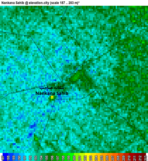
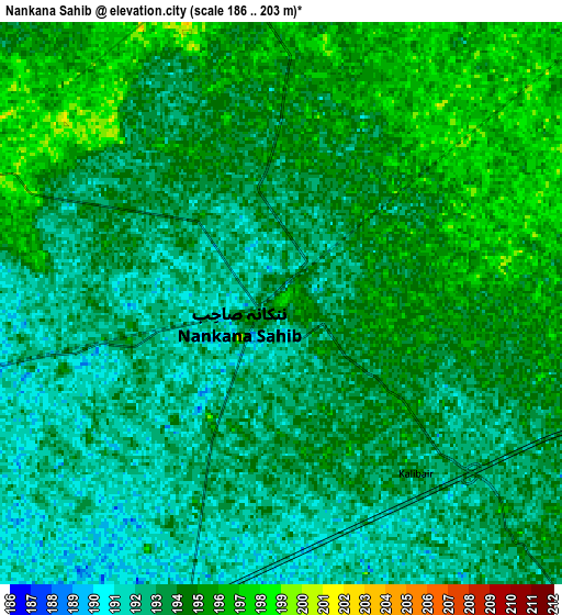
Below is the Elevation map of Nankana Sahib, which displays elevation range with different colors. Scale of the first map is from 187 to 203 m (614 to 666 ft) with average elevation of 192.8 meters (=633 ft) [note 1]
These maps also provides idea of topography and contour of this city, they are displayed at different zoom levels. More info about maps, scale and edge coordinates you can find below images.
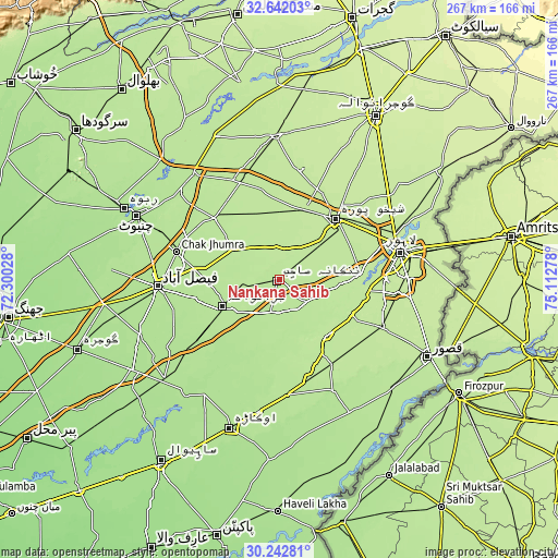
| \ | Map #1 | Map #2 | Topo.Map |
| Scale [m] | 187..203 m | 186..203 m | × |
| Scale [ft] | 614..666 ft | 610..666 ft | × |
| Average | 192.8 m = 633 ft | 193.4 m = 635 ft | × |
| Width | 8.34 km = 5.2 mi | 16.67 km = 10.4 mi | 266.8 km = 165.8 mi |
| Height | 8.34 km = 5.2 mi | 16.67 km = 10.4 mi | 266.8 km = 165.8 mi |
| ↑Max Latitude | 31.487582° | 31.525049° | 32.64203° |
| Latitude at center | 31.4501° | 31.4501° | 31.4501° |
| ↓Min Latitude | 31.412603° | 31.375091° | 30.24281° |
| ← Min Longitude | 73.662585° | 73.618639° | 72.30028° |
| Longitude center | 73.70653° | 73.70653° | 73.70653° |
| →Max Longitude | 73.750475° | 73.794421° | 75.11278° |
Nearby cities:
Cities around Nankana Sahib sort by population:
• Shekhupura elevation 210 m
39.4 km,  42°
42°
• Shahkot 197 m
24.9 km,  302°
302°
• Jaranwala 193 m
30.3 km,  244°
244°
• Mianke Mor 200 m
35.9 km,  140°
140°
• Chuchar-kana Mandi 206 m
34.5 km,  14°
14°
• Sangla Hill 194 m
42.6 km,  314°
314°
• Khurrianwala 190 m
42 km,  277°
277°
• Sharqpur Sharif 211 m
37.4 km,  88°
88°
• Khangah Dogran 207 m
43.3 km,  349°
349°
• Mananwala 201 m
15.4 km, 353°
• Chak Five Hundred Seventy-five 202 m
15.7 km,  47°
47°
• Jandiala Sher Khan 214 m
45.8 km,  25°
25°
Multilingual:
 En español:
Nankana Sahib elevación 198 m.
 En France:
Nankana Sahib élévation 198 m.
 Auf Deutsch:
Nankana Sahib höhe über dem Meeresspiegel ist 198 m.

Sources and notes:
- [note 1] Map square and city borders are not equal. Map elevation data is calculated only from area inside that square.
- [src 1] Elevation data from geonames database provided with same terms of usage.
- [src 2] The elevation map of Nankana Sahib is generated using elevation data from NASA's 3 arcsec (90m) resolution SRTM data.
- [src 3] Base (background) map © OpenStreetMap contributors tiles are generated by Geofabrik and OpenTopoMap.
Copyright & License:
This Nankana Sahib Elevation Map is licensed under CC BY-SA. You may reuse any part from this page, if you give a proper credit by linking to this URL:
 More info on terms of use page.