Naushahra Virkan elevation
Naushahra Virkan (Punjab), Pakistan elevation is 216 meters and Naushahra Virkan elevation in feet is 709 ft above sea level [src 1]. Naushahra Virkan is a populated place (feature code) with elevation that is 130 meters (427 ft) smaller than average city elevation in Pakistan.
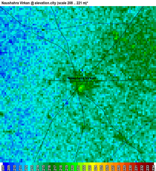
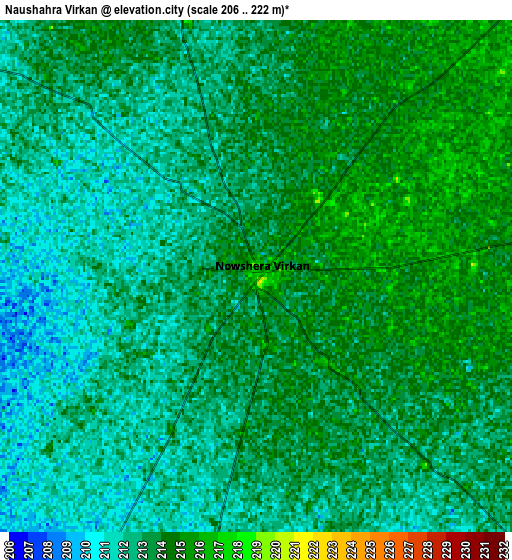
Below is the Elevation map of Naushahra Virkan, which displays elevation range with different colors. Scale of the first map is from 208 to 221 m (682 to 725 ft) with average elevation of 213.2 meters (=699 ft) [note 1]
These maps also provides idea of topography and contour of this city, they are displayed at different zoom levels. More info about maps, scale and edge coordinates you can find below images.
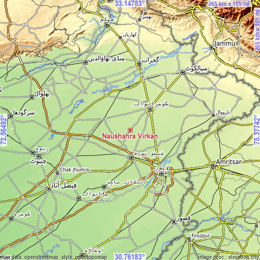
| \ | Map #1 | Map #2 | Topo.Map |
| Scale [m] | 208..221 m | 206..222 m | × |
| Scale [ft] | 682..725 ft | 676..728 ft | × |
| Average | 213.2 m = 699 ft | 212.7 m = 698 ft | × |
| Width | 8.29 km = 5.2 mi | 16.58 km = 10.3 mi | 265.3 km = 164.8 mi |
| Height | 8.29 km = 5.2 mi | 16.58 km = 10.3 mi | 265.3 km = 164.8 mi |
| ↑Max Latitude | 31.999855° | 32.037116° | 33.14783° |
| Latitude at center | 31.96258° | 31.96258° | 31.96258° |
| ↓Min Latitude | 31.925289° | 31.887984° | 30.76183° |
| ← Min Longitude | 73.927225° | 73.883279° | 72.56492° |
| Longitude center | 73.97117° | 73.97117° | 73.97117° |
| →Max Longitude | 74.015115° | 74.059061° | 75.37742° |
Nearby cities:
Cities around Naushahra Virkan sort by population:
• Gujranwala elevation 230 m
29.6 km,  43°
43°
• Shekhupura 210 m
27.8 km,  177°
177°
• Kamoke 221 m
23.8 km,  86°
86°
• Muridke 216 m
32.4 km,  123°
123°
• Hafizabad 210 m
29.3 km,  294°
294°
• Chuchar-kana Mandi 206 m
28.6 km,  214°
214°
• Ladhewala Waraich 228 m
25.5 km,  32°
32°
• Khangah Dogran 207 m
36 km,  246°
246°
• Eminabad 229 m
28.6 km,  71°
71°
• Kaleke Mandi 202 m
35 km,  272°
272°
• Rasulnagar 220 m
44.4 km,  336°
336°
• Jandiala Sher Khan 214 m
16.5 km,  197°
197°
Multilingual:
 En español:
Naushahra Virkan elevación 216 m.
 En France:
Naushahra Virkan élévation 216 m.
 Auf Deutsch:
Naushahra Virkan höhe über dem Meeresspiegel ist 216 m.

Sources and notes:
- [note 1] Map square and city borders are not equal. Map elevation data is calculated only from area inside that square.
- [src 1] Elevation data from geonames database provided with same terms of usage.
- [src 2] The elevation map of Naushahra Virkan is generated using elevation data from NASA's 3 arcsec (90m) resolution SRTM data.
- [src 3] Base (background) map © OpenStreetMap contributors tiles are generated by Geofabrik and OpenTopoMap.
Copyright & License:
This Naushahra Virkan Elevation Map is licensed under CC BY-SA. You may reuse any part from this page, if you give a proper credit by linking to this URL:
 More info on terms of use page.