Pakpattan elevation
Pakpattan (Punjab), Pakistan elevation is 188 meters and Pakpattan elevation in feet is 617 ft above sea level [src 1]. Pakpattan is a seat of a second-order administrative division (feature code) with elevation that is 158 meters (518 ft) smaller than average city elevation in Pakistan.
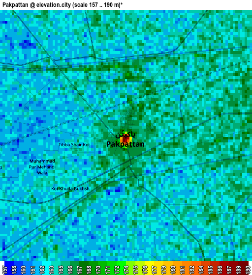
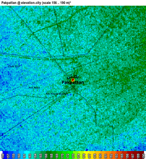
Below is the Elevation map of Pakpattan, which displays elevation range with different colors. Scale of the first map is from 157 to 190 m (515 to 623 ft) with average elevation of 163.5 meters (=536 ft) [note 1]
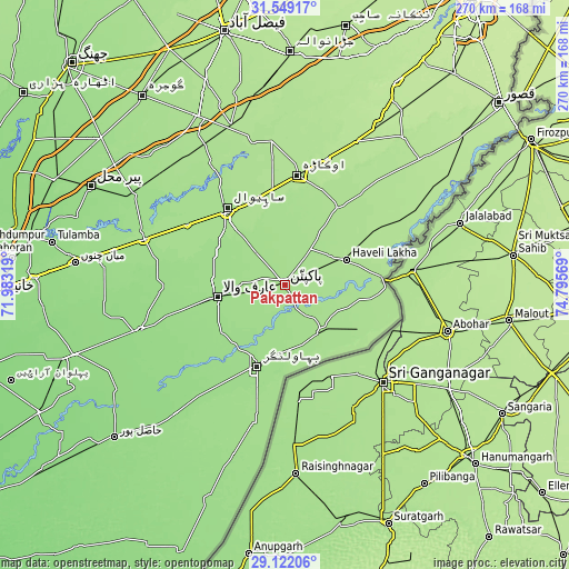
These maps also provides idea of topography and contour of this city, they are displayed at different zoom levels. More info about maps, scale and edge coordinates you can find below images.
| \ | Map #1 | Map #2 | Topo.Map |
| Scale [m] | 157..190 m | 156..190 m | × |
| Scale [ft] | 515..623 ft | 512..623 ft | × |
| Average | 163.5 m = 536 ft | 163.2 m = 535 ft | × |
| Width | 8.43 km = 5.2 mi | 16.87 km = 10.5 mi | 269.9 km = 167.7 mi |
| Height | 8.43 km = 5.2 mi | 16.87 km = 10.5 mi | 269.9 km = 167.7 mi |
| ↑Max Latitude | 30.381058° | 30.418962° | 31.54917° |
| Latitude at center | 30.34314° | 30.34314° | 30.34314° |
| ↓Min Latitude | 30.305207° | 30.26726° | 29.12206° |
| ← Min Longitude | 73.345495° | 73.301549° | 71.98319° |
| Longitude center | 73.38944° | 73.38944° | 73.38944° |
| →Max Longitude | 73.433385° | 73.477331° | 74.79569° |
Nearby cities:
Cities around Pakpattan sort by population:
• Sahiwal elevation 173 m
45.2 km,  322°
322°
• Okara 181 m
52.3 km,  6°
6°
• Bahawalnagar 165 m
23.1 km,  0°
0°
• Bahawalnagar 159 m
40.5 km,  198°
198°
• Arifwala 159 m
31.6 km,  259°
259°
• Dipalpur 176 m
44.2 km,  34°
34°
• Haveli Lakha 175 m
31.5 km,  67°
67°
• Hujra Shah Muqim 183 m
60.7 km,  43°
43°
• Basirpur 181 m
50.4 km,  58°
58°
• Chak Azam Sahu 170 m
57.1 km, 322°
• Minchianabad 168 m
26.4 km,  139°
139°
• Chak One Hundred Twenty Nine Left 162 m
34.4 km,  286°
286°
Multilingual:
 En español:
Pakpattan elevación 188 m.
 En France:
Pakpattan élévation 188 m.
 Auf Deutsch:
Pakpattan höhe über dem Meeresspiegel ist 188 m.

Sources and notes:
- [note 1] Map square and city borders are not equal. Map elevation data is calculated only from area inside that square.
- [src 1] Elevation data from geonames database provided with same terms of usage.
- [src 2] The elevation map of Pakpattan is generated using elevation data from NASA's 3 arcsec (90m) resolution SRTM data.
- [src 3] Base (background) map © OpenStreetMap contributors tiles are generated by Geofabrik and OpenTopoMap.
Copyright & License:
This Pakpattan Elevation Map is licensed under CC BY-SA. You may reuse any part from this page, if you give a proper credit by linking to this URL:
 More info on terms of use page.