Pasrur elevation
Pasrur (Punjab), Pakistan elevation is 251 meters and Pasrur elevation in feet is 823 ft above sea level [src 1]. Pasrur is a populated place (feature code) with elevation that is 95 meters (312 ft) smaller than average city elevation in Pakistan.
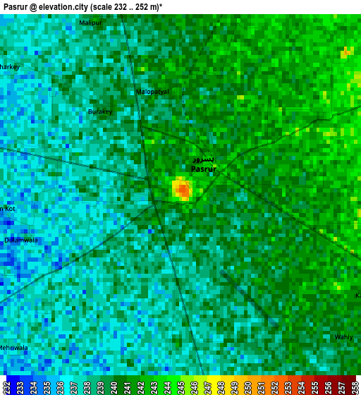
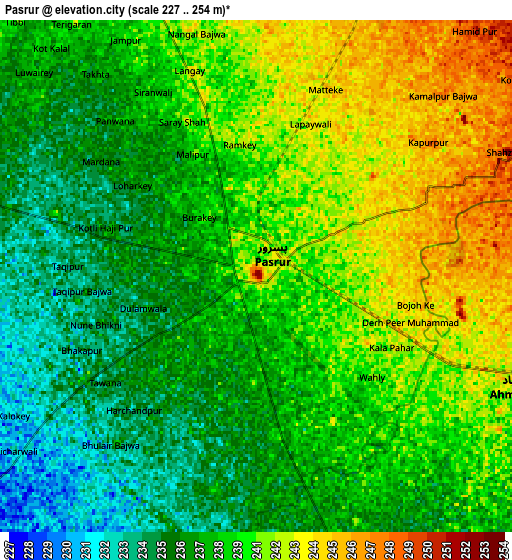
Below is the Elevation map of Pasrur, which displays elevation range with different colors. Scale of the first map is from 232 to 252 m (761 to 827 ft) with average elevation of 239 meters (=784 ft) [note 1]
These maps also provides idea of topography and contour of this city, they are displayed at different zoom levels. More info about maps, scale and edge coordinates you can find below images.
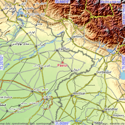
| \ | Map #1 | Map #2 | Topo.Map |
| Scale [m] | 232..252 m | 227..254 m | × |
| Scale [ft] | 761..827 ft | 745..833 ft | × |
| Average | 239 m = 784 ft | 238.9 m = 784 ft | × |
| Width | 8.26 km = 5.1 mi | 16.53 km = 10.3 mi | 264.4 km = 164.3 mi |
| Height | 8.26 km = 5.1 mi | 16.53 km = 10.3 mi | 264.4 km = 164.3 mi |
| ↑Max Latitude | 32.300013° | 32.337151° | 33.44416° |
| Latitude at center | 32.26286° | 32.26286° | 32.26286° |
| ↓Min Latitude | 32.225692° | 32.188509° | 31.06599° |
| ← Min Longitude | 74.619325° | 74.575379° | 73.25702° |
| Longitude center | 74.66327° | 74.66327° | 74.66327° |
| →Max Longitude | 74.707215° | 74.751161° | 76.06952° |
Nearby cities:
Cities around Pasrur sort by population:
• Sialkot elevation 250 m
28.4 km,  334°
334°
• Daska Kalan 242 m
30.2 km,  283°
283°
• Narowal 241 m
26.6 km,  132°
132°
• Sambrial 239 m
37.7 km,  309°
309°
• Fazilpur 248 m
39.1 km,  104°
104°
• Chawinda 255 m
9.9 km,  23°
23°
• Zafarwal 273 m
24 km,  67°
67°
• Kot Ghulam Muhammad 238 m
13.4 km, 305°
• Baddomalhi 228 m
30.3 km,  179°
179°
• Bhopalwala 245 m
33.7 km,  303°
303°
• Kalaswala 240 m
7 km,  191°
191°
• Kot Rajkour 248 m
16.9 km,  348°
348°
Multilingual:
 En español:
Pasrur elevación 251 m.
 En France:
Pasrur élévation 251 m.


Sources and notes:
- [note 1] Map square and city borders are not equal. Map elevation data is calculated only from area inside that square.
- [src 1] Elevation data from geonames database provided with same terms of usage.
- [src 2] The elevation map of Pasrur is generated using elevation data from NASA's 3 arcsec (90m) resolution SRTM data.
- [src 3] Base (background) map © OpenStreetMap contributors tiles are generated by Geofabrik and OpenTopoMap.
Copyright & License:
This Pasrur Elevation Map is licensed under CC BY-SA. You may reuse any part from this page, if you give a proper credit by linking to this URL:
 More info on terms of use page.