Shahpur Chakar elevation
Shahpur Chakar (Sindh), Pakistan elevation is 29 meters and Shahpur Chakar elevation in feet is 95 ft above sea level [src 1]. Shahpur Chakar is a populated place (feature code) with elevation that is 317 meters (1040 ft) smaller than average city elevation in Pakistan.
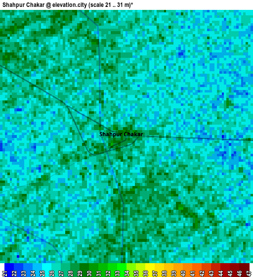
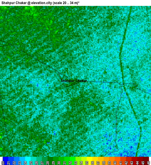
Below is the Elevation map of Shahpur Chakar, which displays elevation range with different colors. Scale of the first map is from 21 to 31 m (69 to 102 ft) with average elevation of 26.1 meters (=86 ft) [note 1]
These maps also provides idea of topography and contour of this city, they are displayed at different zoom levels. More info about maps, scale and edge coordinates you can find below images.
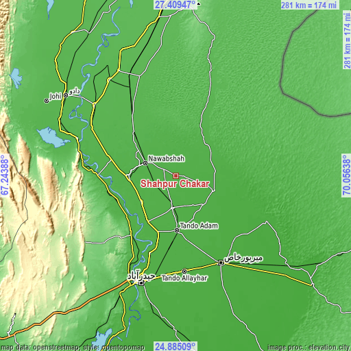
| \ | Map #1 | Map #2 | Topo.Map |
| Scale [m] | 21..31 m | 20..34 m | × |
| Scale [ft] | 69..102 ft | 66..112 ft | × |
| Average | 26.1 m = 86 ft | 26.2 m = 86 ft | × |
| Width | 8.77 km = 5.4 mi | 17.54 km = 10.9 mi | 280.7 km = 174.4 mi |
| Height | 8.77 km = 5.4 mi | 17.54 km = 10.9 mi | 280.7 km = 174.4 mi |
| ↑Max Latitude | 26.193549° | 26.232975° | 27.40947° |
| Latitude at center | 26.15411° | 26.15411° | 26.15411° |
| ↓Min Latitude | 26.114658° | 26.075192° | 24.88509° |
| ← Min Longitude | 68.606185° | 68.562239° | 67.24388° |
| Longitude center | 68.65013° | 68.65013° | 68.65013° |
| →Max Longitude | 68.694075° | 68.738021° | 70.05638° |
Nearby cities:
Cities around Shahpur Chakar sort by population:
• Nawabshah elevation 32 m
26.4 km,  291°
291°
• Tando Adam 29 m
42.9 km,  178°
178°
• Shahdadpur 30 m
25.6 km,  186°
186°
• Sanghar 26 m
32.1 km,  111°
111°
• Hala 30 m
44.1 km,  211°
211°
• Sakrand 36 m
37.5 km,  267°
267°
• Bhit Shah 31 m
41.9 km,  202°
202°
• Jhol 25 m
32.5 km,  132°
132°
• Sinjhoro 25 m
21 km, 131°
• Khadro 29 m
6.8 km,  96°
96°
• Berani 26 m
44 km,  159°
159°
• Jām Sāhib 30 m
15.9 km,  352°
352°
Multilingual:
 En español:
Shahpur Chakar elevación 29 m.
 En France:
Shahpur Chakar élévation 29 m.
 Auf Deutsch:
Shahpur Chakar höhe über dem Meeresspiegel ist 29 m.

Sources and notes:
- [note 1] Map square and city borders are not equal. Map elevation data is calculated only from area inside that square.
- [src 1] Elevation data from geonames database provided with same terms of usage.
- [src 2] The elevation map of Shahpur Chakar is generated using elevation data from NASA's 3 arcsec (90m) resolution SRTM data.
- [src 3] Base (background) map © OpenStreetMap contributors tiles are generated by Geofabrik and OpenTopoMap.
Copyright & License:
This Shahpur Chakar Elevation Map is licensed under CC BY-SA. You may reuse any part from this page, if you give a proper credit by linking to this URL:
 More info on terms of use page.