Talhar elevation
Talhar (Sindh), Pakistan elevation is 13 meters and Talhar elevation in feet is 43 ft above sea level [src 1]. Talhar is a populated place (feature code) with elevation that is 333 meters (1093 ft) smaller than average city elevation in Pakistan.
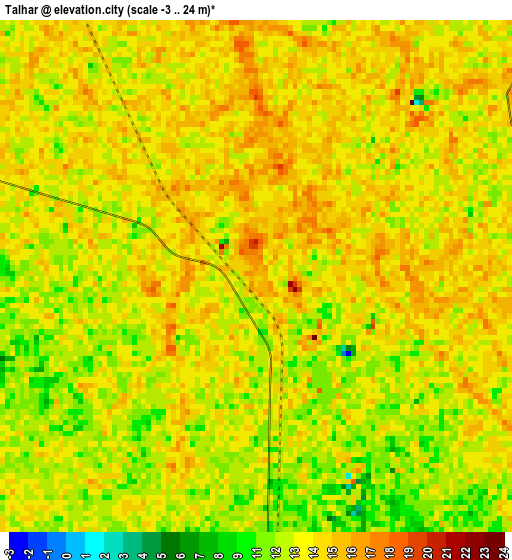
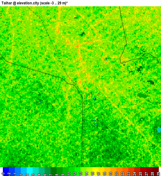
Below is the Elevation map of Talhar, which displays elevation range with different colors. Scale of the first map is from -3 to 24 m (-10 to 79 ft) with average elevation of 13 meters (=43 ft) [note 1]
These maps also provides idea of topography and contour of this city, they are displayed at different zoom levels. More info about maps, scale and edge coordinates you can find below images.
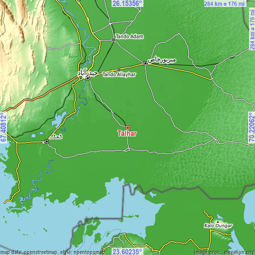
| \ | Map #1 | Map #2 | Topo.Map |
| Scale [m] | -3..24 m | -3..29 m | × |
| Scale [ft] | -10..79 ft | -10..95 ft | × |
| Average | 13 m = 43 ft | 12.7 m = 42 ft | × |
| Width | 8.87 km = 5.5 mi | 17.73 km = 11 mi | 283.7 km = 176.3 mi |
| Height | 8.87 km = 5.5 mi | 17.73 km = 11 mi | 283.7 km = 176.3 mi |
| ↑Max Latitude | 24.924399° | 24.964245° | 26.15356° |
| Latitude at center | 24.88454° | 24.88454° | 24.88454° |
| ↓Min Latitude | 24.844668° | 24.804784° | 23.60235° |
| ← Min Longitude | 68.770425° | 68.726479° | 67.40812° |
| Longitude center | 68.81437° | 68.81437° | 68.81437° |
| →Max Longitude | 68.858315° | 68.902261° | 70.22062° |
Nearby cities:
Cities around Talhar sort by population:
• Badin elevation 13 m
25.5 km,  174°
174°
• Tando Muhammad Khan 24 m
38.6 km,  313°
313°
• Matli 20 m
23.8 km,  317°
317°
• Digri 18 m
42.5 km,  44°
44°
• Tando Bago 18 m
18.6 km,  124°
124°
• Chamber 20 m
45.5 km,  359°
359°
• Mirwah Gorchani 18 m
52.9 km,  26°
26°
• Mirpur Bhtoro 12 m
58.6 km,  252°
252°
• Rajo Khanani 18 m
11.7 km,  19°
19°
• Kadhan 6 m
48.1 km,  158°
158°
• Kario Ghanwar 11 m
22.8 km, 248°
• Bulri 11 m
48.6 km,  267°
267°
Multilingual:
 En español:
Talhar elevación 13 m.
 En France:
Talhar élévation 13 m.


Sources and notes:
- [note 1] Map square and city borders are not equal. Map elevation data is calculated only from area inside that square.
- [src 1] Elevation data from geonames database provided with same terms of usage.
- [src 2] The elevation map of Talhar is generated using elevation data from NASA's 3 arcsec (90m) resolution SRTM data.
- [src 3] Base (background) map © OpenStreetMap contributors tiles are generated by Geofabrik and OpenTopoMap.
Copyright & License:
This Talhar Elevation Map is licensed under CC BY-SA. You may reuse any part from this page, if you give a proper credit by linking to this URL:
 More info on terms of use page.