Kaligutan elevation
Kaligutan (Davao, Compostela Valley), Philippines elevation is 101 meters and Kaligutan elevation in feet is 331 ft above sea level [src 1]. Kaligutan is a populated place (feature code) with elevation that is 13 meters (43 ft) bigger than average city elevation in Philippines.
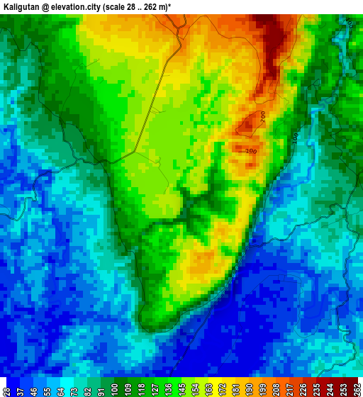
Below is the Elevation map of Kaligutan, which displays elevation range with different colors. Scale of the first map is from 28 to 262 m (92 to 860 ft) with average elevation of 102.4 meters (=336 ft) [note 1]
These maps also provides idea of topography and contour of this city, they are displayed at different zoom levels. More info about maps, scale and edge coordinates you can find below images.
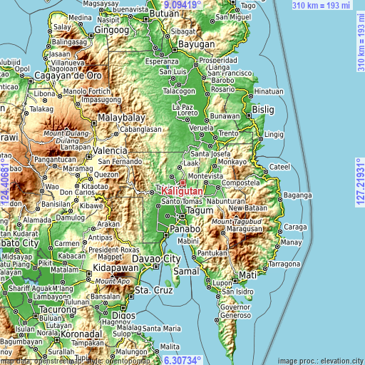
| \ | Map #1 | Topo.Map |
| Scale [m] | 28..262 m | × |
| Scale [ft] | 92..860 ft | × |
| Average | 102.4 m = 336 ft | × |
| Width | 9.68 km = 6 mi | 309.9 km = 192.6 mi |
| Height | 9.68 km = 6 mi | 309.9 km = 192.6 mi |
| ↑Max Latitude | 7.746607° | 9.09419° |
| Latitude at center | 7.70306° | 7.70306° |
| ↓Min Latitude | 7.659509° | 6.30734° |
| ← Min Longitude | 125.769115° | 124.40681° |
| Longitude center | 125.81306° | 125.81306° |
| →Max Longitude | 125.857005° | 127.21931° |
Nearby cities:
Cities around Kaligutan sort by population:
• New Corella elevation 24 m
13 km,  174°
174°
• Cambanugoy 19 m
19.1 km,  199°
199°
• Montevista 73 m
19.4 km,  93°
93°
• Andop 136 m
18.7 km,  339°
339°
• Magatos 20 m
19 km,  210°
210°
• Limbaan 40 m
7.1 km, 173°
• Gabuyan 31 m
19.1 km,  236°
236°
• Del Pilar 18 m
15.6 km, 174°
• Linoan 90 m
19.7 km,  115°
115°
• Suz-on 42 m
19.8 km,  256°
256°
• Concepcion 146 m
12.3 km,  295°
295°
• San Vicente 216 m
14.5 km,  1°
1°
Multilingual:
 En español:
Kaligutan elevación 101 m.
 En France:
Kaligutan élévation 101 m.
 Auf Deutsch:
Kaligutan höhe über dem Meeresspiegel ist 101 m.

Sources and notes:
- [note 1] Map square and city borders are not equal. Map elevation data is calculated only from area inside that square.
- [src 1] Elevation data from geonames database provided with same terms of usage.
- [src 2] The elevation map of Kaligutan is generated using elevation data from NASA's 3 arcsec (90m) resolution SRTM data.
- [src 3] Base (background) map © OpenStreetMap contributors tiles are generated by Geofabrik and OpenTopoMap.
Copyright & License:
This Kaligutan Elevation Map is licensed under CC BY-SA. You may reuse any part from this page, if you give a proper credit by linking to this URL:
 More info on terms of use page.