Andop elevation
Andop (Davao, Compostela Valley), Philippines elevation is 136 meters and Andop elevation in feet is 446 ft above sea level [src 1]. Andop is a populated place (feature code) with elevation that is 48 meters (157 ft) bigger than average city elevation in Philippines.
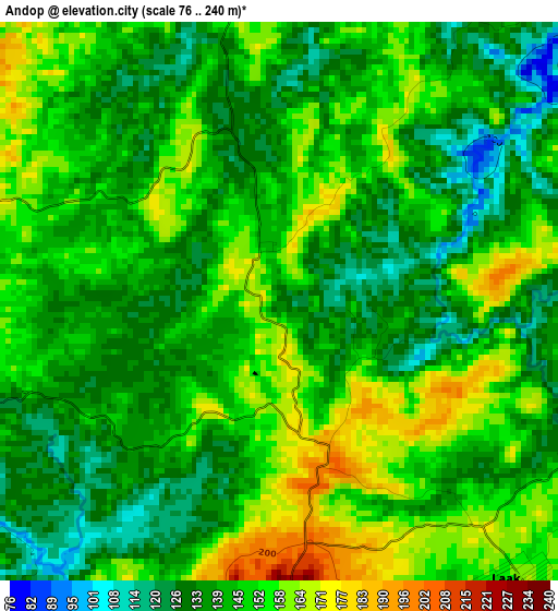
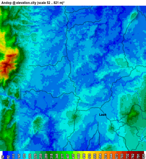
Below is the Elevation map of Andop, which displays elevation range with different colors. Scale of the first map is from 76 to 240 m (249 to 787 ft) with average elevation of 144.6 meters (=474 ft) [note 1]
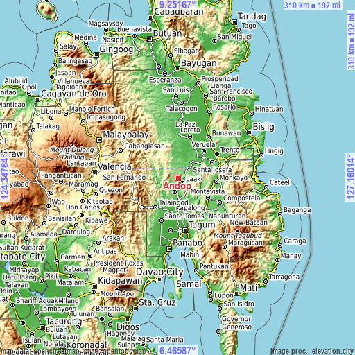
These maps also provides idea of topography and contour of this city, they are displayed at different zoom levels. More info about maps, scale and edge coordinates you can find below images.
| \ | Map #1 | Map #2 | Topo.Map |
| Scale [m] | 76..240 m | 52..821 m | × |
| Scale [ft] | 249..787 ft | 171..2694 ft | × |
| Average | 144.6 m = 474 ft | 179.5 m = 589 ft | × |
| Width | 9.68 km = 6 mi | 19.36 km = 12 mi | 309.8 km = 192.5 mi |
| Height | 9.68 km = 6 mi | 19.36 km = 12 mi | 309.8 km = 192.5 mi |
| ↑Max Latitude | 7.90464° | 7.948166° | 9.25167° |
| Latitude at center | 7.86111° | 7.86111° | 7.86111° |
| ↓Min Latitude | 7.817575° | 7.774036° | 6.46587° |
| ← Min Longitude | 125.709945° | 125.665999° | 124.34764° |
| Longitude center | 125.75389° | 125.75389° | 125.75389° |
| →Max Longitude | 125.797835° | 125.841781° | 127.16014° |
Nearby cities:
Cities around Andop sort by population:
• Santo Niño elevation 52 m
30 km,  208°
208°
• Gupitan 47 m
15.7 km,  232°
232°
• Palma Gil 42 m
27.9 km, 209°
• Limbaan 40 m
25.7 km,  163°
163°
• Gabuyan 31 m
29.7 km,  198°
198°
• Sinubong 29 m
30.2 km,  40°
40°
• Suz-on 42 m
25.5 km, 209°
• Concepcion 146 m
13.1 km, 200°
• Kaligutan 101 m
18.7 km, 159°
• Tapia 72 m
30.8 km,  112°
112°
• Kapalong 577 m
23.8 km,  244°
244°
• San Vicente 216 m
7.6 km, 114°
Multilingual:
 En español:
Andop elevación 136 m.
 En France:
Andop élévation 136 m.


Sources and notes:
- [note 1] Map square and city borders are not equal. Map elevation data is calculated only from area inside that square.
- [src 1] Elevation data from geonames database provided with same terms of usage.
- [src 2] The elevation map of Andop is generated using elevation data from NASA's 3 arcsec (90m) resolution SRTM data.
- [src 3] Base (background) map © OpenStreetMap contributors tiles are generated by Geofabrik and OpenTopoMap.
Copyright & License:
This Andop Elevation Map is licensed under CC BY-SA. You may reuse any part from this page, if you give a proper credit by linking to this URL:
 More info on terms of use page.