Amadeo elevation
Amadeo (Calabarzon, Province of Cavite), Philippines elevation is 437 meters and Amadeo elevation in feet is 1434 ft above sea level [src 1]. Amadeo is a seat of a third-order administrative division (feature code) with elevation that is 349 meters (1145 ft) bigger than average city elevation in Philippines.
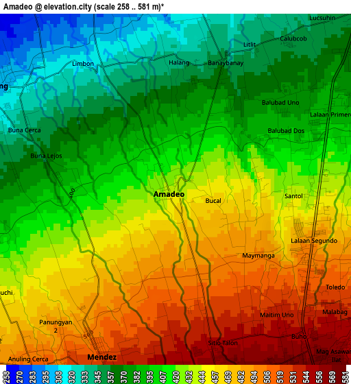
Below is the Elevation map of Amadeo, which displays elevation range with different colors. Scale of the first map is from 258 to 581 m (846 to 1906 ft) with average elevation of 424.6 meters (=1393 ft) [note 1]
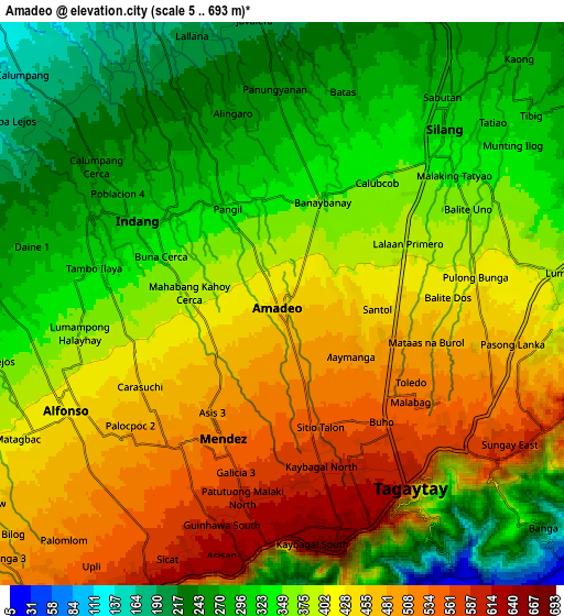
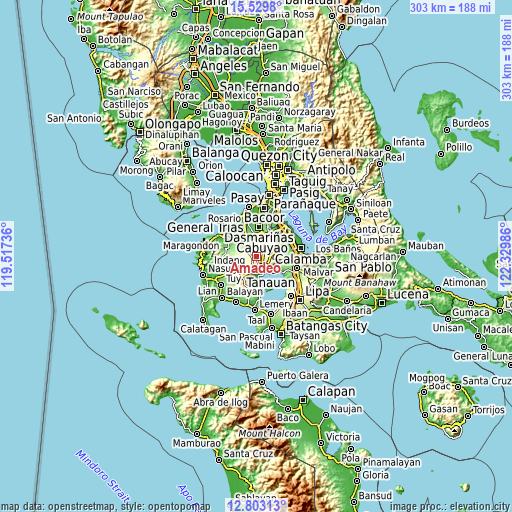
These maps also provides idea of topography and contour of this city, they are displayed at different zoom levels. More info about maps, scale and edge coordinates you can find below images.
| \ | Map #1 | Map #2 | Topo.Map |
| Scale [m] | 258..581 m | 5..693 m | × |
| Scale [ft] | 846..1906 ft | 16..2274 ft | × |
| Average | 424.6 m = 1393 ft | 382.2 m = 1254 ft | × |
| Width | 9.48 km = 5.9 mi | 18.95 km = 11.8 mi | 303.2 km = 188.4 mi |
| Height | 9.48 km = 5.9 mi | 18.95 km = 11.8 mi | 303.2 km = 188.4 mi |
| ↑Max Latitude | 14.213164° | 14.25576° | 15.5298° |
| Latitude at center | 14.17056° | 14.17056° | 14.17056° |
| ↓Min Latitude | 14.127948° | 14.085328° | 12.80313° |
| ← Min Longitude | 120.879665° | 120.835719° | 119.51736° |
| Longitude center | 120.92361° | 120.92361° | 120.92361° |
| →Max Longitude | 120.967555° | 121.011501° | 122.32986° |
Nearby cities:
Cities around Amadeo sort by population:
• Silang elevation 332 m
7.2 km,  45°
45°
• Tagaytay 663 m
8.4 km,  172°
172°
• Patuto 549 m
7.6 km,  142°
142°
• Indang 300 m
5.7 km,  298°
298°
• Mendez-Nuñez 532 m
5 km,  202°
202°
• Alfonso 413 m
8.2 km,  246°
246°
• Balite Segundo 396 m
5.6 km,  75°
75°
• Malabag 493 m
4.8 km,  110°
110°
• Anuling 522 m
6.2 km,  213°
213°
• Taywanak Ilaya 351 m
8.4 km,  260°
260°
• Guyam Malaki 395 m
7 km, 253°
• Pangil 327 m
3.8 km,  333°
333°
Multilingual:
 En español:
Amadeo elevación 437 m.
 En France:
Amadeo élévation 437 m.


Sources and notes:
- [note 1] Map square and city borders are not equal. Map elevation data is calculated only from area inside that square.
- [src 1] Elevation data from geonames database provided with same terms of usage.
- [src 2] The elevation map of Amadeo is generated using elevation data from NASA's 3 arcsec (90m) resolution SRTM data.
- [src 3] Base (background) map © OpenStreetMap contributors tiles are generated by Geofabrik and OpenTopoMap.
Copyright & License:
This Amadeo Elevation Map is licensed under CC BY-SA. You may reuse any part from this page, if you give a proper credit by linking to this URL:
 More info on terms of use page.