Balagtasin elevation
Balagtasin (Calabarzon, Province of Batangas), Philippines elevation is 314 meters and Balagtasin elevation in feet is 1030 ft above sea level [src 1]. Balagtasin is a populated place (feature code) with elevation that is 226 meters (741 ft) bigger than average city elevation in Philippines.
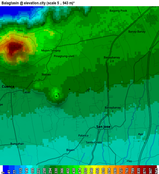
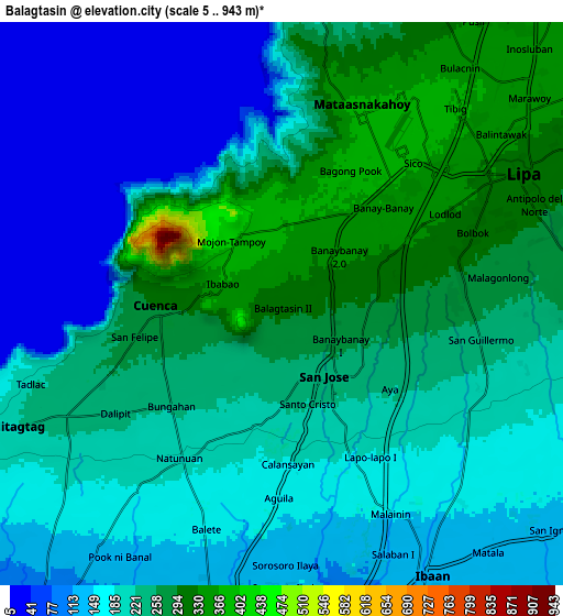
Below is the Elevation map of Balagtasin, which displays elevation range with different colors. Scale of the first map is from 5 to 943 m (16 to 3094 ft) with average elevation of 300.5 meters (=986 ft) [note 1]
These maps also provides idea of topography and contour of this city, they are displayed at different zoom levels. More info about maps, scale and edge coordinates you can find below images.
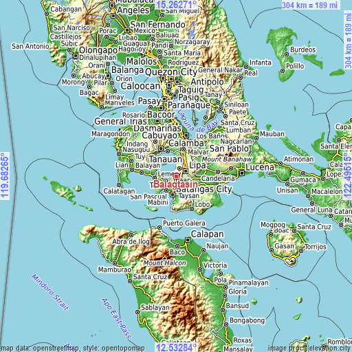
| \ | Map #1 | Map #2 | Topo.Map |
| Scale [m] | 5..943 m | 5..943 m | × |
| Scale [ft] | 16..3094 ft | 16..3094 ft | × |
| Average | 300.5 m = 986 ft | 203.7 m = 668 ft | × |
| Width | 9.49 km = 5.9 mi | 18.97 km = 11.8 mi | 303.5 km = 188.6 mi |
| Height | 9.49 km = 5.9 mi | 18.97 km = 11.8 mi | 303.6 km = 188.6 mi |
| ↑Max Latitude | 13.944454° | 13.9871° | 15.26271° |
| Latitude at center | 13.9018° | 13.9018° | 13.9018° |
| ↓Min Latitude | 13.859138° | 13.816468° | 12.53284° |
| ← Min Longitude | 121.044955° | 121.001009° | 119.68265° |
| Longitude center | 121.0889° | 121.0889° | 121.0889° |
| →Max Longitude | 121.132845° | 121.176791° | 122.49515° |
Nearby cities:
Cities around Balagtasin sort by population:
• Cuenca elevation 300 m
4 km,  270°
270°
• Banaybanay 367 m
4.5 km,  39°
39°
• Taysan 222 m
3.7 km,  166°
166°
• Bukal 151 m
7.3 km,  175°
175°
• Santo Niño 174 m
7.6 km,  141°
141°
• Aya 275 m
2.8 km,  106°
106°
• Talaibon 151 m
9 km, 142°
• Rizal 205 m
8.1 km, 110°
• Mulauin 234 m
8.7 km,  243°
243°
• Pangao 324 m
4.3 km,  66°
66°
• Mataas Na Kahoy 374 m
6.9 km,  22°
22°
• San Jose 238 m
3.1 km,  147°
147°
Multilingual:
 En español:
Balagtasin elevación 314 m.
 En France:
Balagtasin élévation 314 m.
 Auf Deutsch:
Balagtasin höhe über dem Meeresspiegel ist 314 m.

Sources and notes:
- [note 1] Map square and city borders are not equal. Map elevation data is calculated only from area inside that square.
- [src 1] Elevation data from geonames database provided with same terms of usage.
- [src 2] The elevation map of Balagtasin is generated using elevation data from NASA's 3 arcsec (90m) resolution SRTM data.
- [src 3] Base (background) map © OpenStreetMap contributors tiles are generated by Geofabrik and OpenTopoMap.
Copyright & License:
This Balagtasin Elevation Map is licensed under CC BY-SA. You may reuse any part from this page, if you give a proper credit by linking to this URL:
 More info on terms of use page.