Cuenca elevation
Cuenca (Calabarzon, Province of Batangas), Philippines elevation is 300 meters and Cuenca elevation in feet is 984 ft above sea level [src 1]. Cuenca is a seat of a third-order administrative division (feature code) with elevation that is 212 meters (696 ft) bigger than average city elevation in Philippines.
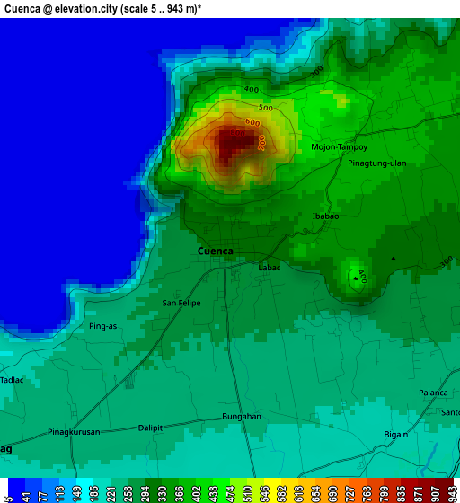
Below is the Elevation map of Cuenca, which displays elevation range with different colors. Scale of the first map is from 5 to 943 m (16 to 3094 ft) with average elevation of 230.2 meters (=755 ft) [note 1]
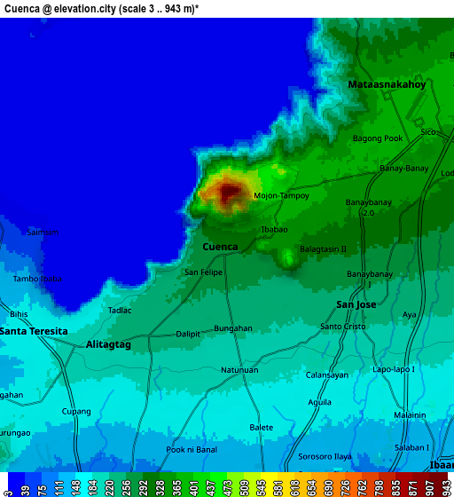
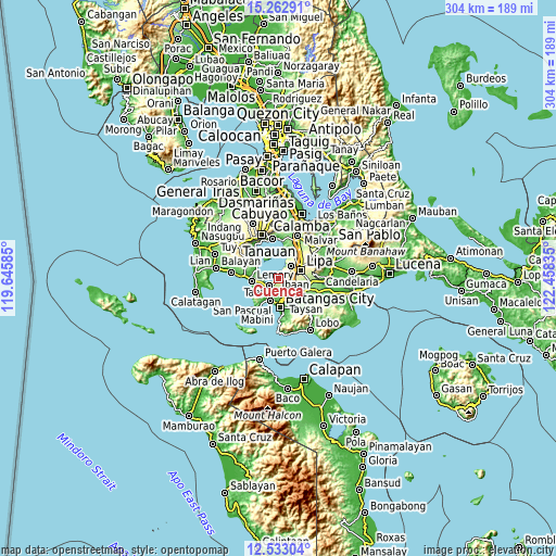
These maps also provides idea of topography and contour of this city, they are displayed at different zoom levels. More info about maps, scale and edge coordinates you can find below images.
| \ | Map #1 | Map #2 | Topo.Map |
| Scale [m] | 5..943 m | 3..943 m | × |
| Scale [ft] | 16..3094 ft | 10..3094 ft | × |
| Average | 230.2 m = 755 ft | 165.8 m = 544 ft | × |
| Width | 9.49 km = 5.9 mi | 18.97 km = 11.8 mi | 303.5 km = 188.6 mi |
| Height | 9.49 km = 5.9 mi | 18.97 km = 11.8 mi | 303.6 km = 188.6 mi |
| ↑Max Latitude | 13.944654° | 13.9873° | 15.26291° |
| Latitude at center | 13.902° | 13.902° | 13.902° |
| ↓Min Latitude | 13.859338° | 13.816668° | 12.53304° |
| ← Min Longitude | 121.008155° | 120.964209° | 119.64585° |
| Longitude center | 121.0521° | 121.0521° | 121.0521° |
| →Max Longitude | 121.096045° | 121.139991° | 122.45835° |
Nearby cities:
Cities around Cuenca sort by population:
• Banaybanay elevation 367 m
7.6 km,  63°
63°
• Taysan 222 m
6 km,  126°
126°
• Mozon 191 m
8.7 km,  230°
230°
• Balagtasin 314 m
4 km,  90°
90°
• Alitagtag 217 m
6.7 km, 231°
• Bukal 151 m
8.6 km,  148°
148°
• Aya 275 m
6.7 km,  97°
97°
• Santa Teresita 176 m
8.6 km,  242°
242°
• Mulauin 234 m
5.5 km,  224°
224°
• Pangao 324 m
8.1 km,  77°
77°
• Mataas Na Kahoy 374 m
9.2 km,  46°
46°
• San Jose 238 m
6.2 km,  114°
114°
Multilingual:
 En español:
Cuenca elevación 300 m.
 En France:
Cuenca élévation 300 m.


Sources and notes:
- [note 1] Map square and city borders are not equal. Map elevation data is calculated only from area inside that square.
- [src 1] Elevation data from geonames database provided with same terms of usage.
- [src 2] The elevation map of Cuenca is generated using elevation data from NASA's 3 arcsec (90m) resolution SRTM data.
- [src 3] Base (background) map © OpenStreetMap contributors tiles are generated by Geofabrik and OpenTopoMap.
Copyright & License:
This Cuenca Elevation Map is licensed under CC BY-SA. You may reuse any part from this page, if you give a proper credit by linking to this URL:
 More info on terms of use page.