Balele elevation
Balele (Calabarzon, Province of Batangas), Philippines elevation is 139 meters and Balele elevation in feet is 456 ft above sea level [src 1]. Balele is a populated place (feature code) with elevation that is 51 meters (167 ft) bigger than average city elevation in Philippines.
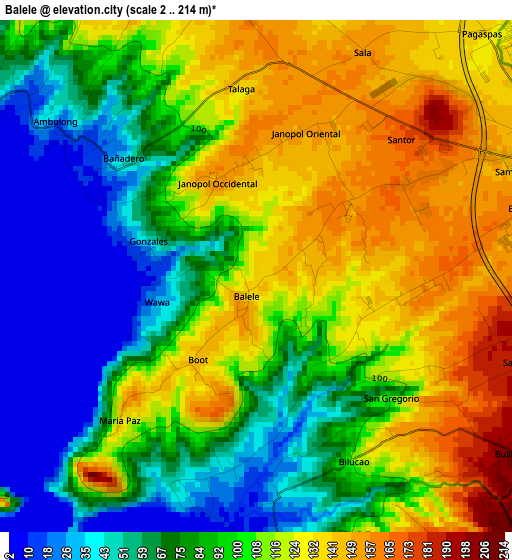
Below is the Elevation map of Balele, which displays elevation range with different colors. Scale of the first map is from 2 to 214 m (7 to 702 ft) with average elevation of 97.5 meters (=320 ft) [note 1]
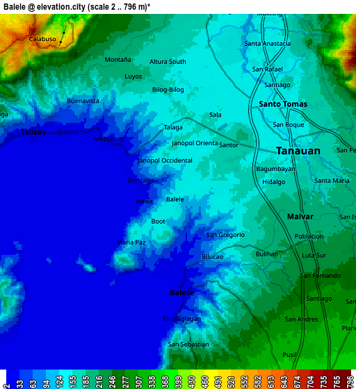
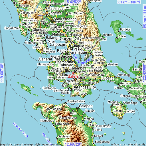
These maps also provides idea of topography and contour of this city, they are displayed at different zoom levels. More info about maps, scale and edge coordinates you can find below images.
| \ | Map #1 | Map #2 | Topo.Map |
| Scale [m] | 2..214 m | 2..796 m | × |
| Scale [ft] | 7..702 ft | 7..2612 ft | × |
| Average | 97.5 m = 320 ft | 142 m = 466 ft | × |
| Width | 9.48 km = 5.9 mi | 18.96 km = 11.8 mi | 303.3 km = 188.5 mi |
| Height | 9.48 km = 5.9 mi | 18.96 km = 11.8 mi | 303.3 km = 188.5 mi |
| ↑Max Latitude | 14.107944° | 14.15056° | 15.42522° |
| Latitude at center | 14.06532° | 14.06532° | 14.06532° |
| ↓Min Latitude | 14.022688° | 13.980049° | 12.69728° |
| ← Min Longitude | 121.049685° | 121.005739° | 119.68738° |
| Longitude center | 121.09363° | 121.09363° | 121.09363° |
| →Max Longitude | 121.137575° | 121.181521° | 122.49988° |
Nearby cities:
Cities around Balele sort by population:
• Tanauan elevation 155 m
6.5 km,  68°
68°
• Santo Tomas 145 m
7 km,  47°
47°
• Bilog-Bilog 157 m
5.4 km,  354°
354°
• Ambulong 14 m
4.3 km,  305°
305°
• Balete 16 m
5.1 km,  178°
178°
• Pantay Na Matanda 135 m
6.5 km,  27°
27°
• Janopol 144 m
2.3 km,  3°
3°
• Boot 139 m
2.8 km,  218°
218°
• San Pedro One 199 m
5.7 km,  103°
103°
• Santor 156 m
3.7 km, 25°
• San Isidro 96 m
3.9 km,  154°
154°
• Kinalaglagan 86 m
7.1 km, 176°
Multilingual:
 En español:
Balele elevación 139 m.
 En France:
Balele élévation 139 m.


Sources and notes:
- [note 1] Map square and city borders are not equal. Map elevation data is calculated only from area inside that square.
- [src 1] Elevation data from geonames database provided with same terms of usage.
- [src 2] The elevation map of Balele is generated using elevation data from NASA's 3 arcsec (90m) resolution SRTM data.
- [src 3] Base (background) map © OpenStreetMap contributors tiles are generated by Geofabrik and OpenTopoMap.
Copyright & License:
This Balele Elevation Map is licensed under CC BY-SA. You may reuse any part from this page, if you give a proper credit by linking to this URL:
 More info on terms of use page.