Pantay Na Matanda elevation
Pantay Na Matanda (Calabarzon, Province of Batangas), Philippines elevation is 135 meters and Pantay Na Matanda elevation in feet is 443 ft above sea level [src 1]. Pantay Na Matanda is a populated place (feature code) with elevation that is 47 meters (154 ft) bigger than average city elevation in Philippines.
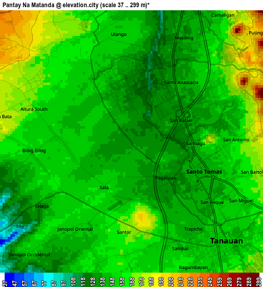
Below is the Elevation map of Pantay Na Matanda, which displays elevation range with different colors. Scale of the first map is from 37 to 299 m (121 to 981 ft) with average elevation of 153.4 meters (=503 ft) [note 1]
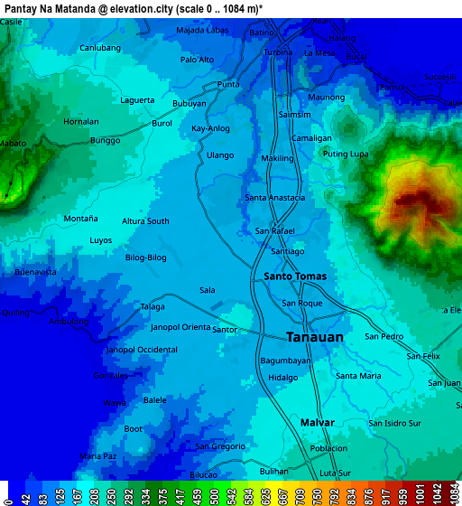
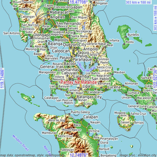
These maps also provides idea of topography and contour of this city, they are displayed at different zoom levels. More info about maps, scale and edge coordinates you can find below images.
| \ | Map #1 | Map #2 | Topo.Map |
| Scale [m] | 37..299 m | 0..1084 m | × |
| Scale [ft] | 121..981 ft | 0..3556 ft | × |
| Average | 153.4 m = 503 ft | 174.1 m = 571 ft | × |
| Width | 9.48 km = 5.9 mi | 18.95 km = 11.8 mi | 303.2 km = 188.4 mi |
| Height | 9.48 km = 5.9 mi | 18.95 km = 11.8 mi | 303.3 km = 188.5 mi |
| ↑Max Latitude | 14.160114° | 14.20272° | 15.47708° |
| Latitude at center | 14.1175° | 14.1175° | 14.1175° |
| ↓Min Latitude | 14.074878° | 14.032248° | 12.74976° |
| ← Min Longitude | 121.077165° | 121.033219° | 119.71486° |
| Longitude center | 121.12111° | 121.12111° | 121.12111° |
| →Max Longitude | 121.165055° | 121.209001° | 122.52736° |
Nearby cities:
Cities around Pantay Na Matanda sort by population:
• Tanauan elevation 155 m
4.6 km,  138°
138°
• Santo Tomas 145 m
2.4 km,  116°
116°
• Malvar 210 m
9 km,  153°
153°
• Bilog-Bilog 157 m
3.5 km,  262°
262°
• Ambulong 14 m
7.2 km,  243°
243°
• Balele 139 m
6.5 km,  207°
207°
• Janopol 144 m
4.5 km,  218°
218°
• Boot 139 m
9.3 km, 210°
• San Pedro One 199 m
7.6 km,  159°
159°
• Santor 156 m
2.8 km, 208°
• Prinza 76 m
8.9 km,  11°
11°
• Tranca 194 m
6.9 km,  270°
270°
Multilingual:
 En español:
Pantay Na Matanda elevación 135 m.
 En France:
Pantay Na Matanda élévation 135 m.
 Auf Deutsch:
Pantay Na Matanda höhe über dem Meeresspiegel ist 135 m.

Sources and notes:
- [note 1] Map square and city borders are not equal. Map elevation data is calculated only from area inside that square.
- [src 1] Elevation data from geonames database provided with same terms of usage.
- [src 2] The elevation map of Pantay Na Matanda is generated using elevation data from NASA's 3 arcsec (90m) resolution SRTM data.
- [src 3] Base (background) map © OpenStreetMap contributors tiles are generated by Geofabrik and OpenTopoMap.
Copyright & License:
This Pantay Na Matanda Elevation Map is licensed under CC BY-SA. You may reuse any part from this page, if you give a proper credit by linking to this URL:
 More info on terms of use page.