Bantuanon elevation
Bantuanon (Northern Mindanao, Province of Bukidnon), Philippines elevation is 510 meters and Bantuanon elevation in feet is 1673 ft above sea level [src 1]. Bantuanon is a populated place (feature code) with elevation that is 422 meters (1385 ft) bigger than average city elevation in Philippines.
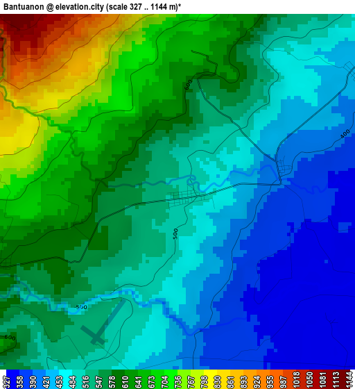
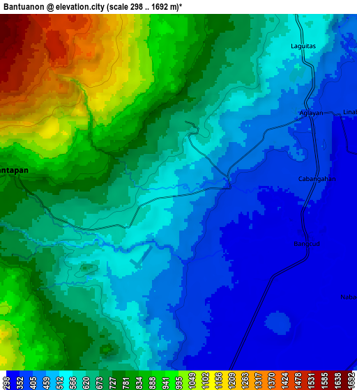
Below is the Elevation map of Bantuanon, which displays elevation range with different colors. Scale of the first map is from 327 to 1144 m (1073 to 3753 ft) with average elevation of 544.1 meters (=1785 ft) [note 1]
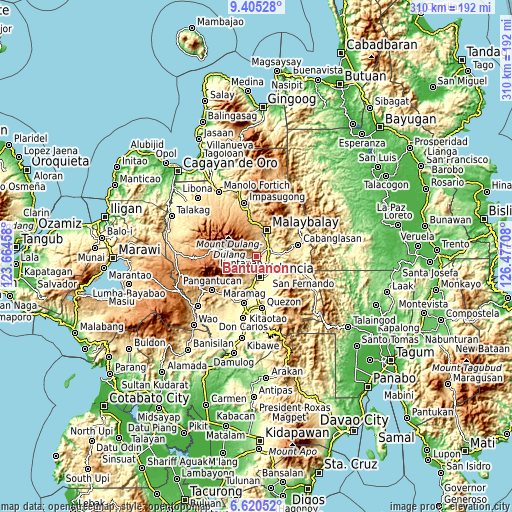
These maps also provides idea of topography and contour of this city, they are displayed at different zoom levels. More info about maps, scale and edge coordinates you can find below images.
| \ | Map #1 | Map #2 | Topo.Map |
| Scale [m] | 327..1144 m | 298..1692 m | × |
| Scale [ft] | 1073..3753 ft | 978..5551 ft | × |
| Average | 544.1 m = 1785 ft | 640.1 m = 2100 ft | × |
| Width | 9.68 km = 6 mi | 19.35 km = 12 mi | 309.6 km = 192.4 mi |
| Height | 9.68 km = 6 mi | 19.35 km = 12 mi | 309.7 km = 192.4 mi |
| ↑Max Latitude | 8.058794° | 8.102303° | 9.40528° |
| Latitude at center | 8.01528° | 8.01528° | 8.01528° |
| ↓Min Latitude | 7.971762° | 7.928239° | 6.62052° |
| ← Min Longitude | 125.026885° | 124.982939° | 123.66458° |
| Longitude center | 125.07083° | 125.07083° | 125.07083° |
| →Max Longitude | 125.114775° | 125.158721° | 126.47708° |
Nearby cities:
Cities around Bantuanon sort by population:
• Lurugan elevation 862 m
11.5 km,  270°
270°
• Linabo 359 m
10.2 km,  64°
64°
• Aglayan 403 m
8.3 km, 57°
• Mailag 321 m
8.9 km,  124°
124°
• Lantapan 595 m
5.1 km,  247°
247°
• Bugcaon 449 m
5.7 km,  53°
53°
• Alanib 820 m
9.4 km,  278°
278°
• Lumbayao 327 m
10.6 km,  89°
89°
• San Carlos 383 m
6.2 km,  173°
173°
• Cabangahan 369 m
7.4 km,  83°
83°
• Balila 631 m
6.5 km,  257°
257°
• Laguitas 541 m
10.5 km,  38°
38°
Multilingual:
 En español:
Bantuanon elevación 510 m.
 En France:
Bantuanon élévation 510 m.
 Auf Deutsch:
Bantuanon höhe über dem Meeresspiegel ist 510 m.

Sources and notes:
- [note 1] Map square and city borders are not equal. Map elevation data is calculated only from area inside that square.
- [src 1] Elevation data from geonames database provided with same terms of usage.
- [src 2] The elevation map of Bantuanon is generated using elevation data from NASA's 3 arcsec (90m) resolution SRTM data.
- [src 3] Base (background) map © OpenStreetMap contributors tiles are generated by Geofabrik and OpenTopoMap.
Copyright & License:
This Bantuanon Elevation Map is licensed under CC BY-SA. You may reuse any part from this page, if you give a proper credit by linking to this URL:
 More info on terms of use page.