Biñan elevation
Biñan (Calabarzon, Province of Laguna), Philippines elevation is 10 meters and Biñan elevation in feet is 33 ft above sea level [src 1]. Biñan is a seat of a third-order administrative division (feature code) with elevation that is 78 meters (256 ft) smaller than average city elevation in Philippines.
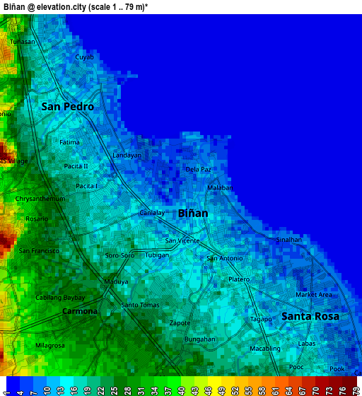
Below is the Elevation map of Biñan, which displays elevation range with different colors. Scale of the first map is from 1 to 79 m (3 to 259 ft) with average elevation of 13.1 meters (=43 ft) [note 1]
These maps also provides idea of topography and contour of this city, they are displayed at different zoom levels. More info about maps, scale and edge coordinates you can find below images.
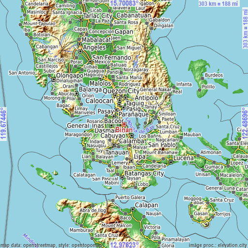
| \ | Map #1 | Map #2 | Topo.Map |
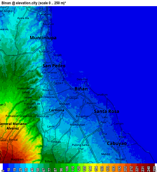
| Scale [m] | 1..79 m | 0..250 m | × |
| Scale [ft] | 3..259 ft | 0..820 ft | × |
| Average | 13.1 m = 43 ft | 34.3 m = 113 ft | × |
| Width | 9.47 km = 5.9 mi | 18.94 km = 11.8 mi | 302.9 km = 188.2 mi |
| Height | 9.47 km = 5.9 mi | 18.94 km = 11.8 mi | 303 km = 188.3 mi |
| ↑Max Latitude | 14.385242° | 14.427805° | 15.70083° |
| Latitude at center | 14.34267° | 14.34267° | 14.34267° |
| ↓Min Latitude | 14.30009° | 14.257503° | 12.97623° |
| ← Min Longitude | 121.036765° | 120.992819° | 119.67446° |
| Longitude center | 121.08071° | 121.08071° | 121.08071° |
| →Max Longitude | 121.124655° | 121.168601° | 122.48696° |
Nearby cities:
Cities around Biñan sort by population:
• Cabuyao elevation 15 m
9.2 km,  147°
147°
• San Pedro 17 m
4.1 km,  297°
297°
• Santa Rosa 13 m
4.7 km,  135°
135°
• Pulong Santa Cruz 52 m
7.7 km,  183°
183°
• Carmona 28 m
4.1 km,  217°
217°
• Mamatid 14 m
14.7 km, 144°
• Bulihan 204 m
11.7 km,  232°
232°
• Gulod 14 m
14.8 km,  89°
89°
• Maguyam 233 m
12.1 km, 222°
• Aplaya 9 m
4.3 km,  124°
124°
• Magsaysay 57 m
5 km,  265°
265°
• Muntinlupa 14 m
6.4 km,  325°
325°
Multilingual:
 En español:
Biñan elevación 10 m.
 En France:
Binan élévation 10 m.
 Auf Deutsch:
Biñan City höhe über dem Meeresspiegel ist 10 m.

Sources and notes:
- [note 1] Map square and city borders are not equal. Map elevation data is calculated only from area inside that square.
- [src 1] Elevation data from geonames database provided with same terms of usage.
- [src 2] The elevation map of Biñan is generated using elevation data from NASA's 3 arcsec (90m) resolution SRTM data.
- [src 3] Base (background) map © OpenStreetMap contributors tiles are generated by Geofabrik and OpenTopoMap.
Copyright & License:
This Biñan Elevation Map is licensed under CC BY-SA. You may reuse any part from this page, if you give a proper credit by linking to this URL:
 More info on terms of use page.