Maguyam elevation
Maguyam (Calabarzon, Province of Cavite), Philippines elevation is 233 meters and Maguyam elevation in feet is 764 ft above sea level [src 1]. Maguyam is a populated place (feature code) with elevation that is 145 meters (476 ft) bigger than average city elevation in Philippines.
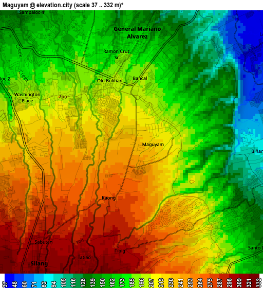
Below is the Elevation map of Maguyam, which displays elevation range with different colors. Scale of the first map is from 37 to 332 m (121 to 1089 ft) with average elevation of 200.1 meters (=656 ft) [note 1]
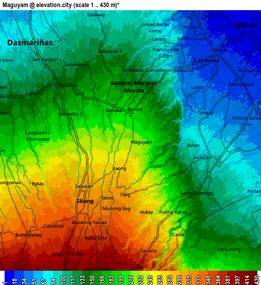
These maps also provides idea of topography and contour of this city, they are displayed at different zoom levels. More info about maps, scale and edge coordinates you can find below images.
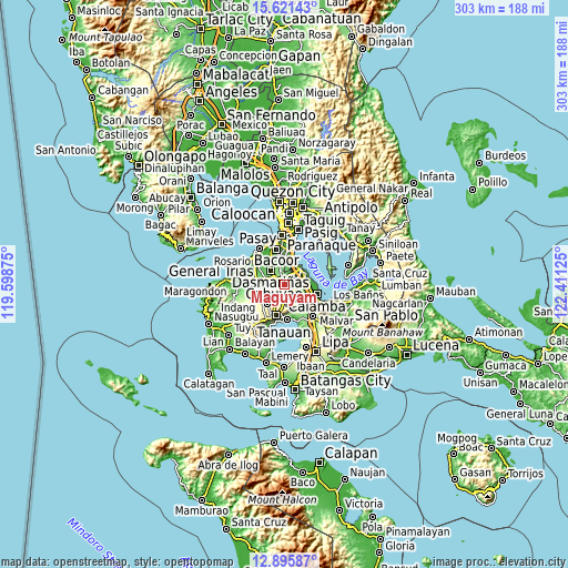
| \ | Map #1 | Map #2 | Topo.Map |
| Scale [m] | 37..332 m | 1..430 m | × |
| Scale [ft] | 121..1089 ft | 3..1411 ft | × |
| Average | 200.1 m = 656 ft | 172.8 m = 567 ft | × |
| Width | 9.47 km = 5.9 mi | 18.94 km = 11.8 mi | 303.1 km = 188.3 mi |
| Height | 9.47 km = 5.9 mi | 18.94 km = 11.8 mi | 303.1 km = 188.3 mi |
| ↑Max Latitude | 14.305357° | 14.347935° | 15.62143° |
| Latitude at center | 14.26277° | 14.26277° | 14.26277° |
| ↓Min Latitude | 14.220175° | 14.177572° | 12.89587° |
| ← Min Longitude | 120.961055° | 120.917109° | 119.59875° |
| Longitude center | 121.005° | 121.005° | 121.005° |
| →Max Longitude | 121.048945° | 121.092891° | 122.41125° |
Nearby cities:
Cities around Maguyam sort by population:
• Dasmariñas elevation 82 m
10.4 km,  315°
315°
• Silang 332 m
6.4 km,  214°
214°
• Pulong Santa Cruz 52 m
7.8 km,  81°
81°
• Carmona 28 m
8 km,  45°
45°
• Bulihan 204 m
2 km,  327°
327°
• Manggahan 119 m
11.6 km,  286°
286°
• Balite Segundo 396 m
9.4 km,  200°
200°
• Biga 237 m
3.6 km,  260°
260°
• Puting Kahoy 234 m
5.9 km,  151°
151°
• Javalera 198 m
9.7 km,  266°
266°
• Magsaysay 57 m
9 km,  20°
20°
• Lumil 381 m
9.1 km,  176°
176°
Multilingual:
 En español:
Maguyam elevación 233 m.
 En France:
Maguyam élévation 233 m.


Sources and notes:
- [note 1] Map square and city borders are not equal. Map elevation data is calculated only from area inside that square.
- [src 1] Elevation data from geonames database provided with same terms of usage.
- [src 2] The elevation map of Maguyam is generated using elevation data from NASA's 3 arcsec (90m) resolution SRTM data.
- [src 3] Base (background) map © OpenStreetMap contributors tiles are generated by Geofabrik and OpenTopoMap.
Copyright & License:
This Maguyam Elevation Map is licensed under CC BY-SA. You may reuse any part from this page, if you give a proper credit by linking to this URL:
 More info on terms of use page.