Bingawan elevation
Bingawan (Western Visayas, Province of Iloilo), Philippines elevation is 81 meters and Bingawan elevation in feet is 266 ft above sea level [src 1]. Bingawan is a seat of a third-order administrative division (feature code) with elevation that is 7 meters (23 ft) smaller than average city elevation in Philippines.
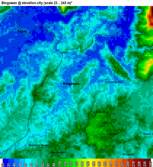
Below is the Elevation map of Bingawan, which displays elevation range with different colors. Scale of the first map is from 23 to 243 m (75 to 797 ft) with average elevation of 66.8 meters (=219 ft) [note 1]
These maps also provides idea of topography and contour of this city, they are displayed at different zoom levels. More info about maps, scale and edge coordinates you can find below images.
| \ | Map #1 | Map #2 | Topo.Map |
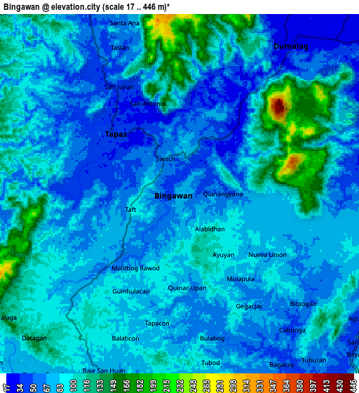
| Scale [m] | 23..243 m | 17..446 m | × |
| Scale [ft] | 75..797 ft | 56..1463 ft | × |
| Average | 66.8 m = 219 ft | 83.9 m = 275 ft | × |
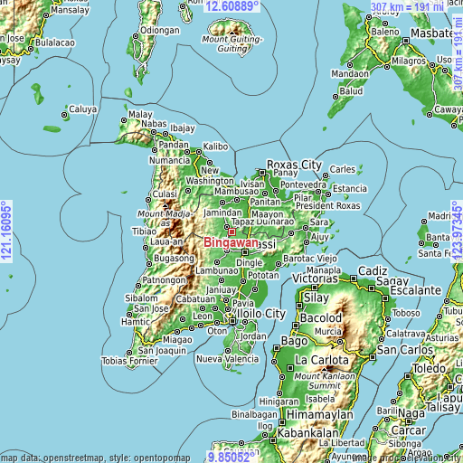
| Width | 9.59 km = 6 mi | 19.17 km = 11.9 mi | 306.7 km = 190.6 mi |
| Height | 9.59 km = 6 mi | 19.17 km = 11.9 mi | 306.7 km = 190.6 mi |
| ↑Max Latitude | 11.2761° | 11.319194° | 12.60889° |
| Latitude at center | 11.233° | 11.233° | 11.233° |
| ↓Min Latitude | 11.189893° | 11.14678° | 9.85052° |
| ← Min Longitude | 122.523255° | 122.479309° | 121.16095° |
| Longitude center | 122.5672° | 122.5672° | 122.5672° |
| →Max Longitude | 122.611145° | 122.655091° | 123.97345° |
Nearby cities:
Cities around Bingawan sort by population:
• Calinog elevation 51 m
12.9 km,  180°
180°
• Duran 43 m
4.2 km,  39°
39°
• Dumalag 28 m
10.4 km, 36°
• Aglalana 64 m
11.5 km,  120°
120°
• San Nicolas 53 m
11.2 km,  331°
331°
• Santa Angel 25 m
11.5 km, 44°
• Tapas 43 m
4.6 km,  313°
313°
• Candelaria 44 m
7.9 km,  322°
322°
• Quinagaringan 52 m
12.5 km,  169°
169°
• San Miguel 75 m
3.4 km,  232°
232°
• Consolacion 38 m
12.8 km,  34°
34°
• Badlan 72 m
11.4 km,  206°
206°
Multilingual:
 En español:
Bingawan elevación 81 m.
 En France:
Bingawan élévation 81 m.


Sources and notes:
- [note 1] Map square and city borders are not equal. Map elevation data is calculated only from area inside that square.
- [src 1] Elevation data from geonames database provided with same terms of usage.
- [src 2] The elevation map of Bingawan is generated using elevation data from NASA's 3 arcsec (90m) resolution SRTM data.
- [src 3] Base (background) map © OpenStreetMap contributors tiles are generated by Geofabrik and OpenTopoMap.
Copyright & License:
This Bingawan Elevation Map is licensed under CC BY-SA. You may reuse any part from this page, if you give a proper credit by linking to this URL:
 More info on terms of use page.