Butigui elevation
Butigui (Cordillera, Mountain Province), Philippines elevation is 147 meters and Butigui elevation in feet is 482 ft above sea level [src 1]. Butigui is a populated place (feature code) with elevation that is 59 meters (194 ft) bigger than average city elevation in Philippines.
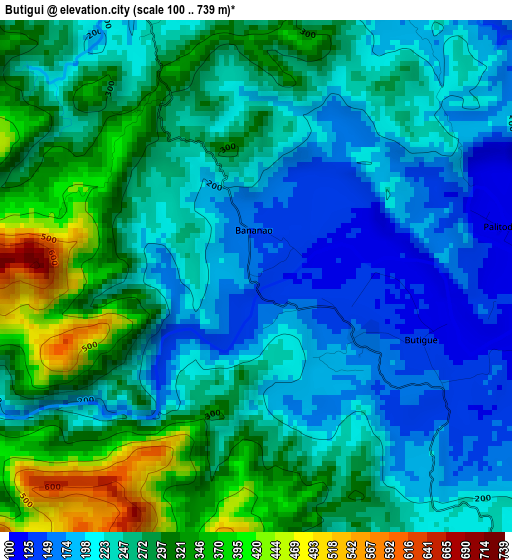
Below is the Elevation map of Butigui, which displays elevation range with different colors. Scale of the first map is from 100 to 739 m (328 to 2425 ft) with average elevation of 255.8 meters (=839 ft) [note 1]
These maps also provides idea of topography and contour of this city, they are displayed at different zoom levels. More info about maps, scale and edge coordinates you can find below images.
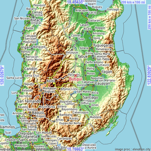
| \ | Map #1 | Topo.Map |
| Scale [m] | 100..739 m | × |
| Scale [ft] | 328..2425 ft | × |
| Average | 255.8 m = 839 ft | × |
| Width | 9.34 km = 5.8 mi | 298.8 km = 185.7 mi |
| Height | 9.34 km = 5.8 mi | 298.9 km = 185.7 mi |
| ↑Max Latitude | 17.157334° | 18.45435° |
| Latitude at center | 17.11534° | 17.11534° |
| ↓Min Latitude | 17.073336° | 15.76663° |
| ← Min Longitude | 121.389095° | 120.02679° |
| Longitude center | 121.43304° | 121.43304° |
| →Max Longitude | 121.476985° | 122.83929° |
Nearby cities:
Cities around Butigui sort by population:
• Roxas elevation 60 m
19.9 km,  88°
88°
• San Manuel 64 m
23.8 km,  115°
115°
• San Jose 65 m
18.2 km,  77°
77°
• Muñoz East 65 m
19.7 km, 76°
• Sandiat Centro 59 m
22.2 km,  102°
102°
• Paracelis 223 m
17.2 km,  11°
11°
• Barucboc Norte 85 m
24.3 km,  49°
49°
• Simimbaan 73 m
15.8 km, 88°
• Bagong Tanza 70 m
24 km,  127°
127°
• Eden 79 m
19.5 km, 116°
• Mallig 66 m
21.8 km,  60°
60°
• Natonin 973 m
16.7 km,  267°
267°
Multilingual:
 En español:
Butigui elevación 147 m.
 En France:
Butigui élévation 147 m.


Sources and notes:
- [note 1] Map square and city borders are not equal. Map elevation data is calculated only from area inside that square.
- [src 1] Elevation data from geonames database provided with same terms of usage.
- [src 2] The elevation map of Butigui is generated using elevation data from NASA's 3 arcsec (90m) resolution SRTM data.
- [src 3] Base (background) map © OpenStreetMap contributors tiles are generated by Geofabrik and OpenTopoMap.
Copyright & License:
This Butigui Elevation Map is licensed under CC BY-SA. You may reuse any part from this page, if you give a proper credit by linking to this URL:
 More info on terms of use page.