Candelaria elevation
Candelaria (Calabarzon, Province of Quezon), Philippines elevation is 72 meters and Candelaria elevation in feet is 236 ft above sea level [src 1]. Candelaria is a seat of a third-order administrative division (feature code) with elevation that is 16 meters (52 ft) smaller than average city elevation in Philippines.
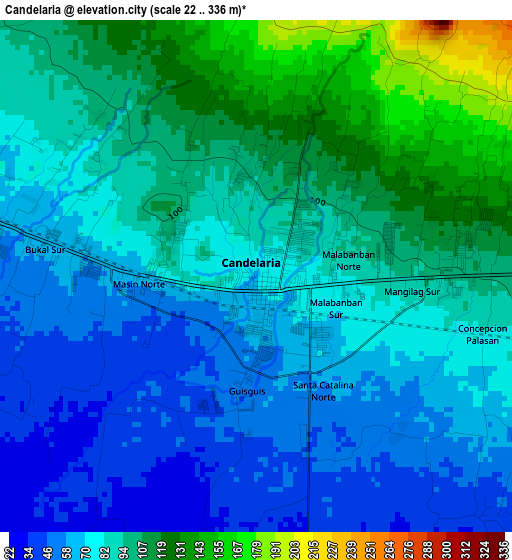
Below is the Elevation map of Candelaria, which displays elevation range with different colors. Scale of the first map is from 22 to 336 m (72 to 1102 ft) with average elevation of 85.1 meters (=279 ft) [note 1]
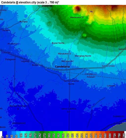
These maps also provides idea of topography and contour of this city, they are displayed at different zoom levels. More info about maps, scale and edge coordinates you can find below images.
| \ | Map #1 | Map #2 | Topo.Map |
| Scale [m] | 22..336 m | 3..780 m | × |
| Scale [ft] | 72..1102 ft | 10..2559 ft | × |
| Average | 85.1 m = 279 ft | 115.8 m = 380 ft | × |
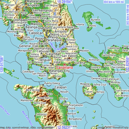
| Width | 9.49 km = 5.9 mi | 18.97 km = 11.8 mi | 303.5 km = 188.6 mi |
| Height | 9.49 km = 5.9 mi | 18.97 km = 11.8 mi | 303.5 km = 188.6 mi |
| ↑Max Latitude | 13.973759° | 14.0164° | 15.29184° |
| Latitude at center | 13.93111° | 13.93111° | 13.93111° |
| ↓Min Latitude | 13.888453° | 13.845789° | 12.56231° |
| ← Min Longitude | 121.379385° | 121.335439° | 120.01708° |
| Longitude center | 121.42333° | 121.42333° | 121.42333° |
| →Max Longitude | 121.467275° | 121.511221° | 122.82958° |
Nearby cities:
Cities around Candelaria sort by population:
• Concepcion Ibaba elevation 83 m
4.2 km,  102°
102°
• Malabanban Norte 102 m
1.8 km,  26°
26°
• Lusacan 52 m
8.9 km,  287°
287°
• Masalukot Uno 113 m
2.7 km,  349°
349°
• Santa Catalina Sur 22 m
6.4 km,  172°
172°
• Paiisa 42 m
7.5 km,  265°
265°
• Cabatang 74 m
7.3 km,  303°
303°
• Bungoy 101 m
9.7 km,  319°
319°
• Montecillo 46 m
7.2 km,  128°
128°
• Cabay 25 m
8.2 km,  214°
214°
• Dagatan 133 m
9.3 km,  327°
327°
• Bukal Sur 67 m
4.1 km,  280°
280°
Multilingual:
 En español:
Candelaria elevación 72 m.
 En France:
Candelaria élévation 72 m.
 Auf Deutsch:
Candelaria höhe über dem Meeresspiegel ist 72 m.

Sources and notes:
- [note 1] Map square and city borders are not equal. Map elevation data is calculated only from area inside that square.
- [src 1] Elevation data from geonames database provided with same terms of usage.
- [src 2] The elevation map of Candelaria is generated using elevation data from NASA's 3 arcsec (90m) resolution SRTM data.
- [src 3] Base (background) map © OpenStreetMap contributors tiles are generated by Geofabrik and OpenTopoMap.
Copyright & License:
This Candelaria Elevation Map is licensed under CC BY-SA. You may reuse any part from this page, if you give a proper credit by linking to this URL:
 More info on terms of use page.