Catablan elevation
Catablan (Ilocos, Province of Pangasinan), Philippines elevation is 22 meters and Catablan elevation in feet is 72 ft above sea level [src 1]. Catablan is a populated place (feature code) with elevation that is 66 meters (217 ft) smaller than average city elevation in Philippines.
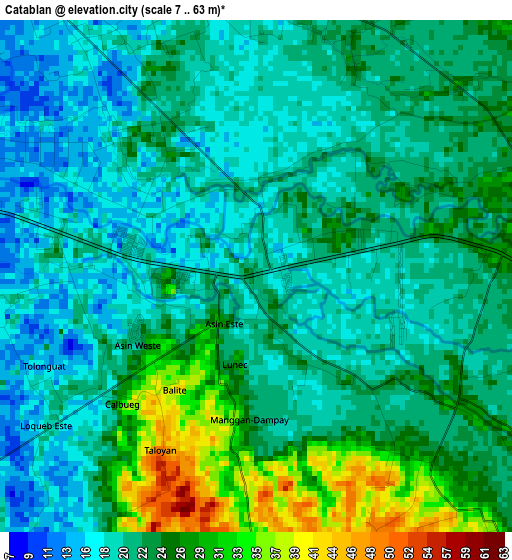
Below is the Elevation map of Catablan, which displays elevation range with different colors. Scale of the first map is from 7 to 63 m (23 to 207 ft) with average elevation of 22.2 meters (=73 ft) [note 1]
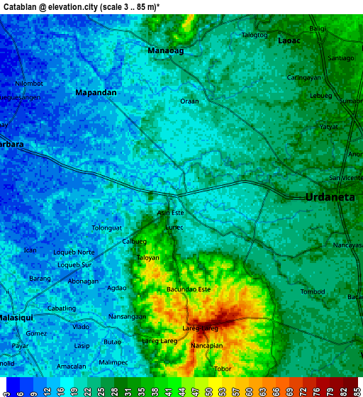
These maps also provides idea of topography and contour of this city, they are displayed at different zoom levels. More info about maps, scale and edge coordinates you can find below images.
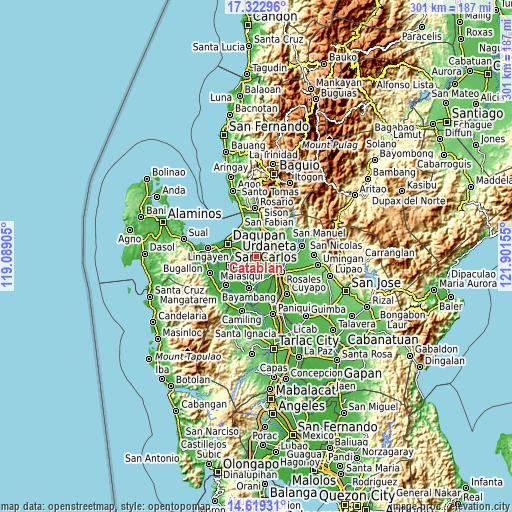
| \ | Map #1 | Map #2 | Topo.Map |
| Scale [m] | 7..63 m | 3..85 m | × |
| Scale [ft] | 23..207 ft | 10..279 ft | × |
| Average | 22.2 m = 73 ft | 23.3 m = 76 ft | × |
| Width | 9.4 km = 5.8 mi | 18.79 km = 11.7 mi | 300.6 km = 186.8 mi |
| Height | 9.4 km = 5.8 mi | 18.79 km = 11.7 mi | 300.6 km = 186.8 mi |
| ↑Max Latitude | 16.017944° | 16.060178° | 17.32296° |
| Latitude at center | 15.9757° | 15.9757° | 15.9757° |
| ↓Min Latitude | 15.933447° | 15.891186° | 14.61931° |
| ← Min Longitude | 120.451355° | 120.407409° | 119.08905° |
| Longitude center | 120.4953° | 120.4953° | 120.4953° |
| →Max Longitude | 120.539245° | 120.583191° | 121.90155° |
Nearby cities:
Cities around Catablan sort by population:
• Urdaneta elevation 32 m
8.1 km,  89°
89°
• Manaoag 23 m
7.6 km,  352°
352°
• Mapandan 15 m
7 km,  321°
321°
• Loqueb Este 17 m
6.3 km,  236°
236°
• Minien East 19 m
1.5 km,  276°
276°
• Unzad 40 m
7.9 km,  143°
143°
• Maticmatic 14 m
4.8 km, 284°
• Canan Norte 41 m
7.6 km,  194°
194°
• Tebag East 21 m
3 km, 281°
• Patayac 11 m
7.9 km,  259°
259°
• Bacundao Weste 39 m
7 km,  196°
196°
• Lunec 36 m
2.5 km, 194°
Multilingual:
 En español:
Catablan elevación 22 m.
 En France:
Catablan élévation 22 m.


Sources and notes:
- [note 1] Map square and city borders are not equal. Map elevation data is calculated only from area inside that square.
- [src 1] Elevation data from geonames database provided with same terms of usage.
- [src 2] The elevation map of Catablan is generated using elevation data from NASA's 3 arcsec (90m) resolution SRTM data.
- [src 3] Base (background) map © OpenStreetMap contributors tiles are generated by Geofabrik and OpenTopoMap.
Copyright & License:
This Catablan Elevation Map is licensed under CC BY-SA. You may reuse any part from this page, if you give a proper credit by linking to this URL:
 More info on terms of use page.