Dolo elevation
Dolo (Davao, Province of Davao del Sur), Philippines elevation is 177 meters and Dolo elevation in feet is 581 ft above sea level [src 1]. Dolo is a populated place (feature code) with elevation that is 89 meters (292 ft) bigger than average city elevation in Philippines.
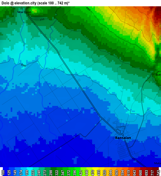
Below is the Elevation map of Dolo, which displays elevation range with different colors. Scale of the first map is from 100 to 742 m (328 to 2434 ft) with average elevation of 226.7 meters (=744 ft) [note 1]
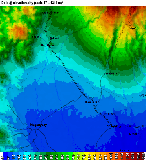
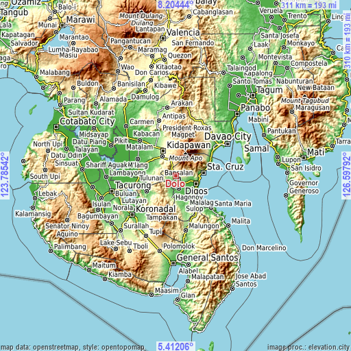
These maps also provides idea of topography and contour of this city, they are displayed at different zoom levels. More info about maps, scale and edge coordinates you can find below images.
| \ | Map #1 | Map #2 | Topo.Map |
| Scale [m] | 100..742 m | 17..1314 m | × |
| Scale [ft] | 328..2434 ft | 56..4311 ft | × |
| Average | 226.7 m = 744 ft | 328.9 m = 1079 ft | × |
| Width | 9.7 km = 6 mi | 19.41 km = 12.1 mi | 310.5 km = 192.9 mi |
| Height | 9.7 km = 6 mi | 19.41 km = 12.1 mi | 310.5 km = 192.9 mi |
| ↑Max Latitude | 6.853913° | 6.897543° | 8.20444° |
| Latitude at center | 6.81028° | 6.81028° | 6.81028° |
| ↓Min Latitude | 6.766643° | 6.723002° | 5.41206° |
| ← Min Longitude | 125.147725° | 125.103779° | 123.78542° |
| Longitude center | 125.19167° | 125.19167° | 125.19167° |
| →Max Longitude | 125.235615° | 125.279561° | 126.59792° |
Nearby cities:
Cities around Dolo sort by population:
• Bansalan elevation 162 m
3.6 km,  138°
138°
• Magsaysay 102 m
4.9 km,  190°
190°
• Matanao 42 m
16.2 km,  154°
154°
• Malasila 364 m
16.4 km,  335°
335°
• Sinayawan 13 m
16.9 km,  129°
129°
• Kisante 518 m
13.2 km, 342°
• Matti 47 m
13.6 km,  108°
108°
• Bulatukan 476 m
10.8 km, 341°
• Goma 80 m
14.4 km,  98°
98°
• Sinawilan 60 m
8.7 km, 135°
• Managa 66 m
11 km, 130°
• Ignit 16 m
16.5 km, 137°
Multilingual:
 En español:
Dolo elevación 177 m.
 En France:
Dolo élévation 177 m.


Sources and notes:
- [note 1] Map square and city borders are not equal. Map elevation data is calculated only from area inside that square.
- [src 1] Elevation data from geonames database provided with same terms of usage.
- [src 2] The elevation map of Dolo is generated using elevation data from NASA's 3 arcsec (90m) resolution SRTM data.
- [src 3] Base (background) map © OpenStreetMap contributors tiles are generated by Geofabrik and OpenTopoMap.
Copyright & License:
This Dolo Elevation Map is licensed under CC BY-SA. You may reuse any part from this page, if you give a proper credit by linking to this URL:
 More info on terms of use page.