Guisguis elevation
Guisguis (Calabarzon, Province of Quezon), Philippines elevation is 20 meters and Guisguis elevation in feet is 66 ft above sea level [src 1]. Guisguis is a populated place (feature code) with elevation that is 68 meters (223 ft) smaller than average city elevation in Philippines.
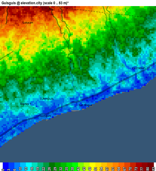
Below is the Elevation map of Guisguis, which displays elevation range with different colors. Scale of the first map is from 0 to 83 m (0 to 272 ft) with average elevation of 31.3 meters (=103 ft) [note 1]
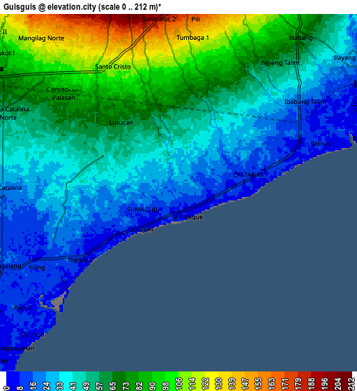
These maps also provides idea of topography and contour of this city, they are displayed at different zoom levels. More info about maps, scale and edge coordinates you can find below images.
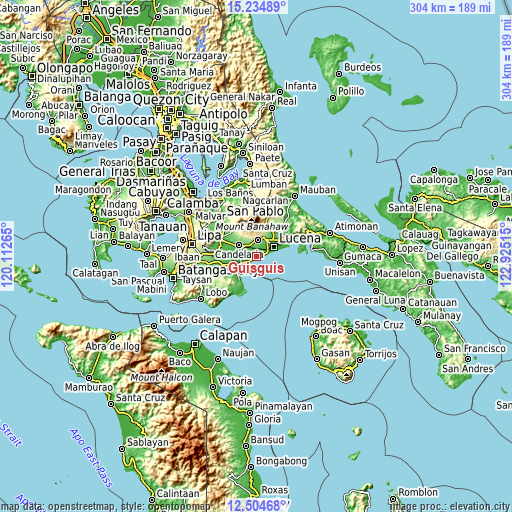
| \ | Map #1 | Map #2 | Topo.Map |
| Scale [m] | 0..83 m | 0..212 m | × |
| Scale [ft] | 0..272 ft | 0..696 ft | × |
| Average | 31.3 m = 103 ft | 54.3 m = 178 ft | × |
| Width | 9.49 km = 5.9 mi | 18.97 km = 11.8 mi | 303.6 km = 188.6 mi |
| Height | 9.49 km = 5.9 mi | 18.97 km = 11.8 mi | 303.6 km = 188.6 mi |
| ↑Max Latitude | 13.916459° | 13.959111° | 15.23489° |
| Latitude at center | 13.8738° | 13.8738° | 13.8738° |
| ↓Min Latitude | 13.831133° | 13.788458° | 12.50468° |
| ← Min Longitude | 121.474955° | 121.431009° | 120.11265° |
| Longitude center | 121.5189° | 121.5189° | 121.5189° |
| →Max Longitude | 121.562845° | 121.606791° | 122.92515° |
Nearby cities:
Cities around Guisguis sort by population:
• Candelaria elevation 72 m
12.1 km,  301°
301°
• Sariaya 197 m
9.9 km,  4°
4°
• Concepcion Ibaba 83 m
8.3 km,  311°
311°
• Bignay Uno 18 m
3.5 km,  252°
252°
• Castañas 4 m
3.7 km,  88°
88°
• Santa Catalina Sur 22 m
9.5 km,  270°
270°
• Janagdong 51 m
3.3 km,  349°
349°
• Isabang 98 m
10.8 km,  31°
31°
• Montecillo 46 m
5 km,  291°
291°
• Bukal 55 m
4.5 km,  10°
10°
• Tipaz 15 m
11.3 km,  243°
243°
• Poctol 9 m
10.2 km,  234°
234°
Multilingual:
 En español:
Guisguis elevación 20 m.
 En France:
Guisguis élévation 20 m.


Sources and notes:
- [note 1] Map square and city borders are not equal. Map elevation data is calculated only from area inside that square.
- [src 1] Elevation data from geonames database provided with same terms of usage.
- [src 2] The elevation map of Guisguis is generated using elevation data from NASA's 3 arcsec (90m) resolution SRTM data.
- [src 3] Base (background) map © OpenStreetMap contributors tiles are generated by Geofabrik and OpenTopoMap.
Copyright & License:
This Guisguis Elevation Map is licensed under CC BY-SA. You may reuse any part from this page, if you give a proper credit by linking to this URL:
 More info on terms of use page.