Imelda elevation
Imelda (Northern Mindanao, Province of Lanao del Norte), Philippines elevation is 85 meters and Imelda elevation in feet is 279 ft above sea level [src 1]. Imelda is a populated place (feature code) with elevation that is 3 meters (10 ft) smaller than average city elevation in Philippines.
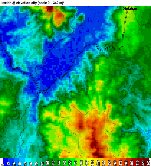
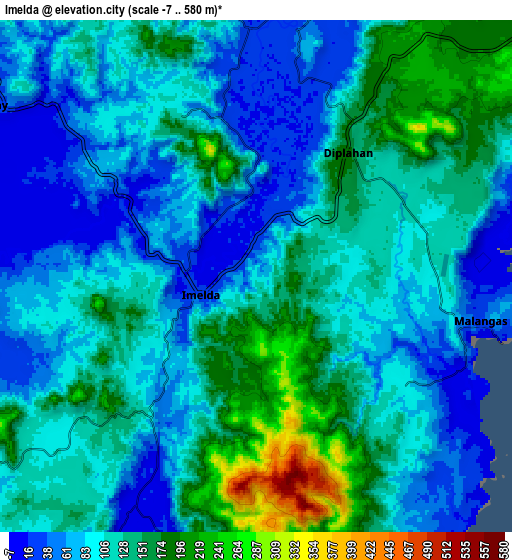
Below is the Elevation map of Imelda, which displays elevation range with different colors. Scale of the first map is from 0 to 342 m (0 to 1122 ft) with average elevation of 107.6 meters (=353 ft) [note 1]
These maps also provides idea of topography and contour of this city, they are displayed at different zoom levels. More info about maps, scale and edge coordinates you can find below images.
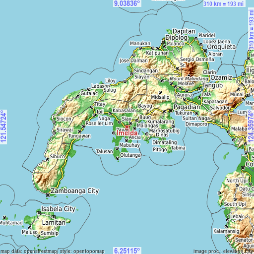
| \ | Map #1 | Map #2 | Topo.Map |
| Scale [m] | 0..342 m | -7..580 m | × |
| Scale [ft] | 0..1122 ft | -23..1903 ft | × |
| Average | 107.6 m = 353 ft | 111.2 m = 365 ft | × |
| Width | 9.69 km = 6 mi | 19.37 km = 12 mi | 309.9 km = 192.6 mi |
| Height | 9.69 km = 6 mi | 19.37 km = 12 mi | 309.9 km = 192.6 mi |
| ↑Max Latitude | 7.690582° | 7.73413° | 9.03836° |
| Latitude at center | 7.64703° | 7.64703° | 7.64703° |
| ↓Min Latitude | 7.603473° | 7.559912° | 6.25115° |
| ← Min Longitude | 122.909545° | 122.865599° | 121.54724° |
| Longitude center | 122.95349° | 122.95349° | 122.95349° |
| →Max Longitude | 122.997435° | 123.041381° | 124.35974° |
Nearby cities:
Cities around Imelda sort by population:
• Katipunan elevation 79 m
15.3 km,  242°
242°
• Buug 194 m
14.9 km,  51°
51°
• Malangas 26 m
8.8 km,  102°
102°
• Payao 10 m
17.9 km,  247°
247°
• Monching 38 m
12.3 km,  308°
308°
• Diplahan 219 m
10.4 km,  41°
41°
• Alicia 15 m
15 km,  189°
189°
• La Dicha 107 m
6.3 km,  59°
59°
• Siay 6 m
11.4 km,  298°
298°
• Del Monte 219 m
10.6 km,  34°
34°
• Ganyangan 7 m
6 km, 306°
• Kawayan 21 m
15 km,  216°
216°
Multilingual:
 En español:
Imelda elevación 85 m.
 En France:
Imelda élévation 85 m.


Sources and notes:
- [note 1] Map square and city borders are not equal. Map elevation data is calculated only from area inside that square.
- [src 1] Elevation data from geonames database provided with same terms of usage.
- [src 2] The elevation map of Imelda is generated using elevation data from NASA's 3 arcsec (90m) resolution SRTM data.
- [src 3] Base (background) map © OpenStreetMap contributors tiles are generated by Geofabrik and OpenTopoMap.
Copyright & License:
This Imelda Elevation Map is licensed under CC BY-SA. You may reuse any part from this page, if you give a proper credit by linking to this URL:
 More info on terms of use page.