Payao elevation
Payao (Zamboanga Peninsula, Province of Zamboanga Sibugay), Philippines elevation is 10 meters and Payao elevation in feet is 33 ft above sea level [src 1]. Payao is a seat of a third-order administrative division (feature code) with elevation that is 78 meters (256 ft) smaller than average city elevation in Philippines.
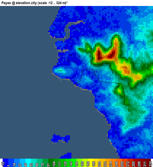
Below is the Elevation map of Payao, which displays elevation range with different colors. Scale of the first map is from -12 to 324 m (-39 to 1063 ft) with average elevation of 41.8 meters (=137 ft) [note 1]
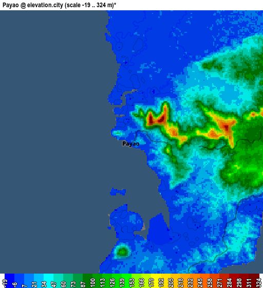
These maps also provides idea of topography and contour of this city, they are displayed at different zoom levels. More info about maps, scale and edge coordinates you can find below images.
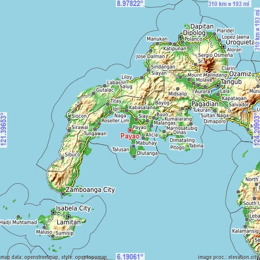
| \ | Map #1 | Map #2 | Topo.Map |
| Scale [m] | -12..324 m | -19..324 m | × |
| Scale [ft] | -39..1063 ft | -62..1063 ft | × |
| Average | 41.8 m = 137 ft | 36.4 m = 119 ft | × |
| Width | 9.69 km = 6 mi | 19.37 km = 12 mi | 310 km = 192.6 mi |
| Height | 9.69 km = 6 mi | 19.37 km = 12 mi | 310 km = 192.6 mi |
| ↑Max Latitude | 7.630228° | 7.673782° | 8.97822° |
| Latitude at center | 7.58667° | 7.58667° | 7.58667° |
| ↓Min Latitude | 7.543107° | 7.49954° | 6.19061° |
| ← Min Longitude | 122.758835° | 122.714889° | 121.39653° |
| Longitude center | 122.80278° | 122.80278° | 122.80278° |
| →Max Longitude | 122.846725° | 122.890671° | 124.20903° |
Nearby cities:
Cities around Payao sort by population:
• Katipunan elevation 79 m
3.1 km,  98°
98°
• Talusan 19 m
17.8 km,  177°
177°
• Imelda 85 m
17.9 km,  67°
67°
• Monching 38 m
16 km,  26°
26°
• Alicia 15 m
16.2 km,  119°
119°
• Batu 18 m
18.8 km,  9°
9°
• Mabuhay 23 m
19.1 km,  168°
168°
• Siay 6 m
13.9 km, 28°
• Dawa-Dawa 27 m
13.7 km,  164°
164°
• Ganyangan 7 m
15.6 km,  48°
48°
• Kawayan 21 m
9.4 km, 124°
• Laparay 11 m
20.4 km, 175°
Multilingual:
 En español:
Payao elevación 10 m.
 En France:
Payao élévation 10 m.


Sources and notes:
- [note 1] Map square and city borders are not equal. Map elevation data is calculated only from area inside that square.
- [src 1] Elevation data from geonames database provided with same terms of usage.
- [src 2] The elevation map of Payao is generated using elevation data from NASA's 3 arcsec (90m) resolution SRTM data.
- [src 3] Base (background) map © OpenStreetMap contributors tiles are generated by Geofabrik and OpenTopoMap.
Copyright & License:
This Payao Elevation Map is licensed under CC BY-SA. You may reuse any part from this page, if you give a proper credit by linking to this URL:
 More info on terms of use page.