Ligao elevation
Ligao (Bicol, Province of Albay), Philippines elevation is 60 meters and Ligao elevation in feet is 197 ft above sea level [src 1]. Ligao is a seat of a third-order administrative division (feature code) with elevation that is 28 meters (92 ft) smaller than average city elevation in Philippines.
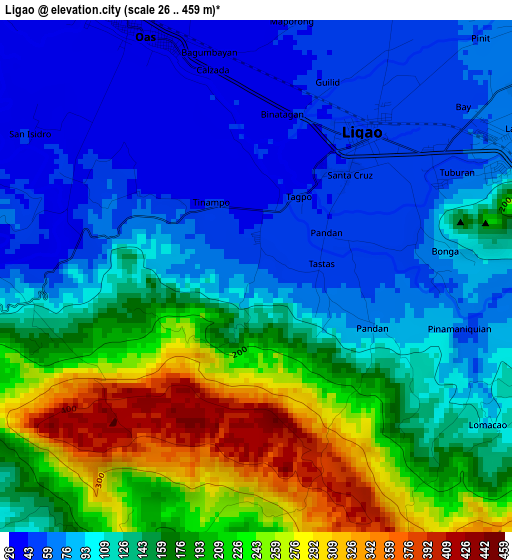
Below is the Elevation map of Ligao, which displays elevation range with different colors. Scale of the first map is from 26 to 459 m (85 to 1506 ft) with average elevation of 138.5 meters (=454 ft) [note 1]
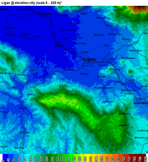
These maps also provides idea of topography and contour of this city, they are displayed at different zoom levels. More info about maps, scale and edge coordinates you can find below images.
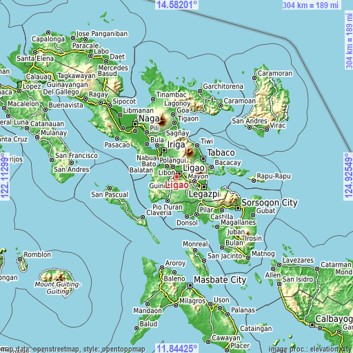
| \ | Map #1 | Map #2 | Topo.Map |
| Scale [m] | 26..459 m | 8..828 m | × |
| Scale [ft] | 85..1506 ft | 26..2717 ft | × |
| Average | 138.5 m = 454 ft | 132.1 m = 433 ft | × |
| Width | 9.51 km = 5.9 mi | 19.03 km = 11.8 mi | 304.4 km = 189.1 mi |
| Height | 9.51 km = 5.9 mi | 19.03 km = 11.8 mi | 304.4 km = 189.1 mi |
| ↑Max Latitude | 13.259748° | 13.302517° | 14.58201° |
| Latitude at center | 13.21697° | 13.21697° | 13.21697° |
| ↓Min Latitude | 13.174185° | 13.131393° | 11.84425° |
| ← Min Longitude | 123.475295° | 123.431349° | 122.11299° |
| Longitude center | 123.51924° | 123.51924° | 123.51924° |
| →Max Longitude | 123.563185° | 123.607131° | 124.92549° |
Nearby cities:
Cities around Ligao sort by population:
• Ponso elevation 42 m
8.2 km,  358°
358°
• Tuburan 54 m
4.5 km,  52°
52°
• Balogo 61 m
8.5 km,  22°
22°
• San Rafael 165 m
8.7 km,  90°
90°
• Mahaba 62 m
6.6 km,  31°
31°
• Batana 73 m
6.1 km, 53°
• Iraya 36 m
3.7 km, 355°
• Tinampo 39 m
1.8 km,  313°
313°
• Bonga 67 m
3.3 km, 90°
• Paulba 59 m
7.5 km,  235°
235°
• Herrera 80 m
8.5 km, 47°
• City of Ligao 70 m
0.5 km,  268°
268°
Multilingual:
 En español:
Ligao elevación 60 m.
 En France:
Ligao élévation 60 m.


Sources and notes:
- [note 1] Map square and city borders are not equal. Map elevation data is calculated only from area inside that square.
- [src 1] Elevation data from geonames database provided with same terms of usage.
- [src 2] The elevation map of Ligao is generated using elevation data from NASA's 3 arcsec (90m) resolution SRTM data.
- [src 3] Base (background) map © OpenStreetMap contributors tiles are generated by Geofabrik and OpenTopoMap.
Copyright & License:
This Ligao Elevation Map is licensed under CC BY-SA. You may reuse any part from this page, if you give a proper credit by linking to this URL:
 More info on terms of use page.