Maligaya elevation
Maligaya (Central Luzon, Province of Nueva Ecija), Philippines elevation is 60 meters and Maligaya elevation in feet is 197 ft above sea level [src 1]. Maligaya is a populated place (feature code) with elevation that is 28 meters (92 ft) smaller than average city elevation in Philippines.
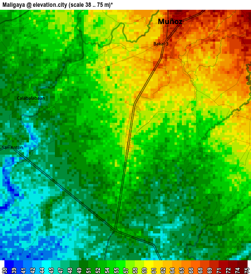
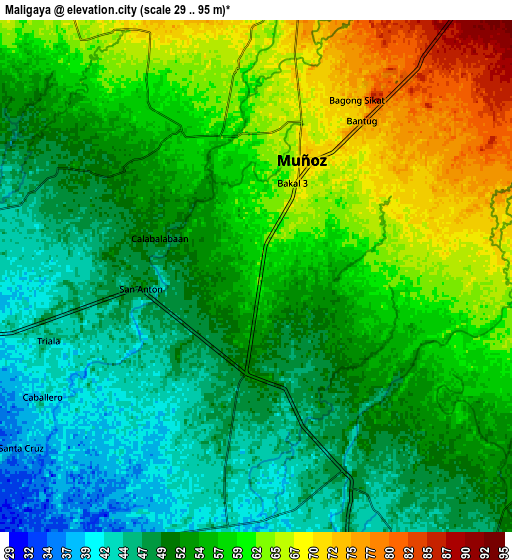
Below is the Elevation map of Maligaya, which displays elevation range with different colors. Scale of the first map is from 38 to 75 m (125 to 246 ft) with average elevation of 54.1 meters (=177 ft) [note 1]
These maps also provides idea of topography and contour of this city, they are displayed at different zoom levels. More info about maps, scale and edge coordinates you can find below images.
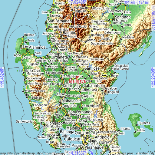
| \ | Map #1 | Map #2 | Topo.Map |
| Scale [m] | 38..75 m | 29..95 m | × |
| Scale [ft] | 125..246 ft | 95..312 ft | × |
| Average | 54.1 m = 177 ft | 55.2 m = 181 ft | × |
| Width | 9.41 km = 5.8 mi | 18.82 km = 11.7 mi | 301.1 km = 187.1 mi |
| Height | 9.41 km = 5.8 mi | 18.82 km = 11.7 mi | 301.1 km = 187.1 mi |
| ↑Max Latitude | 15.717007° | 15.759305° | 17.02405° |
| Latitude at center | 15.6747° | 15.6747° | 15.6747° |
| ↓Min Latitude | 15.632385° | 15.59006° | 14.31637° |
| ← Min Longitude | 120.844755° | 120.800809° | 119.48245° |
| Longitude center | 120.8887° | 120.8887° | 120.8887° |
| →Max Longitude | 120.932645° | 120.976591° | 122.29495° |
Nearby cities:
Cities around Maligaya sort by population:
• Talavera elevation 46 m
10.1 km,  161°
161°
• Muñoz 70 m
4.9 km,  18°
18°
• Baloc 54 m
3.5 km,  186°
186°
• Santo Rosario 49 m
4.4 km,  221°
221°
• Tabacao 59 m
6.2 km,  116°
116°
• Santa Rita 47 m
6.5 km,  198°
198°
• Tondod 86 m
9.8 km,  60°
60°
• Bunol 47 m
5.9 km,  261°
261°
• Palusapis 53 m
2.9 km,  288°
288°
• San Fabian 47 m
8.9 km,  167°
167°
• Magtangol 78 m
9.7 km, 17°
• Santo Domingo 41 m
9.8 km, 187°
Multilingual:
 En español:
Maligaya elevación 60 m.
 En France:
Maligaya élévation 60 m.


Sources and notes:
- [note 1] Map square and city borders are not equal. Map elevation data is calculated only from area inside that square.
- [src 1] Elevation data from geonames database provided with same terms of usage.
- [src 2] The elevation map of Maligaya is generated using elevation data from NASA's 3 arcsec (90m) resolution SRTM data.
- [src 3] Base (background) map © OpenStreetMap contributors tiles are generated by Geofabrik and OpenTopoMap.
Copyright & License:
This Maligaya Elevation Map is licensed under CC BY-SA. You may reuse any part from this page, if you give a proper credit by linking to this URL:
 More info on terms of use page.