Minante Segundo elevation
Minante Segundo (Cagayan Valley, Province of Isabela), Philippines elevation is 63 meters and Minante Segundo elevation in feet is 207 ft above sea level [src 1]. Minante Segundo is a populated place (feature code) with elevation that is 25 meters (82 ft) smaller than average city elevation in Philippines.
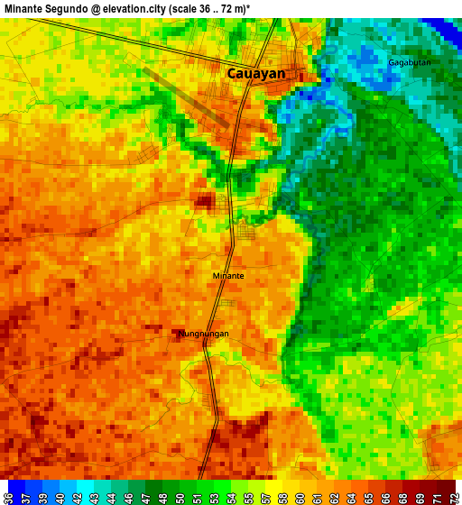
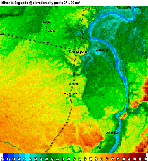
Below is the Elevation map of Minante Segundo, which displays elevation range with different colors. Scale of the first map is from 36 to 72 m (118 to 236 ft) with average elevation of 57.1 meters (=187 ft) [note 1]
These maps also provides idea of topography and contour of this city, they are displayed at different zoom levels. More info about maps, scale and edge coordinates you can find below images.
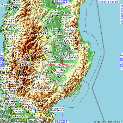
| \ | Map #1 | Map #2 | Topo.Map |
| Scale [m] | 36..72 m | 27..90 m | × |
| Scale [ft] | 118..236 ft | 89..295 ft | × |
| Average | 57.1 m = 187 ft | 58 m = 190 ft | × |
| Width | 9.35 km = 5.8 mi | 18.7 km = 11.6 mi | 299.2 km = 185.9 mi |
| Height | 9.35 km = 5.8 mi | 18.7 km = 11.6 mi | 299.2 km = 185.9 mi |
| ↑Max Latitude | 16.944242° | 16.986275° | 18.24279° |
| Latitude at center | 16.9022° | 16.9022° | 16.9022° |
| ↓Min Latitude | 16.860148° | 16.818087° | 15.55201° |
| ← Min Longitude | 121.717965° | 121.674019° | 120.35566° |
| Longitude center | 121.76191° | 121.76191° | 121.76191° |
| →Max Longitude | 121.805855° | 121.849801° | 123.16816° |
Nearby cities:
Cities around Minante Segundo sort by population:
• Reina Mercedes elevation 52 m
11.5 km,  36°
36°
• La Paz 65 m
10 km,  275°
275°
• Nagrumbuan 67 m
5.6 km,  266°
266°
• Pinoma 69 m
6.6 km,  242°
242°
• Sillawit 62 m
3.2 km,  185°
185°
• Luna 57 m
8.3 km,  335°
335°
• Gappal 59 m
9.7 km,  138°
138°
• Malasin 54 m
11.1 km,  167°
167°
• San Luis 50 m
9.9 km,  45°
45°
• Burgos 73 m
9.2 km,  199°
199°
• Cabatuan 61 m
11.6 km,  301°
301°
• Cauayan 63 m
3.8 km,  17°
17°
Multilingual:
 En español:
Minante Segundo elevación 63 m.
 En France:
Minante Segundo élévation 63 m.
 Auf Deutsch:
Minante Segundo höhe über dem Meeresspiegel ist 63 m.

Sources and notes:
- [note 1] Map square and city borders are not equal. Map elevation data is calculated only from area inside that square.
- [src 1] Elevation data from geonames database provided with same terms of usage.
- [src 2] The elevation map of Minante Segundo is generated using elevation data from NASA's 3 arcsec (90m) resolution SRTM data.
- [src 3] Base (background) map © OpenStreetMap contributors tiles are generated by Geofabrik and OpenTopoMap.
Copyright & License:
This Minante Segundo Elevation Map is licensed under CC BY-SA. You may reuse any part from this page, if you give a proper credit by linking to this URL:
 More info on terms of use page.