Pagsanjan elevation
Pagsanjan (Calabarzon, Province of Laguna), Philippines elevation is 11 meters and Pagsanjan elevation in feet is 36 ft above sea level [src 1]. Pagsanjan is a seat of a third-order administrative division (feature code) with elevation that is 77 meters (253 ft) smaller than average city elevation in Philippines.
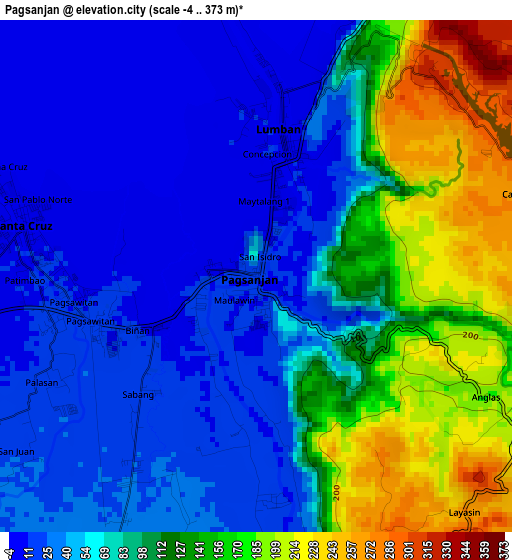
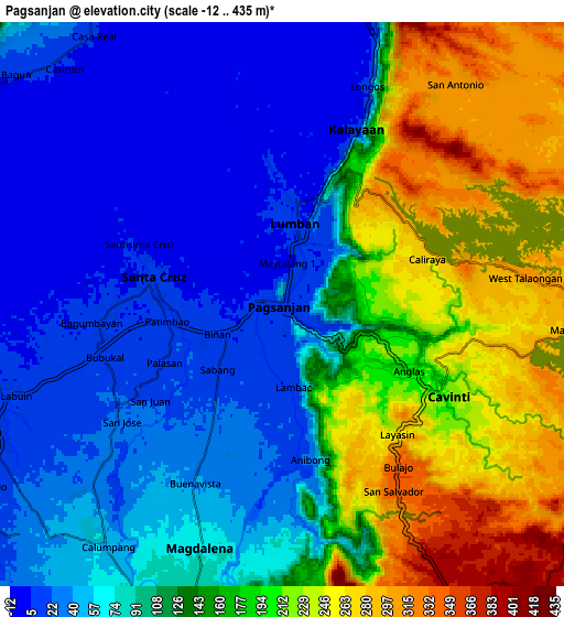
Below is the Elevation map of Pagsanjan, which displays elevation range with different colors. Scale of the first map is from -4 to 373 m (-13 to 1224 ft) with average elevation of 83.4 meters (=274 ft) [note 1]
These maps also provides idea of topography and contour of this city, they are displayed at different zoom levels. More info about maps, scale and edge coordinates you can find below images.
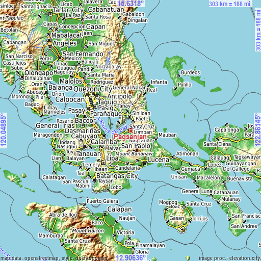
| \ | Map #1 | Map #2 | Topo.Map |
| Scale [m] | -4..373 m | -12..435 m | × |
| Scale [ft] | -13..1224 ft | -39..1427 ft | × |
| Average | 83.4 m = 274 ft | 123.6 m = 406 ft | × |
| Width | 9.47 km = 5.9 mi | 18.94 km = 11.8 mi | 303 km = 188.3 mi |
| Height | 9.47 km = 5.9 mi | 18.94 km = 11.8 mi | 303.1 km = 188.3 mi |
| ↑Max Latitude | 14.315785° | 14.358361° | 15.6318° |
| Latitude at center | 14.2732° | 14.2732° | 14.2732° |
| ↓Min Latitude | 14.230607° | 14.188006° | 12.90636° |
| ← Min Longitude | 121.411255° | 121.367309° | 120.04895° |
| Longitude center | 121.4552° | 121.4552° | 121.4552° |
| →Max Longitude | 121.499145° | 121.543091° | 122.86145° |
Nearby cities:
Cities around Pagsanjan sort by population:
• Santa Cruz elevation 9 m
4.3 km,  282°
282°
• Lumbang 9 m
2.7 km,  10°
10°
• Cavinti 219 m
6.5 km,  119°
119°
• Maulawin 9 m
2.5 km,  252°
252°
• Cabanbanan 26 m
4.3 km,  211°
211°
• Calumpang 49 m
10.3 km, 213°
• San Isidro 44 m
9.4 km,  220°
220°
• Magdalena 67 m
8.6 km,  199°
199°
• San Antonio 384 m
9.5 km,  149°
149°
• Wawa 7 m
3.2 km, 8°
• Cigaras 35 m
5.9 km, 207°
• San Diego 351 m
10.1 km,  160°
160°
Multilingual:
 En español:
Pagsanjan elevación 11 m.
 En France:
Pagsanjan élévation 11 m.
 Auf Deutsch:
Pagsanjan höhe über dem Meeresspiegel ist 11 m.

Sources and notes:
- [note 1] Map square and city borders are not equal. Map elevation data is calculated only from area inside that square.
- [src 1] Elevation data from geonames database provided with same terms of usage.
- [src 2] The elevation map of Pagsanjan is generated using elevation data from NASA's 3 arcsec (90m) resolution SRTM data.
- [src 3] Base (background) map © OpenStreetMap contributors tiles are generated by Geofabrik and OpenTopoMap.
Copyright & License:
This Pagsanjan Elevation Map is licensed under CC BY-SA. You may reuse any part from this page, if you give a proper credit by linking to this URL:
 More info on terms of use page.