Passi elevation
Passi (Western Visayas, Province of Iloilo), Philippines elevation is 42 meters and Passi elevation in feet is 138 ft above sea level [src 1]. Passi is a seat of a third-order administrative division (feature code) with elevation that is 46 meters (151 ft) smaller than average city elevation in Philippines.
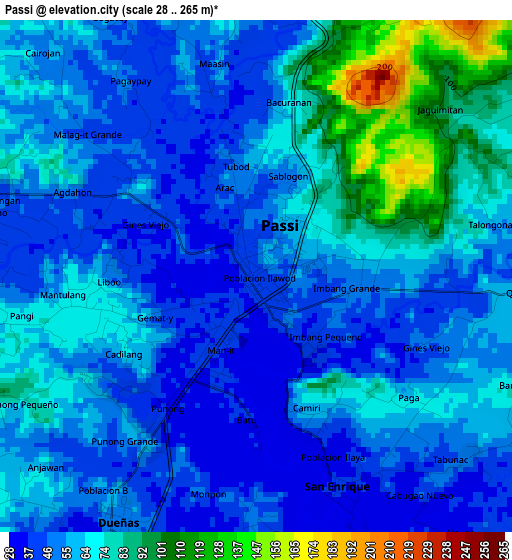
Below is the Elevation map of Passi, which displays elevation range with different colors. Scale of the first map is from 28 to 265 m (92 to 869 ft) with average elevation of 60.7 meters (=199 ft) [note 1]
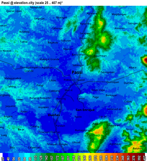
These maps also provides idea of topography and contour of this city, they are displayed at different zoom levels. More info about maps, scale and edge coordinates you can find below images.
| \ | Map #1 | Map #2 | Topo.Map |
| Scale [m] | 28..265 m | 25..407 m | × |
| Scale [ft] | 92..869 ft | 82..1335 ft | × |
| Average | 60.7 m = 199 ft | 75.7 m = 248 ft | × |
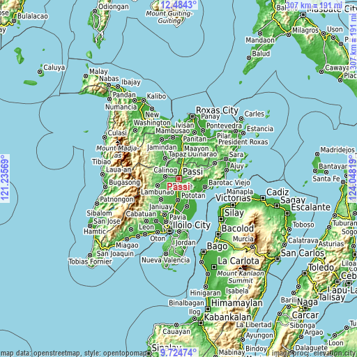
| Width | 9.59 km = 6 mi | 19.18 km = 11.9 mi | 306.8 km = 190.6 mi |
| Height | 9.59 km = 6 mi | 19.18 km = 11.9 mi | 306.9 km = 190.7 mi |
| ↑Max Latitude | 11.150899° | 11.194011° | 12.4843° |
| Latitude at center | 11.10778° | 11.10778° | 11.10778° |
| ↓Min Latitude | 11.064655° | 11.021523° | 9.72474° |
| ← Min Longitude | 122.597995° | 122.554049° | 121.23569° |
| Longitude center | 122.64194° | 122.64194° | 122.64194° |
| →Max Longitude | 122.685885° | 122.729831° | 124.04819° |
Nearby cities:
Cities around Passi sort by population:
• Dingle elevation 30 m
12.5 km,  165°
165°
• Calinog 51 m
8.3 km,  276°
276°
• Dueñas 51 m
5.4 km,  212°
212°
• Maribong 56 m
11.9 km,  265°
265°
• Aglalana 64 m
8.2 km,  11°
11°
• Alimono 81 m
11.6 km,  41°
41°
• San Enrique 38 m
4.3 km,  159°
159°
• Ponong 37 m
3.3 km, 211°
• Jaguimitan 74 m
9.6 km,  68°
68°
• Quinagaringan 52 m
6.2 km,  285°
285°
• Abaca 69 m
8.6 km, 69°
• Mapili 94 m
10.6 km,  89°
89°
Multilingual:
 En español:
Passi elevación 42 m.
 En France:
Passi élévation 42 m.


Sources and notes:
- [note 1] Map square and city borders are not equal. Map elevation data is calculated only from area inside that square.
- [src 1] Elevation data from geonames database provided with same terms of usage.
- [src 2] The elevation map of Passi is generated using elevation data from NASA's 3 arcsec (90m) resolution SRTM data.
- [src 3] Base (background) map © OpenStreetMap contributors tiles are generated by Geofabrik and OpenTopoMap.
Copyright & License:
This Passi Elevation Map is licensed under CC BY-SA. You may reuse any part from this page, if you give a proper credit by linking to this URL:
 More info on terms of use page.