Ramon elevation
Ramon (Cagayan Valley, Province of Isabela), Philippines elevation is 109 meters and Ramon elevation in feet is 358 ft above sea level [src 1]. Ramon is a seat of a third-order administrative division (feature code) with elevation that is 21 meters (69 ft) bigger than average city elevation in Philippines.
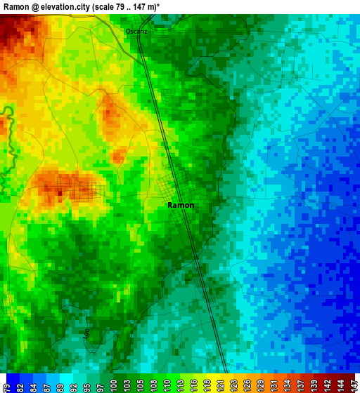
Below is the Elevation map of Ramon, which displays elevation range with different colors. Scale of the first map is from 79 to 147 m (259 to 482 ft) with average elevation of 101.9 meters (=334 ft) [note 1]
These maps also provides idea of topography and contour of this city, they are displayed at different zoom levels. More info about maps, scale and edge coordinates you can find below images.
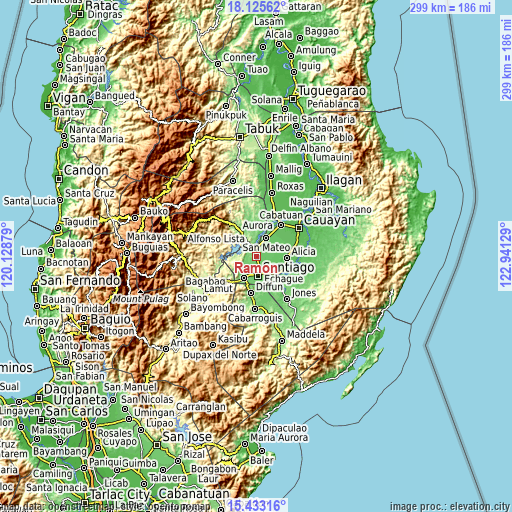
| \ | Map #1 | Map #2 | Topo.Map |
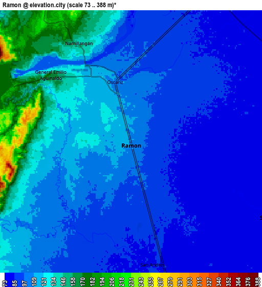
| Scale [m] | 79..147 m | 73..388 m | × |
| Scale [ft] | 259..482 ft | 240..1273 ft | × |
| Average | 101.9 m = 334 ft | 108.6 m = 356 ft | × |
| Width | 9.36 km = 5.8 mi | 18.71 km = 11.6 mi | 299.4 km = 186 mi |
| Height | 9.36 km = 5.8 mi | 18.71 km = 11.6 mi | 299.4 km = 186 mi |
| ↑Max Latitude | 16.826229° | 16.868288° | 18.12562° |
| Latitude at center | 16.78416° | 16.78416° | 16.78416° |
| ↓Min Latitude | 16.742082° | 16.699995° | 15.43316° |
| ← Min Longitude | 121.491095° | 121.447149° | 120.12879° |
| Longitude center | 121.53504° | 121.53504° | 121.53504° |
| →Max Longitude | 121.578985° | 121.622931° | 122.94129° |
Nearby cities:
Cities around Ramon sort by population:
• Santiago elevation 86 m
10.8 km,  172°
172°
• San Mateo 82 m
12.2 km,  26°
26°
• Salinungan Proper 80 m
12.7 km,  41°
41°
• Batal 76 m
12.8 km,  146°
146°
• Sinamar 82 m
13.3 km,  14°
14°
• Soyung 77 m
16.7 km,  123°
123°
• Cordon 119 m
14.3 km,  211°
211°
• Ramos West 80 m
12.7 km,  138°
138°
• Cabulay 106 m
5.9 km,  222°
222°
• Rizal 92 m
7.6 km,  163°
163°
• San Isidro 78 m
10.4 km, 123°
• Potia 171 m
9.2 km,  323°
323°
Multilingual:
 En español:
Ramon elevación 109 m.
 En France:
Ramon élévation 109 m.


Sources and notes:
- [note 1] Map square and city borders are not equal. Map elevation data is calculated only from area inside that square.
- [src 1] Elevation data from geonames database provided with same terms of usage.
- [src 2] The elevation map of Ramon is generated using elevation data from NASA's 3 arcsec (90m) resolution SRTM data.
- [src 3] Base (background) map © OpenStreetMap contributors tiles are generated by Geofabrik and OpenTopoMap.
Copyright & License:
This Ramon Elevation Map is licensed under CC BY-SA. You may reuse any part from this page, if you give a proper credit by linking to this URL:
 More info on terms of use page.