Rizal elevation
Rizal (Calabarzon, Province of Laguna), Philippines elevation is 252 meters and Rizal elevation in feet is 827 ft above sea level [src 1]. Rizal is a seat of a third-order administrative division (feature code) with elevation that is 164 meters (538 ft) bigger than average city elevation in Philippines.
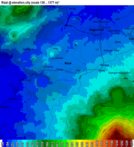
Below is the Elevation map of Rizal, which displays elevation range with different colors. Scale of the first map is from 136 to 1377 m (446 to 4518 ft) with average elevation of 325.2 meters (=1067 ft) [note 1]
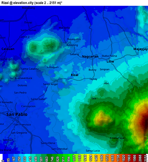
These maps also provides idea of topography and contour of this city, they are displayed at different zoom levels. More info about maps, scale and edge coordinates you can find below images.
| \ | Map #1 | Map #2 | Topo.Map |
| Scale [m] | 136..1377 m | 2..2151 m | × |
| Scale [ft] | 446..4518 ft | 7..7057 ft | × |
| Average | 325.2 m = 1067 ft | 319.9 m = 1050 ft | × |
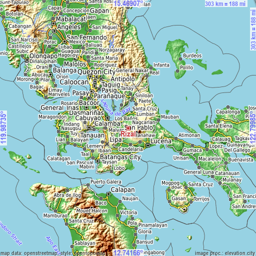
| Width | 9.48 km = 5.9 mi | 18.96 km = 11.8 mi | 303.3 km = 188.5 mi |
| Height | 9.48 km = 5.9 mi | 18.96 km = 11.8 mi | 303.3 km = 188.5 mi |
| ↑Max Latitude | 14.152056° | 14.194663° | 15.46907° |
| Latitude at center | 14.10944° | 14.10944° | 14.10944° |
| ↓Min Latitude | 14.066816° | 14.024185° | 12.74166° |
| ← Min Longitude | 121.349655° | 121.305709° | 119.98735° |
| Longitude center | 121.3936° | 121.3936° | 121.3936° |
| →Max Longitude | 121.437545° | 121.481491° | 122.79985° |
Nearby cities:
Cities around Rizal sort by population:
• San Pablo elevation 115 m
8.6 km,  238°
238°
• Calauan 18 m
9.6 km,  298°
298°
• Nagcarlan 201 m
3.9 km,  39°
39°
• Lilio 256 m
5.2 km,  62°
62°
• Majayjay 281 m
9.5 km, 64°
• Dolores 291 m
9.8 km,  169°
169°
• Santa Lucia 463 m
9.2 km,  153°
153°
• Halayhayin 59 m
9 km,  9°
9°
• San Rafael 238 m
3.1 km,  47°
47°
• Calumpang 49 m
9.7 km, 5°
• Taytay 240 m
2.1 km,  31°
31°
• Santa Catalina 123 m
5.7 km,  283°
283°
Multilingual:
 En español:
Rizal elevación 252 m.
 En France:
Rizal élévation 252 m.


Sources and notes:
- [note 1] Map square and city borders are not equal. Map elevation data is calculated only from area inside that square.
- [src 1] Elevation data from geonames database provided with same terms of usage.
- [src 2] The elevation map of Rizal is generated using elevation data from NASA's 3 arcsec (90m) resolution SRTM data.
- [src 3] Base (background) map © OpenStreetMap contributors tiles are generated by Geofabrik and OpenTopoMap.
Copyright & License:
This Rizal Elevation Map is licensed under CC BY-SA. You may reuse any part from this page, if you give a proper credit by linking to this URL:
 More info on terms of use page.