Saguday elevation
Saguday (Cagayan Valley, Province of Quirino), Philippines elevation is 104 meters and Saguday elevation in feet is 341 ft above sea level [src 1]. Saguday is a seat of a third-order administrative division (feature code) with elevation that is 16 meters (52 ft) bigger than average city elevation in Philippines.
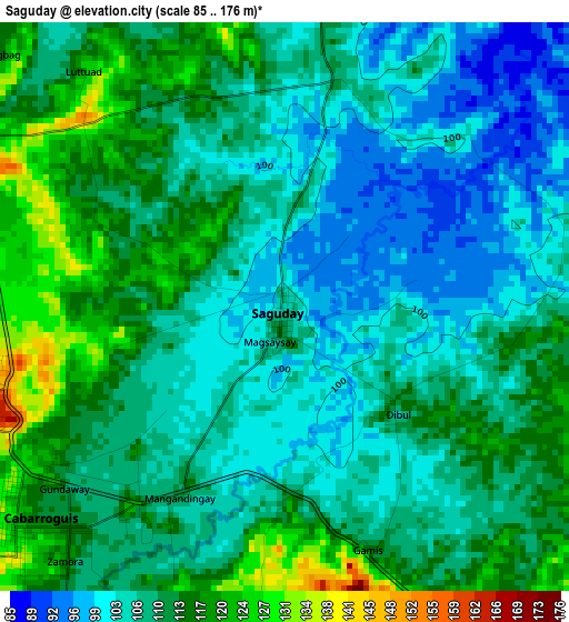
Below is the Elevation map of Saguday, which displays elevation range with different colors. Scale of the first map is from 85 to 176 m (279 to 577 ft) with average elevation of 108.8 meters (=357 ft) [note 1]
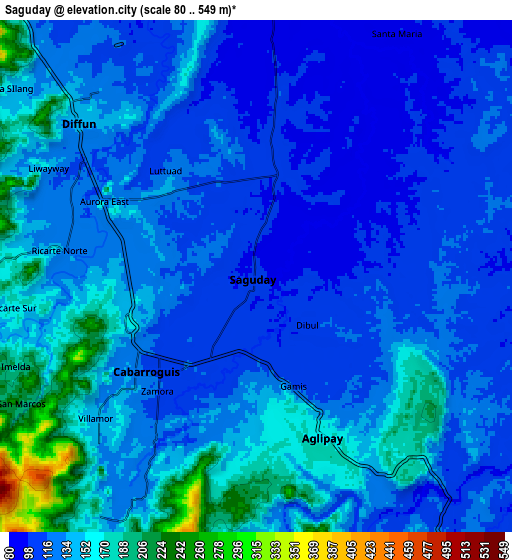
These maps also provides idea of topography and contour of this city, they are displayed at different zoom levels. More info about maps, scale and edge coordinates you can find below images.
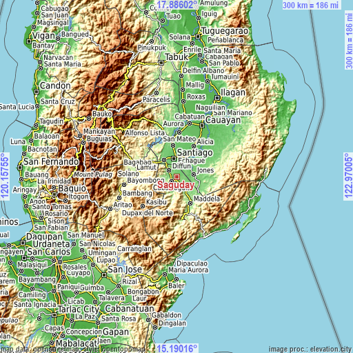
| \ | Map #1 | Map #2 | Topo.Map |
| Scale [m] | 85..176 m | 80..549 m | × |
| Scale [ft] | 279..577 ft | 262..1801 ft | × |
| Average | 108.8 m = 357 ft | 134.1 m = 440 ft | × |
| Width | 9.37 km = 5.8 mi | 18.74 km = 11.6 mi | 299.8 km = 186.3 mi |
| Height | 9.37 km = 5.8 mi | 18.74 km = 11.6 mi | 299.8 km = 186.3 mi |
| ↑Max Latitude | 16.584922° | 16.627034° | 17.88602° |
| Latitude at center | 16.5428° | 16.5428° | 16.5428° |
| ↓Min Latitude | 16.500669° | 16.458529° | 15.19016° |
| ← Min Longitude | 121.519855° | 121.475909° | 120.15755° |
| Longitude center | 121.5638° | 121.5638° | 121.5638° |
| →Max Longitude | 121.607745° | 121.651691° | 122.97005° |
Nearby cities:
Cities around Saguday sort by population:
• Santiago elevation 86 m
16.2 km,  354°
354°
• Batal 76 m
16.6 km,  13°
13°
• Cabarroguis 126 m
5.8 km,  232°
232°
• Masaya Sur 111 m
20.1 km,  103°
103°
• Soyung 77 m
20.6 km,  31°
31°
• Jones 102 m
14.9 km,  83°
83°
• Cordon 119 m
18 km,  324°
324°
• Ramos West 80 m
18.1 km,  17°
17°
• Rizal 92 m
19.6 km,  357°
357°
• Pangal Sur 93 m
13 km,  60°
60°
• Aglipay 114 m
10.5 km,  124°
124°
• Diffun 134 m
8.1 km,  310°
310°
Multilingual:
 En español:
Saguday elevación 104 m.
 En France:
Saguday élévation 104 m.


Sources and notes:
- [note 1] Map square and city borders are not equal. Map elevation data is calculated only from area inside that square.
- [src 1] Elevation data from geonames database provided with same terms of usage.
- [src 2] The elevation map of Saguday is generated using elevation data from NASA's 3 arcsec (90m) resolution SRTM data.
- [src 3] Base (background) map © OpenStreetMap contributors tiles are generated by Geofabrik and OpenTopoMap.
Copyright & License:
This Saguday Elevation Map is licensed under CC BY-SA. You may reuse any part from this page, if you give a proper credit by linking to this URL:
 More info on terms of use page.