Santa Lucia elevation
Santa Lucia (Central Luzon, Province of Tarlac), Philippines elevation is 109 meters and Santa Lucia elevation in feet is 358 ft above sea level [src 1]. Santa Lucia is a populated place (feature code) with elevation that is 21 meters (69 ft) bigger than average city elevation in Philippines.
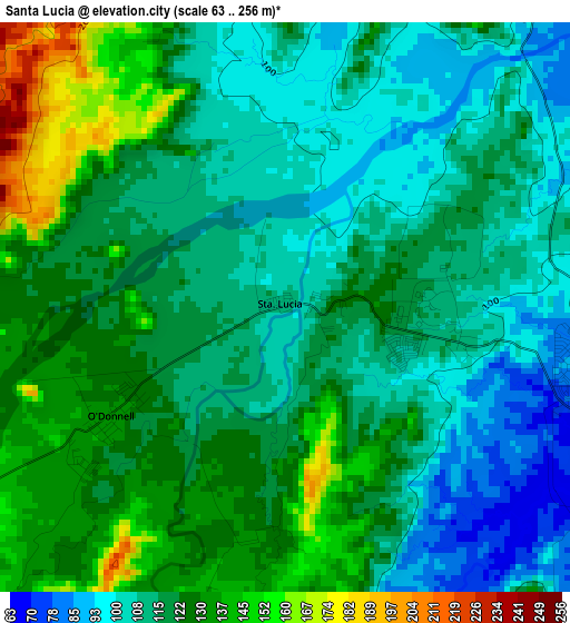
Below is the Elevation map of Santa Lucia, which displays elevation range with different colors. Scale of the first map is from 63 to 256 m (207 to 840 ft) with average elevation of 118.3 meters (=388 ft) [note 1]
These maps also provides idea of topography and contour of this city, they are displayed at different zoom levels. More info about maps, scale and edge coordinates you can find below images.
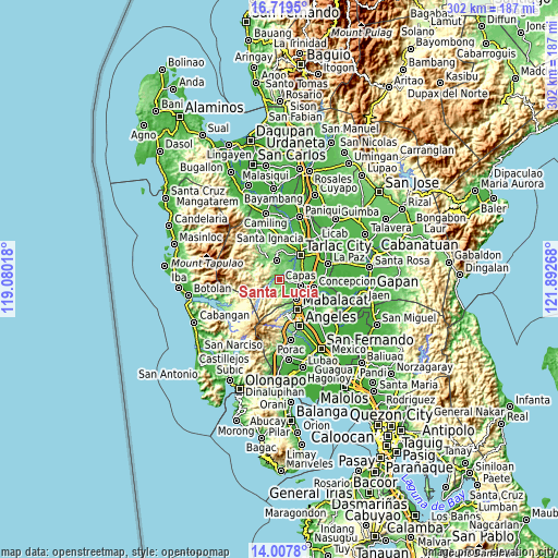
| \ | Map #1 | Map #2 | Topo.Map |
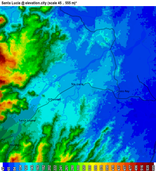
| Scale [m] | 63..256 m | 45..555 m | × |
| Scale [ft] | 207..840 ft | 148..1821 ft | × |
| Average | 118.3 m = 388 ft | 146.4 m = 480 ft | × |
| Width | 9.42 km = 5.9 mi | 18.85 km = 11.7 mi | 301.5 km = 187.3 mi |
| Height | 9.42 km = 5.9 mi | 18.85 km = 11.7 mi | 301.5 km = 187.3 mi |
| ↑Max Latitude | 15.41043° | 15.452791° | 16.7195° |
| Latitude at center | 15.36806° | 15.36806° | 15.36806° |
| ↓Min Latitude | 15.325682° | 15.283295° | 14.0078° |
| ← Min Longitude | 120.442485° | 120.398539° | 119.08018° |
| Longitude center | 120.48643° | 120.48643° | 120.48643° |
| →Max Longitude | 120.530375° | 120.574321° | 121.89268° |
Nearby cities:
Cities around Santa Lucia sort by population:
• Capas elevation 53 m
11.8 km,  110°
110°
• Murcia 53 m
13.7 km,  72°
72°
• Villa Aglipay 91 m
11.5 km,  341°
341°
• Talaga 62 m
11.2 km,  80°
80°
• Iba 109 m
12.5 km,  319°
319°
• Santo Cristo 52 m
11.9 km, 106°
• Santa Rosa 51 m
14 km,  90°
90°
• Arminia 66 m
11.2 km,  47°
47°
• Sula 115 m
13.9 km, 315°
• Calingcuan 49 m
11.1 km, 110°
• Santa Juliana 161 m
7.6 km,  234°
234°
• Moriones 94 m
10.6 km,  347°
347°
Multilingual:
 En español:
Santa Lucia elevación 109 m.
 En France:
Santa Lucia élévation 109 m.
 Auf Deutsch:
Santa Lucia höhe über dem Meeresspiegel ist 109 m.

Sources and notes:
- [note 1] Map square and city borders are not equal. Map elevation data is calculated only from area inside that square.
- [src 1] Elevation data from geonames database provided with same terms of usage.
- [src 2] The elevation map of Santa Lucia is generated using elevation data from NASA's 3 arcsec (90m) resolution SRTM data.
- [src 3] Base (background) map © OpenStreetMap contributors tiles are generated by Geofabrik and OpenTopoMap.
Copyright & License:
This Santa Lucia Elevation Map is licensed under CC BY-SA. You may reuse any part from this page, if you give a proper credit by linking to this URL:
 More info on terms of use page.