Santa Rosa elevation
Santa Rosa (Central Luzon, Province of Tarlac), Philippines elevation is 51 meters and Santa Rosa elevation in feet is 167 ft above sea level [src 1]. Santa Rosa is a populated place (feature code) with elevation that is 37 meters (121 ft) smaller than average city elevation in Philippines.
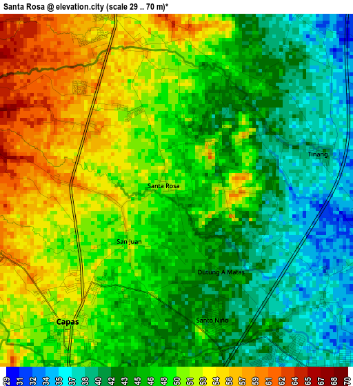
Below is the Elevation map of Santa Rosa, which displays elevation range with different colors. Scale of the first map is from 29 to 70 m (95 to 230 ft) with average elevation of 47.4 meters (=156 ft) [note 1]
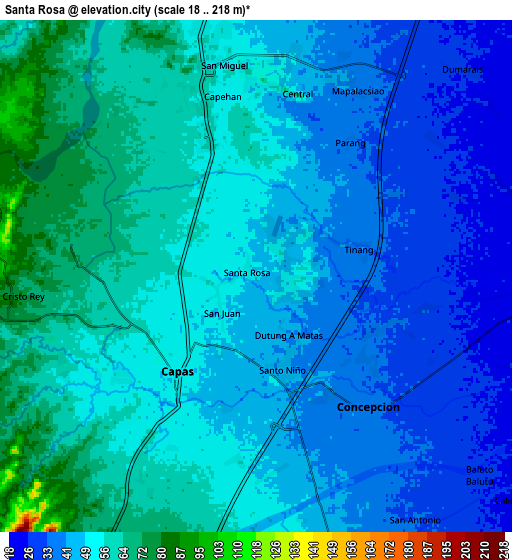
These maps also provides idea of topography and contour of this city, they are displayed at different zoom levels. More info about maps, scale and edge coordinates you can find below images.
| \ | Map #1 | Map #2 | Topo.Map |
| Scale [m] | 29..70 m | 18..218 m | × |
| Scale [ft] | 95..230 ft | 59..715 ft | × |
| Average | 47.4 m = 156 ft | 49.4 m = 162 ft | × |
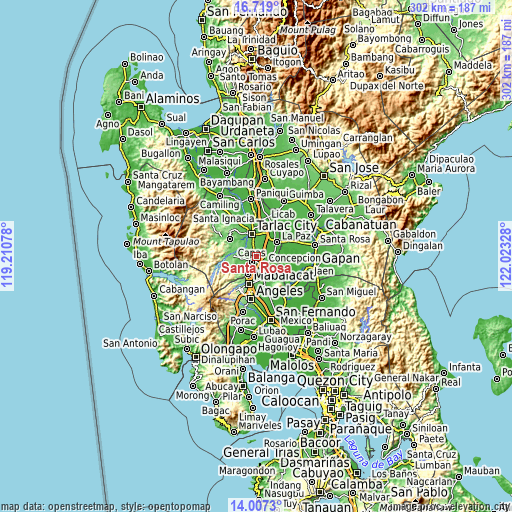
| Width | 9.42 km = 5.9 mi | 18.85 km = 11.7 mi | 301.5 km = 187.3 mi |
| Height | 9.42 km = 5.9 mi | 18.85 km = 11.7 mi | 301.5 km = 187.3 mi |
| ↑Max Latitude | 15.40993° | 15.452291° | 16.719° |
| Latitude at center | 15.36756° | 15.36756° | 15.36756° |
| ↓Min Latitude | 15.325182° | 15.282795° | 14.0073° |
| ← Min Longitude | 120.573085° | 120.529139° | 119.21078° |
| Longitude center | 120.61703° | 120.61703° | 120.61703° |
| →Max Longitude | 120.660975° | 120.704921° | 122.02328° |
Nearby cities:
Cities around Santa Rosa sort by population:
• Capas elevation 53 m
5 km,  215°
215°
• Concepcion 36 m
6.4 km,  137°
137°
• Mapalacsiao 40 m
7.8 km,  29°
29°
• Murcia 53 m
4.2 km,  348°
348°
• Talaga 62 m
3.5 km,  301°
301°
• Santo Cristo 52 m
4.1 km, 218°
• Tinang 42 m
4 km,  76°
76°
• Calingcuan 49 m
5.2 km, 223°
• Santo Niño 46 m
3.8 km,  165°
165°
• Motrico 30 m
8.2 km,  51°
51°
• Mabilog 37 m
6 km,  59°
59°
• Pando 28 m
7.8 km,  67°
67°
Multilingual:
 En español:
Santa Rosa elevación 51 m.
 En France:
Santa Rosa élévation 51 m.
 Auf Deutsch:
Santa Rosa höhe über dem Meeresspiegel ist 51 m.

Sources and notes:
- [note 1] Map square and city borders are not equal. Map elevation data is calculated only from area inside that square.
- [src 1] Elevation data from geonames database provided with same terms of usage.
- [src 2] The elevation map of Santa Rosa is generated using elevation data from NASA's 3 arcsec (90m) resolution SRTM data.
- [src 3] Base (background) map © OpenStreetMap contributors tiles are generated by Geofabrik and OpenTopoMap.
Copyright & License:
This Santa Rosa Elevation Map is licensed under CC BY-SA. You may reuse any part from this page, if you give a proper credit by linking to this URL:
 More info on terms of use page.