Solano elevation
Solano (Cagayan Valley, Province of Nueva Vizcaya), Philippines elevation is 264 meters and Solano elevation in feet is 866 ft above sea level [src 1]. Solano is a seat of a third-order administrative division (feature code) with elevation that is 176 meters (577 ft) bigger than average city elevation in Philippines.
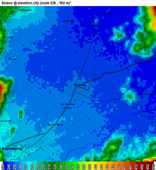
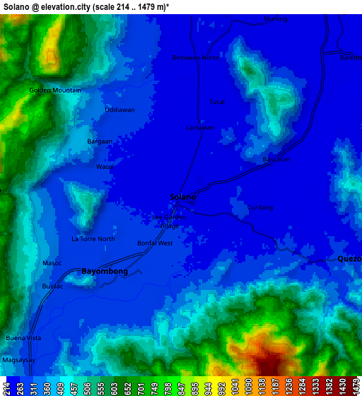
Below is the Elevation map of Solano, which displays elevation range with different colors. Scale of the first map is from 238 to 502 m (781 to 1647 ft) with average elevation of 267.7 meters (=878 ft) [note 1]
These maps also provides idea of topography and contour of this city, they are displayed at different zoom levels. More info about maps, scale and edge coordinates you can find below images.
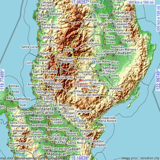
| \ | Map #1 | Map #2 | Topo.Map |
| Scale [m] | 238..502 m | 214..1479 m | × |
| Scale [ft] | 781..1647 ft | 702..4852 ft | × |
| Average | 267.7 m = 878 ft | 390.4 m = 1281 ft | × |
| Width | 9.37 km = 5.8 mi | 18.74 km = 11.6 mi | 299.8 km = 186.3 mi |
| Height | 9.37 km = 5.8 mi | 18.74 km = 11.6 mi | 299.8 km = 186.3 mi |
| ↑Max Latitude | 16.561307° | 16.603425° | 17.86257° |
| Latitude at center | 16.51918° | 16.51918° | 16.51918° |
| ↓Min Latitude | 16.477044° | 16.434899° | 15.16638° |
| ← Min Longitude | 121.137295° | 121.093349° | 119.77499° |
| Longitude center | 121.18124° | 121.18124° | 121.18124° |
| →Max Longitude | 121.225185° | 121.269131° | 122.58749° |
Nearby cities:
Cities around Solano sort by population:
• Bayombong elevation 280 m
5.4 km,  218°
218°
• Baggabag B 259 m
1.8 km,  147°
147°
• Quezon 270 m
9.4 km,  103°
103°
• Bintawan 244 m
6.3 km,  6°
6°
• Ibung 242 m
10 km,  2°
2°
• Lamut 220 m
15.2 km,  17°
17°
• Tuao 233 m
11.2 km,  46°
46°
• Uddiawan 291 m
5.5 km,  324°
324°
• Busilak 302 m
7.7 km,  232°
232°
• Buliwao 299 m
6.8 km,  125°
125°
• Bagabag 228 m
12.5 km,  38°
38°
• Villa Verde 257 m
8.9 km, 4°
Multilingual:
 En español:
Solano elevación 264 m.
 En France:
Solano élévation 264 m.


Sources and notes:
- [note 1] Map square and city borders are not equal. Map elevation data is calculated only from area inside that square.
- [src 1] Elevation data from geonames database provided with same terms of usage.
- [src 2] The elevation map of Solano is generated using elevation data from NASA's 3 arcsec (90m) resolution SRTM data.
- [src 3] Base (background) map © OpenStreetMap contributors tiles are generated by Geofabrik and OpenTopoMap.
Copyright & License:
This Solano Elevation Map is licensed under CC BY-SA. You may reuse any part from this page, if you give a proper credit by linking to this URL:
 More info on terms of use page.