Magugpo Poblacion elevation
Magugpo Poblacion (Davao, Province of Davao del Norte), Philippines elevation is 24 meters and Magugpo Poblacion elevation in feet is 79 ft above sea level [src 1]. Magugpo Poblacion is a populated place (feature code) with elevation that is 64 meters (210 ft) smaller than average city elevation in Philippines.
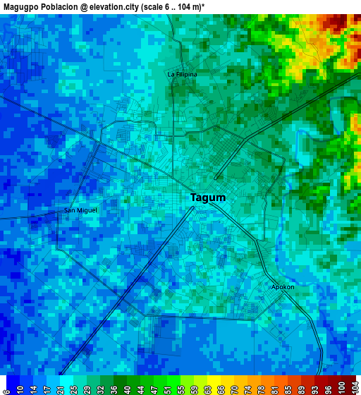
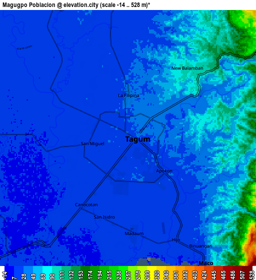
Below is the Elevation map of Magugpo Poblacion, which displays elevation range with different colors. Scale of the first map is from 6 to 104 m (20 to 341 ft) with average elevation of 24.2 meters (=79 ft) [note 1]
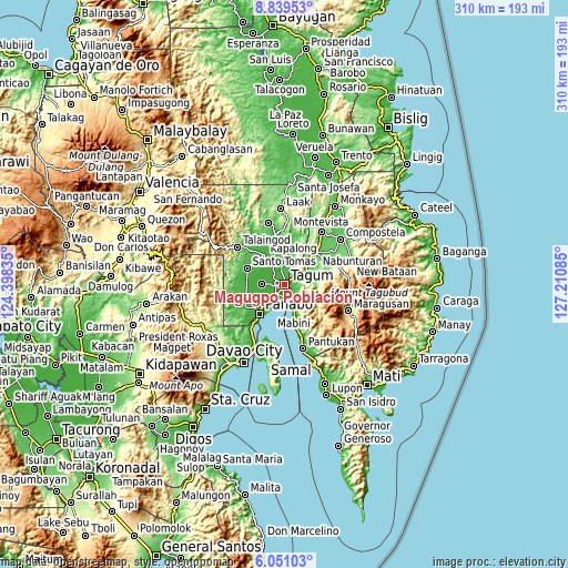
These maps also provides idea of topography and contour of this city, they are displayed at different zoom levels. More info about maps, scale and edge coordinates you can find below images.
| \ | Map #1 | Map #2 | Topo.Map |
| Scale [m] | 6..104 m | -14..528 m | × |
| Scale [ft] | 20..341 ft | -46..1732 ft | × |
| Average | 24.2 m = 79 ft | 39.3 m = 129 ft | × |
| Width | 9.69 km = 6 mi | 19.38 km = 12 mi | 310.1 km = 192.7 mi |
| Height | 9.69 km = 6 mi | 19.38 km = 12 mi | 310.1 km = 192.7 mi |
| ↑Max Latitude | 7.491072° | 7.53464° | 8.83953° |
| Latitude at center | 7.4475° | 7.4475° | 7.4475° |
| ↓Min Latitude | 7.403923° | 7.360342° | 6.05103° |
| ← Min Longitude | 125.760655° | 125.716709° | 124.39835° |
| Longitude center | 125.8046° | 125.8046° | 125.8046° |
| →Max Longitude | 125.848545° | 125.892491° | 127.21085° |
Nearby cities:
Cities around Magugpo Poblacion sort by population:
• Cabayangan elevation 5 m
9.1 km,  240°
240°
• Maco 11 m
11 km,  149°
149°
• Corocotan 11 m
6.4 km,  213°
213°
• Pagsabangan 14 m
7.1 km,  301°
301°
• Bincoñgan 12 m
10.8 km, 213°
• New Bohol 33 m
9.1 km,  22°
22°
• Hiju, Maco 12 m
7.4 km,  159°
159°
• New Leyte 14 m
8.4 km,  314°
314°
• Esperanza 13 m
9.8 km, 300°
• Dumlan 55 m
8.8 km,  104°
104°
• Buclad 15 m
10.7 km,  326°
326°
• Anibongan 12 m
11.2 km, 237°
Multilingual:
 En español:
Taúm elevación 24 m.
 En France:
Magugpo Poblacion élévation 24 m.
 Auf Deutsch:
Tagum City höhe über dem Meeresspiegel ist 24 m.

Sources and notes:
- [note 1] Map square and city borders are not equal. Map elevation data is calculated only from area inside that square.
- [src 1] Elevation data from geonames database provided with same terms of usage.
- [src 2] The elevation map of Magugpo Poblacion is generated using elevation data from NASA's 3 arcsec (90m) resolution SRTM data.
- [src 3] Base (background) map © OpenStreetMap contributors tiles are generated by Geofabrik and OpenTopoMap.
Copyright & License:
This Magugpo Poblacion Elevation Map is licensed under CC BY-SA. You may reuse any part from this page, if you give a proper credit by linking to this URL:
 More info on terms of use page.