Alotau elevation
Alotau (Milne Bay), Papua New Guinea elevation is 11 meters and Alotau elevation in feet is 36 ft above sea level [src 1]. Alotau is a seat of a first-order administrative division (feature code) with elevation that is 551 meters (1808 ft) smaller than average city elevation in Papua New Guinea.
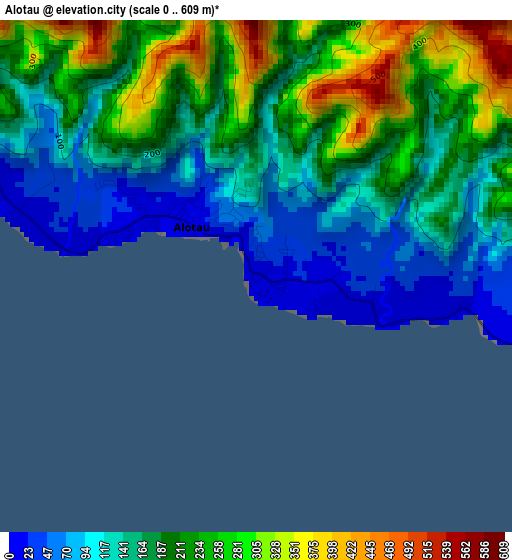
Below is the Elevation map of Alotau, which displays elevation range with different colors. Scale of the first map is from 0 to 609 m (0 to 1998 ft) with average elevation of 179.1 meters (=588 ft) [note 1]
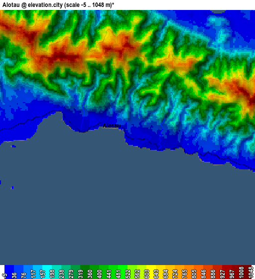
These maps also provides idea of topography and contour of this city, they are displayed at different zoom levels. More info about maps, scale and edge coordinates you can find below images.
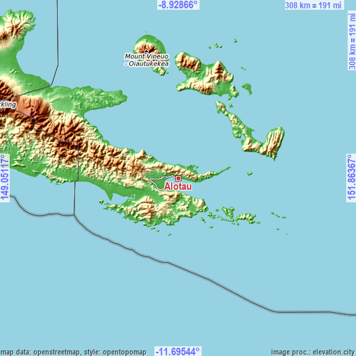
| \ | Map #1 | Map #2 | Topo.Map |
| Scale [m] | 0..609 m | -5..1048 m | × |
| Scale [ft] | 0..1998 ft | -16..3438 ft | × |
| Average | 179.1 m = 588 ft | 323.3 m = 1061 ft | × |
| Width | 9.61 km = 6 mi | 19.23 km = 11.9 mi | 307.6 km = 191.1 mi |
| Height | 9.61 km = 6 mi | 19.23 km = 11.9 mi | 307.7 km = 191.2 mi |
| ↑Max Latitude | -10.271852° | -10.228608° | -8.92866° |
| Latitude at center | -10.31509° | -10.31509° | -10.31509° |
| ↓Min Latitude | -10.358322° | -10.401548° | -11.69544° |
| ← Min Longitude | 150.413475° | 150.369529° | 149.05117° |
| Longitude center | 150.45742° | 150.45742° | 150.45742° |
| →Max Longitude | 150.501365° | 150.545311° | 151.86367° |
Nearby cities:
Cities around Alotau sort by population:
• Port Moresby elevation 1 m
374 km,  284°
284°
• Popondetta 106 m
298.7 km,  305°
305°
• Kokoda 372 m
338.4 km,  298°
298°
• Samarai 8 m
39.7 km,  145°
145°
• Kwikila 68 m
311.2 km, 280°
Multilingual:
 En español:
Alotau elevación 11 m.
 En France:
Alotau élévation 11 m.


Sources and notes:
- [note 1] Map square and city borders are not equal. Map elevation data is calculated only from area inside that square.
- [src 1] Elevation data from geonames database provided with same terms of usage.
- [src 2] The elevation map of Alotau is generated using elevation data from NASA's 3 arcsec (90m) resolution SRTM data.
- [src 3] Base (background) map © OpenStreetMap contributors tiles are generated by Geofabrik and OpenTopoMap.
Copyright & License:
This Alotau Elevation Map is licensed under CC BY-SA. You may reuse any part from this page, if you give a proper credit by linking to this URL:
 More info on terms of use page.