Cochas elevation
Cochas (Junin, Provincia de Concepción), Peru elevation is 3176 meters and Cochas elevation in feet is 10420 ft above sea level [src 1]. Cochas is a seat of a third-order administrative division (feature code) with elevation that is 855 meters (2805 ft) bigger than average city elevation in Peru.
Below is the Elevation map of Cochas, which displays elevation range with different colors. Scale of the first map is from 2472 to 4426 m (8110 to 14521 ft) with average elevation of 3529.6 meters (=11580 ft) [note 1]
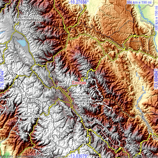
These maps also provides idea of topography and contour of this city, they are displayed at different zoom levels. More info about maps, scale and edge coordinates you can find below images.
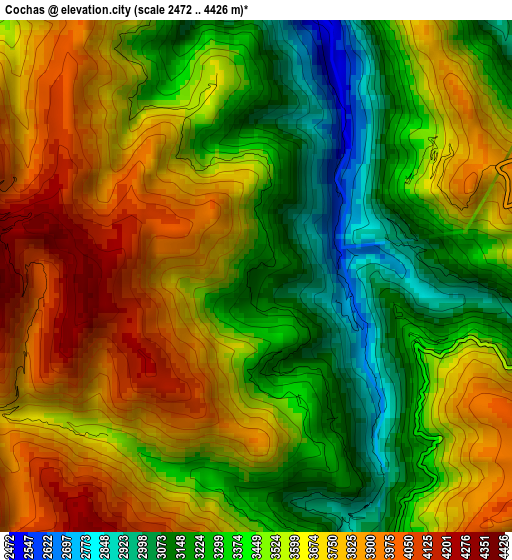
| \ | Map #1 | Topo.Map |
| Scale [m] | 2472..4426 m | × |
| Scale [ft] | 8110..14521 ft | × |
| Average | 3529.6 m = 11580 ft | × |
| Width | 9.57 km = 5.9 mi | 306.2 km = 190.3 mi |
| Height | 9.57 km = 5.9 mi | 306.3 km = 190.3 mi |
| ↑Max Latitude | -11.614048° | -10.27656° |
| Latitude at center | -11.65709° | -11.65709° |
| ↓Min Latitude | -11.700126° | -13.03079° |
| ← Min Longitude | -75.145135° | -76.50744° |
| Longitude center | -75.10119° | -75.10119° |
| →Max Longitude | -75.057245° | -73.69494° |
Nearby cities:
Cities around Cochas sort by population:
• Concepción elevation 3287 m
37.1 km,  218°
218°
• Saño 3289 m
37.4 km,  206°
206°
• San Lorenzo 3309 m
37.1 km,  235°
235°
• Matahuasi 3289 m
37.1 km,  225°
225°
• Quilcas 3321 m
35.5 km, 209°
• Apata 3340 m
35.2 km, 231°
• Andamarca 2485 m
33.5 km,  104°
104°
• Masma Chicche 3643 m
33.4 km, 244°
• Quichuay 3405 m
32.8 km, 217°
• Ingenio 3466 m
31.4 km, 214°
• Comas 3268 m
7.1 km,  162°
162°
• Mucllo 2493 m
4.7 km,  13°
13°
Multilingual:
 En español:
Cochas elevación 3176 m.
 En France:
Cochas élévation 3176 m.


Sources and notes:
- [note 1] Map square and city borders are not equal. Map elevation data is calculated only from area inside that square.
- [src 1] Elevation data from geonames database provided with same terms of usage.
- [src 2] The elevation map of Cochas is generated using elevation data from NASA's 3 arcsec (90m) resolution SRTM data.
- [src 3] Base (background) map © OpenStreetMap contributors tiles are generated by Geofabrik and OpenTopoMap.
Copyright & License:
This Cochas Elevation Map is licensed under CC BY-SA. You may reuse any part from this page, if you give a proper credit by linking to this URL:
 More info on terms of use page.