Puno elevation
Puno, Peru elevation is 3825 meters and Puno elevation in feet is 12549 ft above sea level [src 1]. Puno is a seat of a first-order administrative division (feature code) with elevation that is 1504 meters (4934 ft) bigger than average city elevation in Peru.
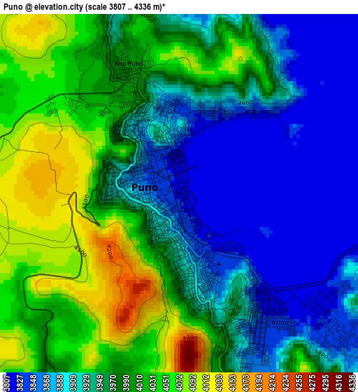
Below is the Elevation map of Puno, which displays elevation range with different colors. Scale of the first map is from 3807 to 4336 m (12490 to 14226 ft) with average elevation of 3962.2 meters (=12999 ft) [note 1]
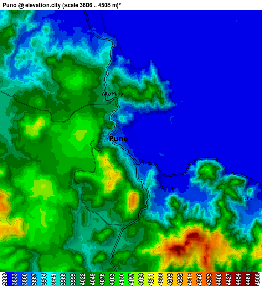
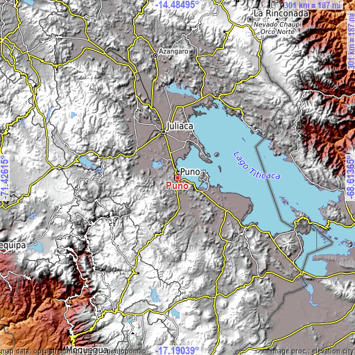
These maps also provides idea of topography and contour of this city, they are displayed at different zoom levels. More info about maps, scale and edge coordinates you can find below images.
| \ | Map #1 | Map #2 | Topo.Map |
| Scale [m] | 3807..4336 m | 3806..4508 m | × |
| Scale [ft] | 12490..14226 ft | 12487..14790 ft | × |
| Average | 3962.2 m = 12999 ft | 3968.5 m = 13020 ft | × |
| Width | 9.4 km = 5.8 mi | 18.8 km = 11.7 mi | 300.8 km = 186.9 mi |
| Height | 9.4 km = 5.8 mi | 18.8 km = 11.7 mi | 300.8 km = 186.9 mi |
| ↑Max Latitude | -15.799919° | -15.75763° | -14.48495° |
| Latitude at center | -15.8422° | -15.8422° | -15.8422° |
| ↓Min Latitude | -15.884472° | -15.926735° | -17.19039° |
| ← Min Longitude | -70.063845° | -70.107791° | -71.42615° |
| Longitude center | -70.0199° | -70.0199° | -70.0199° |
| →Max Longitude | -69.975955° | -69.932009° | -68.61365° |
Nearby cities:
Cities around Puno sort by population:
• Atuncolla elevation 3828 m
22.5 km,  321°
321°
• Taquile 3911 m
37 km,  76°
76°
• Cabana 3897 m
38.3 km,  303°
303°
• Mañazo 3918 m
33.9 km,  277°
277°
• Laraqueri 3935 m
32.5 km,  185°
185°
• Caracoto 3828 m
31.8 km,  344°
344°
• Capachica 3830 m
31.8 km,  43°
43°
• Coata 3817 m
31.5 km,  13°
13°
• Vilque 3845 m
26 km,  288°
288°
• Huata 3878 m
25.7 km, 12°
• Tiquillaca 3855 m
19.5 km, 278°
• Paucarcolla 3819 m
12.5 km,  345°
345°
Multilingual:
 En español:
Puno elevación 3825 m.
 En France:
Puno élévation 3825 m.


Sources and notes:
- [note 1] Map square and city borders are not equal. Map elevation data is calculated only from area inside that square.
- [src 1] Elevation data from geonames database provided with same terms of usage.
- [src 2] The elevation map of Puno is generated using elevation data from NASA's 3 arcsec (90m) resolution SRTM data.
- [src 3] Base (background) map © OpenStreetMap contributors tiles are generated by Geofabrik and OpenTopoMap.
Copyright & License:
This Puno Elevation Map is licensed under CC BY-SA. You may reuse any part from this page, if you give a proper credit by linking to this URL:
 More info on terms of use page.