Subtanjalla elevation
Subtanjalla (Ica, Provincia de Ica), Peru elevation is 428 meters and Subtanjalla elevation in feet is 1404 ft above sea level [src 1]. Subtanjalla is a seat of a third-order administrative division (feature code) with elevation that is 1893 meters (6211 ft) smaller than average city elevation in Peru.
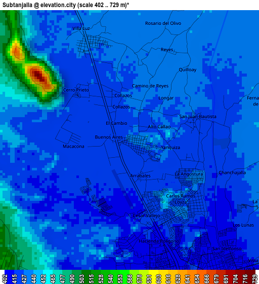
Below is the Elevation map of Subtanjalla, which displays elevation range with different colors. Scale of the first map is from 402 to 729 m (1319 to 2392 ft) with average elevation of 432.2 meters (=1418 ft) [note 1]
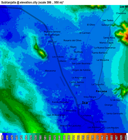
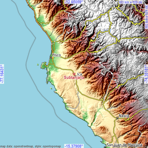
These maps also provides idea of topography and contour of this city, they are displayed at different zoom levels. More info about maps, scale and edge coordinates you can find below images.
| \ | Map #1 | Map #2 | Topo.Map |
| Scale [m] | 402..729 m | 386..950 m | × |
| Scale [ft] | 1319..2392 ft | 1266..3117 ft | × |
| Average | 432.2 m = 1418 ft | 460.6 m = 1511 ft | × |
| Width | 9.48 km = 5.9 mi | 18.96 km = 11.8 mi | 303.4 km = 188.5 mi |
| Height | 9.48 km = 5.9 mi | 18.96 km = 11.8 mi | 303.4 km = 188.5 mi |
| ↑Max Latitude | -13.97625° | -13.933601° | -12.65059° |
| Latitude at center | -14.01889° | -14.01889° | -14.01889° |
| ↓Min Latitude | -14.061522° | -14.104147° | -15.37908° |
| ← Min Longitude | -75.802005° | -75.845951° | -77.16431° |
| Longitude center | -75.75806° | -75.75806° | -75.75806° |
| →Max Longitude | -75.714115° | -75.670169° | -74.35181° |
Nearby cities:
Cities around Subtanjalla sort by population:
• Ica elevation 408 m
6.3 km,  149°
149°
• Villa Tupac Amaru 82 m
54.4 km,  308°
308°
• Santiago 379 m
19.1 km,  164°
164°
• Los Aquijes 418 m
11.3 km,  140°
140°
• San Juan Bautista 427 m
2.6 km,  69°
69°
• Huancano 1020 m
49 km,  18°
18°
• Independencia 190 m
46.3 km,  320°
320°
• Ocucaje 323 m
37.9 km,  165°
165°
• Humay 496 m
36.9 km,  335°
335°
• Pueblo Nuevo 403 m
13.3 km, 155°
• La Tinguiña 456 m
6.5 km,  106°
106°
• Guadalupe 432 m
5.9 km,  350°
350°
Multilingual:
 En español:
Subtanjalla elevación 428 m.
 En France:
Subtanjalla élévation 428 m.
 Auf Deutsch:
Subtanjalla höhe über dem Meeresspiegel ist 428 m.

Sources and notes:
- [note 1] Map square and city borders are not equal. Map elevation data is calculated only from area inside that square.
- [src 1] Elevation data from geonames database provided with same terms of usage.
- [src 2] The elevation map of Subtanjalla is generated using elevation data from NASA's 3 arcsec (90m) resolution SRTM data.
- [src 3] Base (background) map © OpenStreetMap contributors tiles are generated by Geofabrik and OpenTopoMap.
Copyright & License:
This Subtanjalla Elevation Map is licensed under CC BY-SA. You may reuse any part from this page, if you give a proper credit by linking to this URL:
 More info on terms of use page.