El Alto elevation
El Alto (Piura, Provincia de Talara), Peru elevation is 277 meters and El Alto elevation in feet is 909 ft above sea level [src 1]. El Alto is a populated place (feature code) with elevation that is 2044 meters (6706 ft) smaller than average city elevation in Peru.
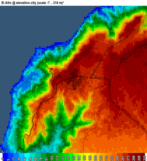
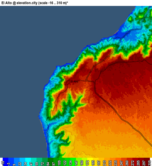
Below is the Elevation map of El Alto, which displays elevation range with different colors. Scale of the first map is from -7 to 310 m (-23 to 1017 ft) with average elevation of 197.8 meters (=649 ft) [note 1]
These maps also provides idea of topography and contour of this city, they are displayed at different zoom levels. More info about maps, scale and edge coordinates you can find below images.
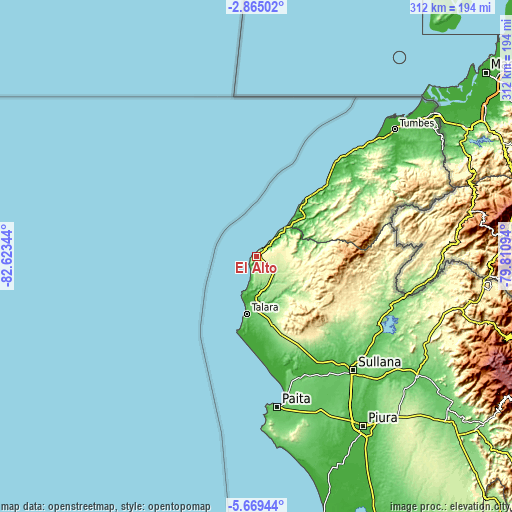
| \ | Map #1 | Map #2 | Topo.Map |
| Scale [m] | -7..310 m | -16..310 m | × |
| Scale [ft] | -23..1017 ft | -52..1017 ft | × |
| Average | 197.8 m = 649 ft | 192.3 m = 631 ft | × |
| Width | 9.75 km = 6.1 mi | 19.49 km = 12.1 mi | 311.8 km = 193.7 mi |
| Height | 9.75 km = 6.1 mi | 19.49 km = 12.1 mi | 311.9 km = 193.8 mi |
| ↑Max Latitude | -4.224685° | -4.180858° | -2.86502° |
| Latitude at center | -4.26851° | -4.26851° | -4.26851° |
| ↓Min Latitude | -4.312332° | -4.356152° | -5.66944° |
| ← Min Longitude | -81.261135° | -81.305081° | -82.62344° |
| Longitude center | -81.21719° | -81.21719° | -81.21719° |
| →Max Longitude | -81.173245° | -81.129299° | -79.81094° |
Nearby cities:
Cities around El Alto sort by population:
• Talara elevation 12 m
34.9 km,  190°
190°
• La Breita 232 m
36.7 km,  87°
87°
• Máncora 11 m
26 km,  46°
46°
• Papayal 262 m
57.3 km,  68°
68°
• Tamarindo 26 m
72.9 km,  158°
158°
• Cañaveral 138 m
72.6 km,  59°
59°
• Amotape 14 m
71.7 km, 161°
• Arenal 36 m
71.5 km, 162°
• Cancas 22 m
47.1 km,  40°
40°
• Negritos 14 m
43.9 km, 192°
• Lobitos 1 m
22.2 km,  199°
199°
• Los Organos 7 m
14.4 km, 45°
Multilingual:
 En español:
El Alto elevación 277 m.
 En France:
El Alto élévation 277 m.


Sources and notes:
- [note 1] Map square and city borders are not equal. Map elevation data is calculated only from area inside that square.
- [src 1] Elevation data from geonames database provided with same terms of usage.
- [src 2] The elevation map of El Alto is generated using elevation data from NASA's 3 arcsec (90m) resolution SRTM data.
- [src 3] Base (background) map © OpenStreetMap contributors tiles are generated by Geofabrik and OpenTopoMap.
Copyright & License:
This El Alto Elevation Map is licensed under CC BY-SA. You may reuse any part from this page, if you give a proper credit by linking to this URL:
 More info on terms of use page.