Morropón elevation
Morropón (Piura, Morropon), Peru elevation is 130 meters and Morropón elevation in feet is 427 ft above sea level [src 1]. Morropón is a populated place (feature code) with elevation that is 2191 meters (7188 ft) smaller than average city elevation in Peru.
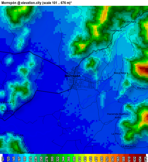
Below is the Elevation map of Morropón, which displays elevation range with different colors. Scale of the first map is from 101 to 676 m (331 to 2218 ft) with average elevation of 176.7 meters (=580 ft) [note 1]
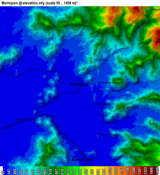
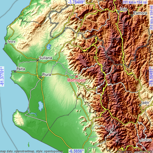
These maps also provides idea of topography and contour of this city, they are displayed at different zoom levels. More info about maps, scale and edge coordinates you can find below images.
| \ | Map #1 | Map #2 | Topo.Map |
| Scale [m] | 101..676 m | 95..1458 m | × |
| Scale [ft] | 331..2218 ft | 312..4783 ft | × |
| Average | 176.7 m = 580 ft | 287.3 m = 943 ft | × |
| Width | 9.73 km = 6 mi | 19.47 km = 12.1 mi | 311.4 km = 193.5 mi |
| Height | 9.73 km = 6 mi | 19.47 km = 12.1 mi | 311.4 km = 193.5 mi |
| ↑Max Latitude | -5.143033° | -5.099263° | -3.78489° |
| Latitude at center | -5.1868° | -5.1868° | -5.1868° |
| ↓Min Latitude | -5.230564° | -5.274325° | -6.5856° |
| ← Min Longitude | -80.014705° | -80.058651° | -81.37701° |
| Longitude center | -79.97076° | -79.97076° | -79.97076° |
| →Max Longitude | -79.926815° | -79.882869° | -78.56451° |
Nearby cities:
Cities around Morropón sort by population:
• Chulucanas elevation 92 m
23.7 km,  296°
296°
• Buenos Aires 154 m
8.3 km,  174°
174°
• Lagunas 2176 m
46.4 km,  17°
17°
• Canchaque 1290 m
46 km,  116°
116°
• Sapillica 1440 m
45.4 km,  358°
358°
• Pacaipampa 1953 m
39.8 km,  57°
57°
• Tunal 1111 m
32.8 km,  94°
94°
• Frias 1668 m
28.7 km,  5°
5°
• Chalaco 2260 m
25.6 km,  49°
49°
• Yamango 1088 m
24.5 km, 87°
• Santo Domingo 1545 m
20.8 km,  30°
30°
• Paltashaco 827 m
13.7 km,  44°
44°
Multilingual:
 En español:
Morropón elevación 130 m.
 En France:
Morropón élévation 130 m.
 Auf Deutsch:
Morropón höhe über dem Meeresspiegel ist 130 m.

Sources and notes:
- [note 1] Map square and city borders are not equal. Map elevation data is calculated only from area inside that square.
- [src 1] Elevation data from geonames database provided with same terms of usage.
- [src 2] The elevation map of Morropón is generated using elevation data from NASA's 3 arcsec (90m) resolution SRTM data.
- [src 3] Base (background) map © OpenStreetMap contributors tiles are generated by Geofabrik and OpenTopoMap.
Copyright & License:
This Morropón Elevation Map is licensed under CC BY-SA. You may reuse any part from this page, if you give a proper credit by linking to this URL:
 More info on terms of use page.