La Trinidad elevation
La Trinidad (Herrera), Panama elevation is 90 meters and La Trinidad elevation in feet is 295 ft above sea level [src 1]. La Trinidad is a seat of a third-order administrative division (feature code) with elevation that is 82 meters (269 ft) smaller than average city elevation in Panama.
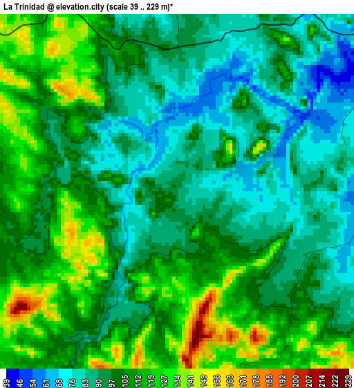
Below is the Elevation map of La Trinidad, which displays elevation range with different colors. Scale of the first map is from 39 to 229 m (128 to 751 ft) with average elevation of 101.3 meters (=332 ft) [note 1]
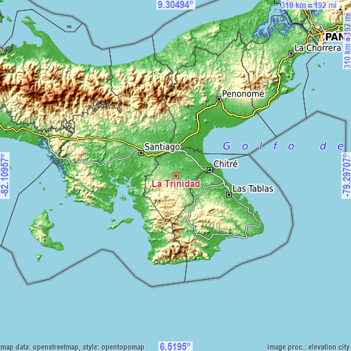
These maps also provides idea of topography and contour of this city, they are displayed at different zoom levels. More info about maps, scale and edge coordinates you can find below images.
| \ | Map #1 | Topo.Map |
| Scale [m] | 39..229 m | × |
| Scale [ft] | 128..751 ft | × |
| Average | 101.3 m = 332 ft | × |
| Width | 9.68 km = 6 mi | 309.7 km = 192.4 mi |
| Height | 9.68 km = 6 mi | 309.7 km = 192.4 mi |
| ↑Max Latitude | 7.958094° | 9.30494° |
| Latitude at center | 7.91457° | 7.91457° |
| ↓Min Latitude | 7.871041° | 6.5195° |
| ← Min Longitude | -80.747265° | -82.10957° |
| Longitude center | -80.70332° | -80.70332° |
| →Max Longitude | -80.659375° | -79.29707° |
Nearby cities:
Cities around La Trinidad sort by population:
• Ocú elevation 122 m
8.9 km,  289°
289°
• Pesé 85 m
9.8 km,  93°
93°
• Las Minas 337 m
14 km,  199°
199°
• Sabana Grande 134 m
8.1 km,  118°
118°
• El Pedregoso 71 m
7.6 km,  71°
71°
• Chumical 128 m
8.2 km, 198°
• Los Castillos 52 m
12.2 km,  49°
49°
• Rincón Hondo 58 m
13.4 km,  125°
125°
• Llano Grande 74 m
6.7 km,  352°
352°
• Llano de La Cruz 36 m
7.9 km,  58°
58°
• Las Guabas 168 m
11.4 km,  267°
267°
• Cabuya 94 m
10.1 km,  318°
318°
Multilingual:
 En español:
La Trinidad elevación 90 m.
 En France:
La Trinidad élévation 90 m.
 Auf Deutsch:
La Trinidad höhe über dem Meeresspiegel ist 90 m.

Sources and notes:
- [note 1] Map square and city borders are not equal. Map elevation data is calculated only from area inside that square.
- [src 1] Elevation data from geonames database provided with same terms of usage.
- [src 2] The elevation map of La Trinidad is generated using elevation data from NASA's 3 arcsec (90m) resolution SRTM data.
- [src 3] Base (background) map © OpenStreetMap contributors tiles are generated by Geofabrik and OpenTopoMap.
Copyright & License:
This La Trinidad Elevation Map is licensed under CC BY-SA. You may reuse any part from this page, if you give a proper credit by linking to this URL:
 More info on terms of use page.