Şalālah elevation
Şalālah (Dhofar), Oman elevation is 13 meters and Şalālah elevation in feet is 43 ft above sea level [src 1]. Şalālah is a seat of a first-order administrative division (feature code) with elevation that is 194 meters (636 ft) smaller than average city elevation in Oman.
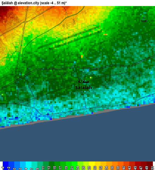
Below is the Elevation map of Şalālah, which displays elevation range with different colors. Scale of the first map is from -4 to 51 m (-13 to 167 ft) with average elevation of 17.2 meters (=56 ft) [note 1]
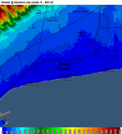
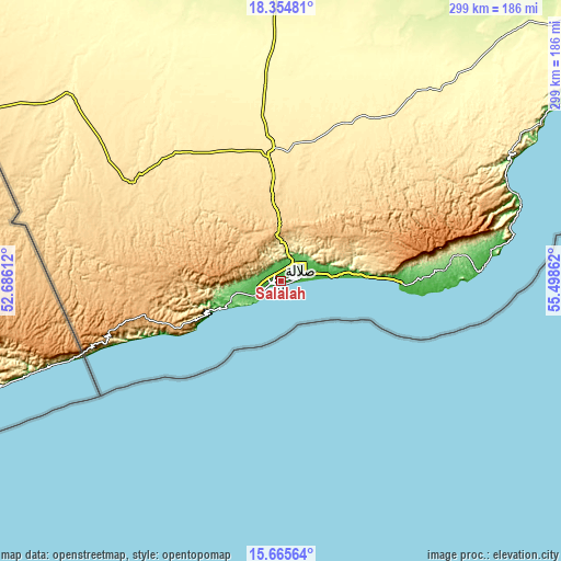
These maps also provides idea of topography and contour of this city, they are displayed at different zoom levels. More info about maps, scale and edge coordinates you can find below images.
| \ | Map #1 | Map #2 | Topo.Map |
| Scale [m] | -4..51 m | -5..643 m | × |
| Scale [ft] | -13..167 ft | -16..2110 ft | × |
| Average | 17.2 m = 56 ft | 54 m = 177 ft | × |
| Width | 9.34 km = 5.8 mi | 18.69 km = 11.6 mi | 299 km = 185.8 mi |
| Height | 9.34 km = 5.8 mi | 18.69 km = 11.6 mi | 299 km = 185.8 mi |
| ↑Max Latitude | 17.057067° | 17.099075° | 18.35481° |
| Latitude at center | 17.01505° | 17.01505° | 17.01505° |
| ↓Min Latitude | 16.973024° | 16.930988° | 15.66564° |
| ← Min Longitude | 54.048425° | 54.004479° | 52.68612° |
| Longitude center | 54.09237° | 54.09237° | 54.09237° |
| →Max Longitude | 54.136315° | 54.180261° | 55.49862° |
Nearby cities:
Cities around Şalālah sort by population:
• Haymā’ elevation 135 m
400.2 km,  35°
35°
• Al Mazyūnah 504 m
177.4 km,  301°
301°
Multilingual:
 En español:
Şalālah elevación 13 m.
 En France:
Salalah élévation 13 m.


Sources and notes:
- [note 1] Map square and city borders are not equal. Map elevation data is calculated only from area inside that square.
- [src 1] Elevation data from geonames database provided with same terms of usage.
- [src 2] The elevation map of Şalālah is generated using elevation data from NASA's 3 arcsec (90m) resolution SRTM data.
- [src 3] Base (background) map © OpenStreetMap contributors tiles are generated by Geofabrik and OpenTopoMap.
Copyright & License:
This Şalālah Elevation Map is licensed under CC BY-SA. You may reuse any part from this page, if you give a proper credit by linking to this URL:
 More info on terms of use page.