Murrays Bay elevation
Murrays Bay (Auckland), New Zealand elevation is 40 meters and Murrays Bay elevation in feet is 131 ft above sea level [src 1]. Murrays Bay is a section of populated place (feature code) with elevation that is 37 meters (121 ft) smaller than average city elevation in New Zealand.
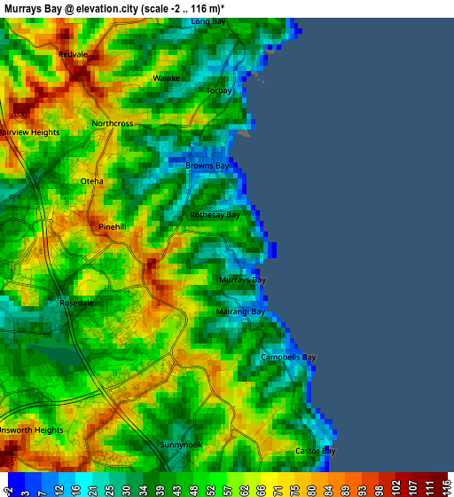
Below is the Elevation map of Murrays Bay, which displays elevation range with different colors. Scale of the first map is from -2 to 116 m (-7 to 381 ft) with average elevation of 52 meters (=171 ft) [note 1]
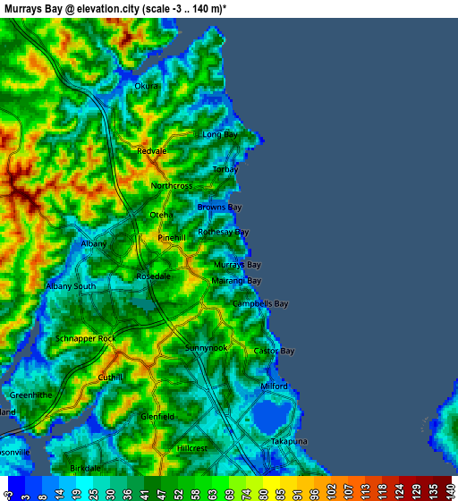
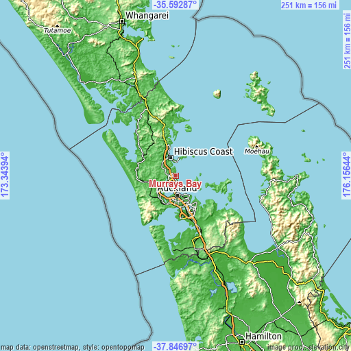
These maps also provides idea of topography and contour of this city, they are displayed at different zoom levels. More info about maps, scale and edge coordinates you can find below images.
| \ | Map #1 | Map #2 | Topo.Map |
| Scale [m] | -2..116 m | -3..140 m | × |
| Scale [ft] | -7..381 ft | -10..459 ft | × |
| Average | 52 m = 171 ft | 49.1 m = 161 ft | × |
| Width | 7.83 km = 4.9 mi | 15.67 km = 9.7 mi | 250.6 km = 155.7 mi |
| Height | 7.83 km = 4.9 mi | 15.66 km = 9.7 mi | 250.6 km = 155.7 mi |
| ↑Max Latitude | -36.692961° | -36.657715° | -35.59287° |
| Latitude at center | -36.72819° | -36.72819° | -36.72819° |
| ↓Min Latitude | -36.763403° | -36.7986° | -37.84697° |
| ← Min Longitude | 174.706245° | 174.662299° | 173.34394° |
| Longitude center | 174.75019° | 174.75019° | 174.75019° |
| →Max Longitude | 174.794135° | 174.838081° | 176.15644° |
Nearby cities:
Cities around Murrays Bay sort by population:
• Auckland elevation 43 m
13.4 km,  174°
174°
• Manukau City 43 m
31.6 km,  158°
158°
• Waitakere 87 m
22.6 km,  201°
201°
• North Shore 30 m
8 km,  180°
180°
• Mangere 15 m
27 km, 170°
• Pakuranga 36 m
22.7 km,  139°
139°
• Rothesay Bay 46 m
0.9 km,  285°
285°
• Rosebank 19 m
17.8 km, 203°
• Tamaki 28 m
20.3 km,  151°
151°
• Titirangi 162 m
24.7 km, 199°
• Muriwai Beach 115 m
28.5 km,  249°
249°
• Parakai 4 m
29.6 km, 287°
Multilingual:
 En español:
Murrays Bay elevación 40 m.
 En France:
Murrays Bay élévation 40 m.
 Auf Deutsch:
Murrays Bay höhe über dem Meeresspiegel ist 40 m.

Sources and notes:
- [note 1] Map square and city borders are not equal. Map elevation data is calculated only from area inside that square.
- [src 1] Elevation data from geonames database provided with same terms of usage.
- [src 2] The elevation map of Murrays Bay is generated using elevation data from NASA's 3 arcsec (90m) resolution SRTM data.
- [src 3] Base (background) map © OpenStreetMap contributors tiles are generated by Geofabrik and OpenTopoMap.
Copyright & License:
This Murrays Bay Elevation Map is licensed under CC BY-SA. You may reuse any part from this page, if you give a proper credit by linking to this URL:
 More info on terms of use page.