Gaur elevation
Gaur (Central Region), Nepal elevation is 76 meters and Gaur elevation in feet is 249 ft above sea level [src 1]. Gaur is a populated place (feature code) with elevation that is 883 meters (2897 ft) smaller than average city elevation in Nepal.
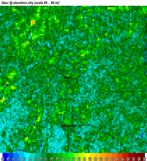
Below is the Elevation map of Gaur, which displays elevation range with different colors. Scale of the first map is from 69 to 86 m (226 to 282 ft) with average elevation of 76.7 meters (=252 ft) [note 1]
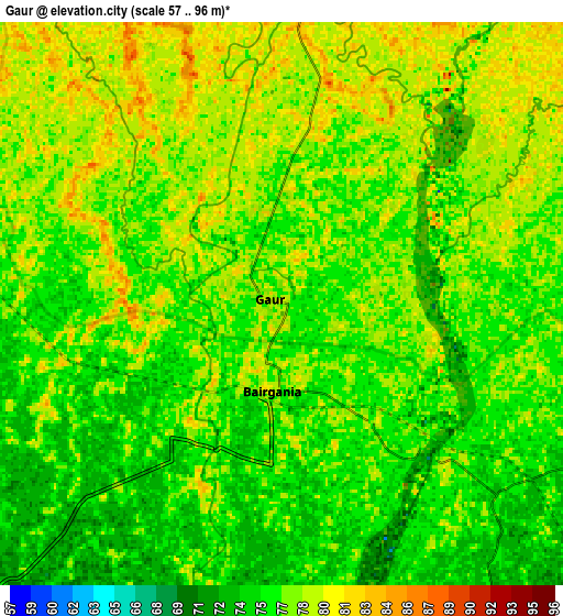
These maps also provides idea of topography and contour of this city, they are displayed at different zoom levels. More info about maps, scale and edge coordinates you can find below images.
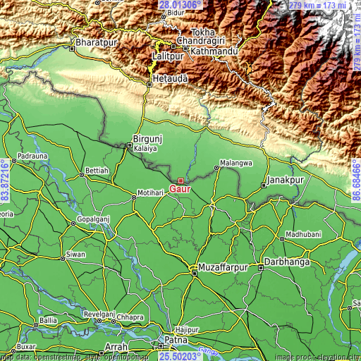
| \ | Map #1 | Map #2 | Topo.Map |
| Scale [m] | 69..86 m | 57..96 m | × |
| Scale [ft] | 226..282 ft | 187..315 ft | × |
| Average | 76.7 m = 252 ft | 76.7 m = 252 ft | × |
| Width | 8.73 km = 5.4 mi | 17.45 km = 10.8 mi | 279.2 km = 173.5 mi |
| Height | 8.73 km = 5.4 mi | 17.45 km = 10.8 mi | 279.2 km = 173.5 mi |
| ↑Max Latitude | 26.80371° | 26.842927° | 28.01306° |
| Latitude at center | 26.76448° | 26.76448° | 26.76448° |
| ↓Min Latitude | 26.725236° | 26.685978° | 25.50203° |
| ← Min Longitude | 85.234465° | 85.190519° | 83.87216° |
| Longitude center | 85.27841° | 85.27841° | 85.27841° |
| →Max Longitude | 85.322355° | 85.366301° | 86.68466° |
Nearby cities:
Cities around Gaur sort by population:
• Birgañj elevation 79 m
48.4 km,  305°
305°
• Janakpur 83 m
64.5 km,  93°
93°
• Hetauda 467 m
77.7 km,  341°
341°
• Panauti 1440 m
94.3 km,  14°
14°
• Panauti̇̄ 1455 m
94.1 km, 14°
• Siraha 82 m
93.1 km,  97°
97°
• Jaleshwar 72 m
53.4 km, 103°
• Malaṅgawā 89 m
29.7 km,  69°
69°
• Banepā 1477 m
99.5 km, 14°
• Dhulikhel 1484 m
98.9 km,  15°
15°
• Hari Bdr Tamang House 1703 m
97.8 km, 10°
• kankrabari Dovan 1703 m
97.8 km, 10°
Multilingual:
 En español:
Gaur elevación 76 m.
 En France:
Gaur élévation 76 m.


Sources and notes:
- [note 1] Map square and city borders are not equal. Map elevation data is calculated only from area inside that square.
- [src 1] Elevation data from geonames database provided with same terms of usage.
- [src 2] The elevation map of Gaur is generated using elevation data from NASA's 3 arcsec (90m) resolution SRTM data.
- [src 3] Base (background) map © OpenStreetMap contributors tiles are generated by Geofabrik and OpenTopoMap.
Copyright & License:
This Gaur Elevation Map is licensed under CC BY-SA. You may reuse any part from this page, if you give a proper credit by linking to this URL:
 More info on terms of use page.