Nagarkot elevation
Nagarkot (Central Region, Bāgmatī Zone), Nepal elevation is 1905 meters and Nagarkot elevation in feet is 6250 ft above sea level [src 1]. Nagarkot is a seat of a fourth-order administrative division (feature code) with elevation that is 946 meters (3104 ft) bigger than average city elevation in Nepal.
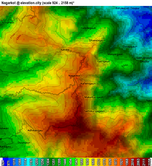
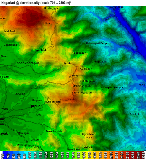
Below is the Elevation map of Nagarkot, which displays elevation range with different colors. Scale of the first map is from 924 to 2158 m (3031 to 7080 ft) with average elevation of 1595.4 meters (=5234 ft) [note 1]
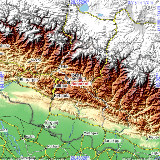
These maps also provides idea of topography and contour of this city, they are displayed at different zoom levels. More info about maps, scale and edge coordinates you can find below images.
| \ | Map #1 | Map #2 | Topo.Map |
| Scale [m] | 924..2158 m | 704..2393 m | × |
| Scale [ft] | 3031..7080 ft | 2310..7851 ft | × |
| Average | 1595.4 m = 5234 ft | 1414.5 m = 4641 ft | × |
| Width | 8.65 km = 5.4 mi | 17.3 km = 10.7 mi | 276.8 km = 172 mi |
| Height | 8.65 km = 5.4 mi | 17.3 km = 10.7 mi | 276.8 km = 172 mi |
| ↑Max Latitude | 27.754117° | 27.792999° | 28.95296° |
| Latitude at center | 27.71522° | 27.71522° | 27.71522° |
| ↓Min Latitude | 27.67631° | 27.637385° | 26.46328° |
| ← Min Longitude | 85.476805° | 85.432859° | 84.1145° |
| Longitude center | 85.52075° | 85.52075° | 85.52075° |
| →Max Longitude | 85.564695° | 85.608641° | 86.927° |
Nearby cities:
Cities around Nagarkot sort by population:
• Kathmandu elevation 1296 m
19.8 km,  265°
265°
• Pātan 1334 m
20.8 km,  258°
258°
• Madhyapur Thimi 1341 m
13.7 km,  253°
253°
• Panauti 1440 m
14.5 km,  179°
179°
• Kirtipur 1408 m
24.3 km, 260°
• Panauti̇̄ 1455 m
14.5 km, 182°
• Banepā 1477 m
9.2 km, 179°
• Dhulikhel 1484 m
10.6 km,  168°
168°
• Hari Bdr Tamang House 1703 m
11.4 km,  212°
212°
• kankrabari Dovan 1703 m
11.4 km, 212°
• Kothari 1629 m
50.8 km,  57°
57°
• Bhaktapur 1348 m
10.1 km,  242°
242°
Multilingual:
 En español:
Nagarkot elevación 1905 m.
 En France:
Nagarkot élévation 1905 m.
 Auf Deutsch:
Nagarkot höhe über dem Meeresspiegel ist 1905 m.

Sources and notes:
- [note 1] Map square and city borders are not equal. Map elevation data is calculated only from area inside that square.
- [src 1] Elevation data from geonames database provided with same terms of usage.
- [src 2] The elevation map of Nagarkot is generated using elevation data from NASA's 3 arcsec (90m) resolution SRTM data.
- [src 3] Base (background) map © OpenStreetMap contributors tiles are generated by Geofabrik and OpenTopoMap.
Copyright & License:
This Nagarkot Elevation Map is licensed under CC BY-SA. You may reuse any part from this page, if you give a proper credit by linking to this URL:
 More info on terms of use page.