Bruflat elevation
Bruflat (Oppland, Etnedal), Norway elevation is 331 meters and Bruflat elevation in feet is 1086 ft above sea level [src 1]. Bruflat is a seat of a second-order administrative division (feature code) with elevation that is 230 meters (755 ft) bigger than average city elevation in Norway.
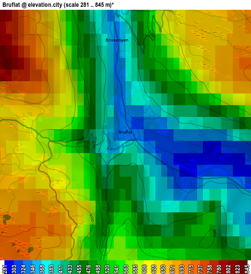
Below is the Elevation map of Bruflat, which displays elevation range with different colors. Scale of the first map is from 281 to 845 m (922 to 2772 ft) with average elevation of 525.1 meters (=1723 ft) [note 1]
These maps also provides idea of topography and contour of this city, they are displayed at different zoom levels. More info about maps, scale and edge coordinates you can find below images.
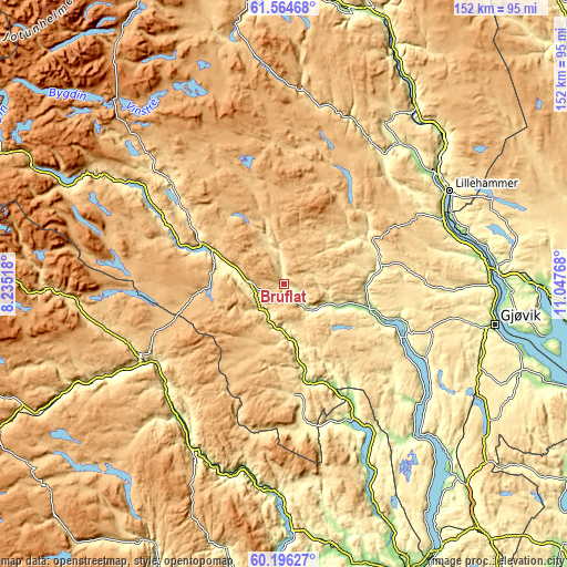
| \ | Map #1 | Topo.Map |
| Scale [m] | 281..845 m | × |
| Scale [ft] | 922..2772 ft | × |
| Average | 525.1 m = 1723 ft | × |
| Width | 4.75 km = 3 mi | 152.2 km = 94.6 mi |
| Height | 4.75 km = 3 mi | 152.1 km = 94.5 mi |
| ↑Max Latitude | 60.909183° | 61.56468° |
| Latitude at center | 60.88781° | 60.88781° |
| ↓Min Latitude | 60.866423° | 60.19627° |
| ← Min Longitude | 9.597485° | 8.23518° |
| Longitude center | 9.64143° | 9.64143° |
| →Max Longitude | 9.685375° | 11.04768° |
Nearby cities:
Cities around Bruflat sort by population:
• Lillehammer elevation 210 m
51.1 km,  60°
60°
• Raufoss 324 m
55.7 km,  108°
108°
• Dokka 180 m
24.1 km,  104°
104°
• Gol 235 m
43.1 km,  241°
241°
• Hov 270 m
43.9 km,  118°
118°
• Nesbyen 154 m
46.1 km,  219°
219°
• Fagernes 374 m
24.6 km,  296°
296°
• Bagn 222 m
8.7 km,  213°
213°
• Flå 140 m
51.8 km,  190°
190°
• Segalstad bru 320 m
49.1 km,  39°
39°
• Heggenes 540 m
42 km,  312°
312°
• Slidre 420 m
42 km, 302°
Multilingual:
 En español:
Bruflat elevación 331 m.
 En France:
Bruflat élévation 331 m.


Sources and notes:
- [note 1] Map square and city borders are not equal. Map elevation data is calculated only from area inside that square.
- [src 1] Elevation data from geonames database provided with same terms of usage.
- [src 2] The elevation map of Bruflat is generated using GMTED2010 database with 7.5 arcsec (225m) resolution.
- [src 3] Base (background) map © OpenStreetMap contributors tiles are generated by Geofabrik and OpenTopoMap.
Copyright & License:
This Bruflat Elevation Map is licensed under CC BY-SA. You may reuse any part from this page, if you give a proper credit by linking to this URL:
 More info on terms of use page.