Kløfta elevation
Kløfta (Akershus, Ullensaker), Norway elevation is 160 meters and Kløfta elevation in feet is 525 ft above sea level [src 1]. Kløfta is a populated place (feature code) with elevation that is 59 meters (194 ft) bigger than average city elevation in Norway.
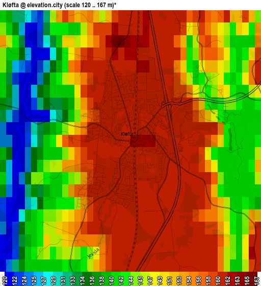
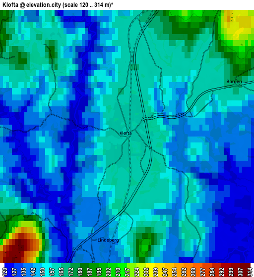
Below is the Elevation map of Kløfta, which displays elevation range with different colors. Scale of the first map is from 120 to 167 m (394 to 548 ft) with average elevation of 149.4 meters (=490 ft) [note 1]
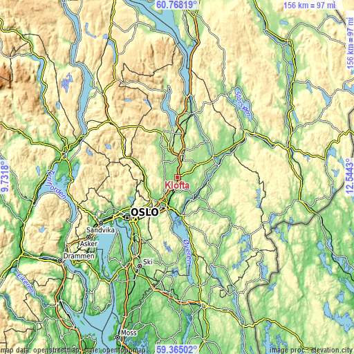
These maps also provides idea of topography and contour of this city, they are displayed at different zoom levels. More info about maps, scale and edge coordinates you can find below images.
| \ | Map #1 | Map #2 | Topo.Map |
| Scale [m] | 120..167 m | 120..314 m | × |
| Scale [ft] | 394..548 ft | 394..1030 ft | × |
| Average | 149.4 m = 490 ft | 153.2 m = 503 ft | × |
| Width | 4.88 km = 3 mi | 9.75 km = 6.1 mi | 156 km = 96.9 mi |
| Height | 4.88 km = 3 mi | 9.75 km = 6.1 mi | 156 km = 96.9 mi |
| ↑Max Latitude | 60.095986° | 60.117888° | 60.76819° |
| Latitude at center | 60.07407° | 60.07407° | 60.07407° |
| ↓Min Latitude | 60.052139° | 60.030194° | 59.36502° |
| ← Min Longitude | 11.094105° | 11.050159° | 9.7318° |
| Longitude center | 11.13805° | 11.13805° | 11.13805° |
| →Max Longitude | 11.181995° | 11.225941° | 12.5443° |
Nearby cities:
Cities around Kløfta sort by population:
• Lillestrøm elevation 116 m
14 km,  200°
200°
• Jessheim 212 m
7.8 km,  15°
15°
• Fetsund 128 m
16.6 km,  176°
176°
• Rotnes 190 m
15.5 km,  262°
262°
• Sørumsand 127 m
11.3 km,  149°
149°
• Auli 161 m
13.1 km,  109°
109°
• Åneby 134 m
15 km,  276°
276°
• Leirsund 113 m
9 km, 198°
• Neskollen 174 m
12.3 km,  64°
64°
• Frogner 138 m
5.8 km, 199°
• Ask 160 m
5.7 km,  266°
266°
• Fjerdingby 204 m
16.9 km,  193°
193°
Multilingual:
 En español:
Kløfta elevación 160 m.
 En France:
Kløfta élévation 160 m.


Sources and notes:
- [note 1] Map square and city borders are not equal. Map elevation data is calculated only from area inside that square.
- [src 1] Elevation data from geonames database provided with same terms of usage.
- [src 2] The elevation map of Kløfta is generated using GMTED2010 database with 7.5 arcsec (225m) resolution.
- [src 3] Base (background) map © OpenStreetMap contributors tiles are generated by Geofabrik and OpenTopoMap.
Copyright & License:
This Kløfta Elevation Map is licensed under CC BY-SA. You may reuse any part from this page, if you give a proper credit by linking to this URL:
 More info on terms of use page.