Sørumsand elevation
Sørumsand (Akershus, Sørum), Norway elevation is 127 meters and Sørumsand elevation in feet is 417 ft above sea level [src 1]. Sørumsand is a seat of a second-order administrative division (feature code) with elevation that is 26 meters (85 ft) bigger than average city elevation in Norway.
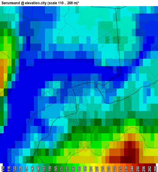
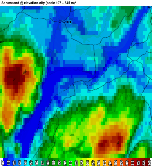
Below is the Elevation map of Sørumsand, which displays elevation range with different colors. Scale of the first map is from 110 to 268 m (361 to 879 ft) with average elevation of 143.4 meters (=470 ft) [note 1]
These maps also provides idea of topography and contour of this city, they are displayed at different zoom levels. More info about maps, scale and edge coordinates you can find below images.
| \ | Map #1 | Map #2 | Topo.Map |
| Scale [m] | 110..268 m | 107..345 m | × |
| Scale [ft] | 361..879 ft | 351..1132 ft | × |
| Average | 143.4 m = 470 ft | 175.3 m = 575 ft | × |
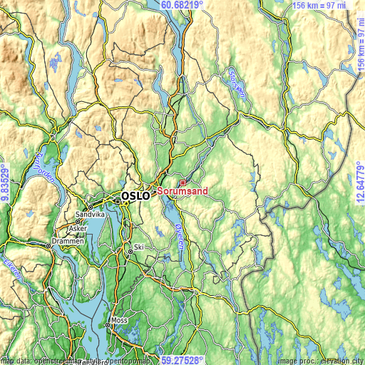
| Width | 4.89 km = 3 mi | 9.78 km = 6.1 mi | 156.4 km = 97.2 mi |
| Height | 4.89 km = 3 mi | 9.78 km = 6.1 mi | 156.4 km = 97.2 mi |
| ↑Max Latitude | 60.008185° | 60.030144° | 60.68219° |
| Latitude at center | 59.98621° | 59.98621° | 59.98621° |
| ↓Min Latitude | 59.964221° | 59.942217° | 59.27528° |
| ← Min Longitude | 11.197595° | 11.153649° | 9.83529° |
| Longitude center | 11.24154° | 11.24154° | 11.24154° |
| →Max Longitude | 11.285485° | 11.329431° | 12.64779° |
Nearby cities:
Cities around Sørumsand sort by population:
• Lillestrøm elevation 116 m
11.2 km,  252°
252°
• Fetsund 128 m
8.3 km,  214°
214°
• Kløfta 160 m
11.3 km,  329°
329°
• Auli 161 m
8.5 km,  50°
50°
• Aursmoen 180 m
13 km,  120°
120°
• Leirsund 113 m
8.6 km,  277°
277°
• Neskollen 174 m
16 km,  19°
19°
• Frogner 138 m
8.8 km,  298°
298°
• Ask 160 m
14.8 km,  309°
309°
• Fjellfoten 182 m
17.2 km, 48°
• Kjenn 181 m
17.2 km, 249°
• Fjerdingby 204 m
11.9 km,  235°
235°
Multilingual:
 En español:
Sørumsand elevación 127 m.
 En France:
Sørumsand élévation 127 m.
 Auf Deutsch:
Sørumsand höhe über dem Meeresspiegel ist 127 m.

Sources and notes:
- [note 1] Map square and city borders are not equal. Map elevation data is calculated only from area inside that square.
- [src 1] Elevation data from geonames database provided with same terms of usage.
- [src 2] The elevation map of Sørumsand is generated using elevation data from NASA's 3 arcsec (90m) resolution SRTM data.
- [src 3] Base (background) map © OpenStreetMap contributors tiles are generated by Geofabrik and OpenTopoMap.
Copyright & License:
This Sørumsand Elevation Map is licensed under CC BY-SA. You may reuse any part from this page, if you give a proper credit by linking to this URL:
 More info on terms of use page.